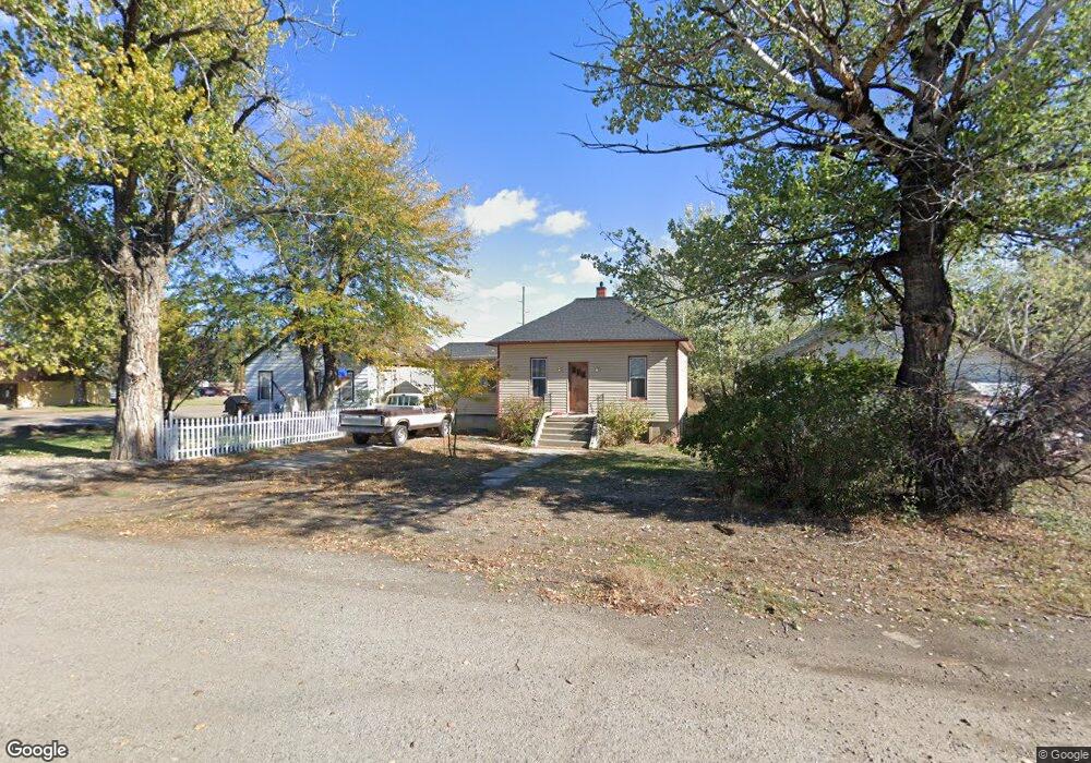
225 S 12th Ave Forsyth, MT 59327
Estimated Value: $103,000 - $297,000
2
Beds
1
Bath
786
Sq Ft
$235/Sq Ft
Est. Value
About This Home
This home is located at 225 S 12th Ave, Forsyth, MT 59327 and is currently estimated at $184,351, approximately $234 per square foot. 225 S 12th Ave is a home with nearby schools including Forsyth Elementary School, Forsyth Junior High School, and Forsyth High School.
Ownership History
Date
Name
Owned For
Owner Type
Purchase Details
Closed on
Jun 24, 2024
Sold by
Erlenbusch Bruce
Bought by
Frank Mark L
Current Estimated Value
Home Financials for this Owner
Home Financials are based on the most recent Mortgage that was taken out on this home.
Original Mortgage
$45,316
Outstanding Balance
$42,640
Interest Rate
6.38%
Mortgage Type
Credit Line Revolving
Estimated Equity
$141,711
Purchase Details
Closed on
Dec 21, 2006
Sold by
Tiday Michael
Bought by
Erlenbusch Bruce
Create a Home Valuation Report for This Property
The Home Valuation Report is an in-depth analysis detailing your home's value as well as a comparison with similar homes in the area
Home Values in the Area
Average Home Value in this Area
Purchase History
| Date | Buyer | Sale Price | Title Company |
|---|---|---|---|
| Frank Mark L | $56,645 | -- | |
| Frank Mark L | -- | None Listed On Document | |
| Erlenbusch Bruce | -- | -- |
Source: Public Records
Mortgage History
| Date | Status | Borrower | Loan Amount |
|---|---|---|---|
| Open | Frank Mark L | $45,316 | |
| Closed | Frank Mark L | $45,316 |
Source: Public Records
Tax History Compared to Growth
Tax History
| Year | Tax Paid | Tax Assessment Tax Assessment Total Assessment is a certain percentage of the fair market value that is determined by local assessors to be the total taxable value of land and additions on the property. | Land | Improvement |
|---|---|---|---|---|
| 2025 | $895 | $78,400 | $0 | $0 |
| 2024 | $1,060 | $66,400 | $0 | $0 |
| 2023 | $958 | $66,400 | $0 | $0 |
| 2022 | $897 | $58,100 | $0 | $0 |
| 2021 | $527 | $58,100 | $0 | $0 |
| 2020 | $987 | $75,200 | $0 | $0 |
| 2019 | $972 | $75,200 | $0 | $0 |
| 2018 | $962 | $73,900 | $0 | $0 |
| 2017 | $933 | $73,900 | $0 | $0 |
| 2016 | $880 | $70,500 | $0 | $0 |
| 2015 | $641 | $70,500 | $0 | $0 |
| 2014 | $450 | $28,249 | $0 | $0 |
Source: Public Records
Map
Nearby Homes
- 241 S 12th Ave
- 209 S 12th Ave
- 226 S 12th Ave
- 248 1/2 12 S Ave
- 248.5 S 12th Ave
- 1290 Front St
- 1315 Front St
- 242 S 11th Ave
- 250 S 11th Ave
- 1081 Front St
- 241 S 10th Ave
- 267 S 10th Ave
- 109 S 10th Ave Forsyth Mt Ave
- 109 S 10th Ave- Forsyth
- Old Highway 10
- 109 10th Ave
- 1425 Front St
- 310 S 10th Ave
- 290 S 10th Ave
- 960 Prospect St