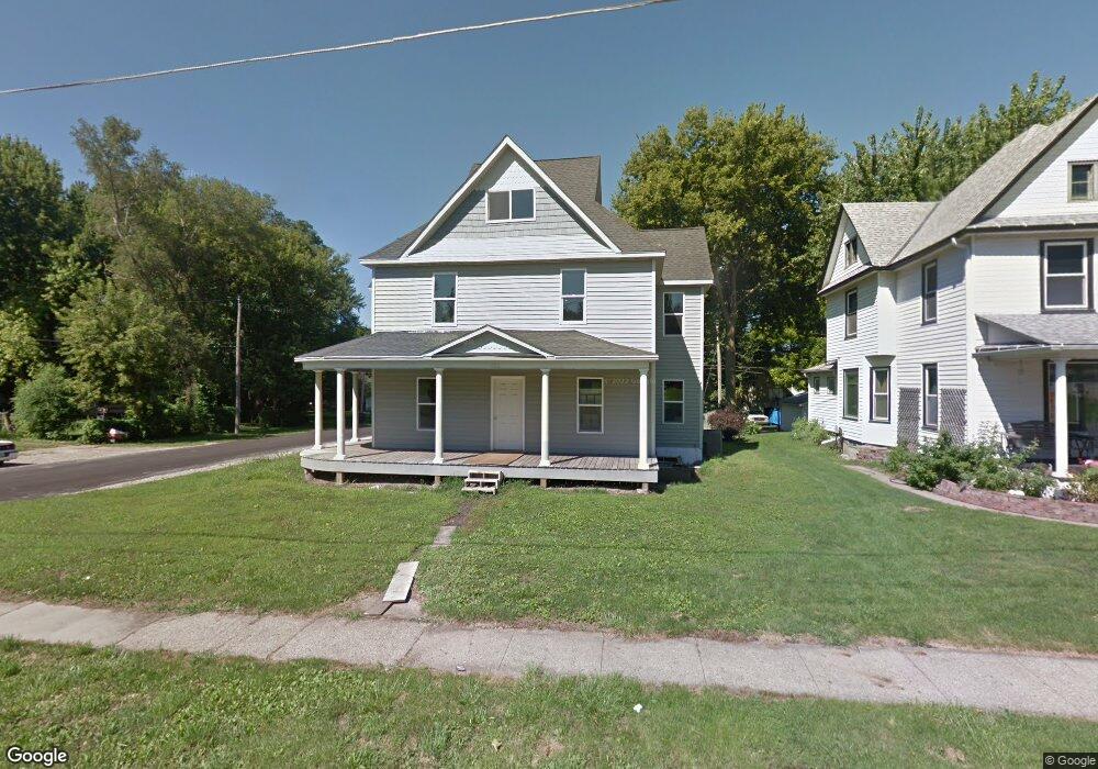
225 S Walnut St Colfax, IA 50054
Estimated Value: $270,000 - $323,000
4
Beds
4
Baths
2,982
Sq Ft
$99/Sq Ft
Est. Value
About This Home
This home is located at 225 S Walnut St, Colfax, IA 50054 and is currently estimated at $295,520, approximately $99 per square foot. 225 S Walnut St is a home located in Jasper County with nearby schools including Colfax-Mingo Elementary School and Colfax-Mingo High School.
Ownership History
Date
Name
Owned For
Owner Type
Purchase Details
Closed on
Nov 7, 2006
Sold by
Hutchins James L and Hutchins Jeri E
Bought by
Reed Eric J and Reed Tonya G
Current Estimated Value
Home Financials for this Owner
Home Financials are based on the most recent Mortgage that was taken out on this home.
Original Mortgage
$67,500
Outstanding Balance
$40,374
Interest Rate
6.41%
Mortgage Type
New Conventional
Estimated Equity
$255,146
Create a Home Valuation Report for This Property
The Home Valuation Report is an in-depth analysis detailing your home's value as well as a comparison with similar homes in the area
Purchase History
| Date | Buyer | Sale Price | Title Company |
|---|---|---|---|
| Reed Eric J | $75,000 | None Available |
Source: Public Records
Mortgage History
| Date | Status | Borrower | Loan Amount |
|---|---|---|---|
| Open | Reed Eric J | $67,500 |
Source: Public Records
Tax History
| Year | Tax Paid | Tax Assessment Tax Assessment Total Assessment is a certain percentage of the fair market value that is determined by local assessors to be the total taxable value of land and additions on the property. | Land | Improvement |
|---|---|---|---|---|
| 2025 | -- | $301,820 | $13,700 | $288,120 |
| 2024 | -- | $271,740 | $13,700 | $258,040 |
| 2023 | $4,638 | $271,740 | $13,700 | $258,040 |
| 2022 | $4,154 | $215,820 | $13,700 | $202,120 |
| 2021 | $3,550 | $197,410 | $13,700 | $183,710 |
| 2020 | $3,550 | $160,700 | $9,590 | $151,110 |
| 2019 | $1,760 | $73,090 | $0 | $0 |
| 2018 | $1,760 | $73,090 | $0 | $0 |
| 2017 | $1,734 | $73,090 | $0 | $0 |
| 2016 | $1,738 | $73,090 | $0 | $0 |
| 2015 | $1,726 | $73,090 | $0 | $0 |
| 2014 | $1,642 | $73,090 | $0 | $0 |
Source: Public Records
Map
Nearby Homes
- 108 S Walnut St
- 110 W Broadway St
- 119 W Washington St
- 215 W Spring St
- 222 E Broadway St
- 205 E Division St
- 226 S Iowa St
- 501 W Broadway St
- 500 W Washington St
- 17 S Kelly St
- 300 E Front St
- 520 S Oak Park Ave
- 400 S Goodrich St
- 655 E Division St
- 624 S Goodrich St
- 1161 S Goodrich St
- 1132 S Goodrich St
- 11213 Orchard Ave
- HWY 117 at Intersection of Fleet Ave
- 0 W 120th St S
- 219 S Walnut St
- 215 S Walnut St
- 305 Walnut St
- 220 S Locust St
- 33 W Spring St
- 309 Walnut St
- 212 S Locust St
- 224 S Walnut St
- 230 S Walnut St
- 309 S Walnut St Unit E
- 309 S Walnut St Unit D
- 309 S Walnut St Unit C
- 214 S Walnut St
- 210 S Walnut St
- 246 S Walnut St
- 306 S Locust St
- 238 S Walnut St
- 206 S Locust St
- 200 S Locust St