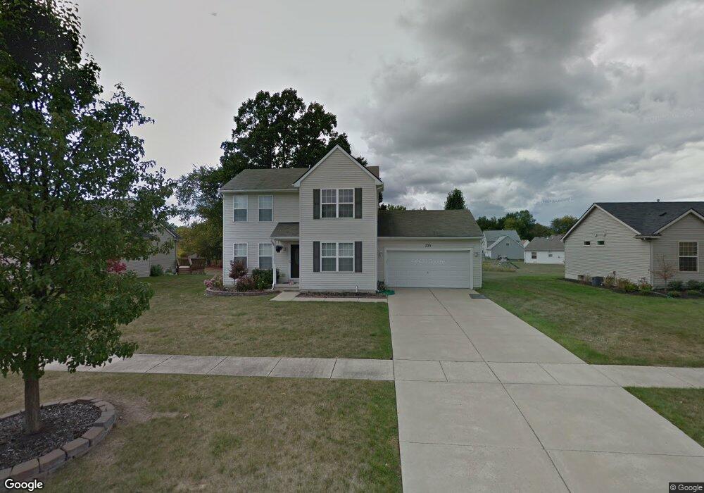
225 Sunflower Dr Unit 62 Linden, MI 48451
Estimated Value: $288,463 - $328,000
--
Bed
--
Bath
1,609
Sq Ft
$193/Sq Ft
Est. Value
About This Home
This home is located at 225 Sunflower Dr Unit 62, Linden, MI 48451 and is currently estimated at $310,116, approximately $192 per square foot. 225 Sunflower Dr Unit 62 is a home located in Genesee County with nearby schools including Linden Elementary School, Linden Middle School, and Linden High School.
Ownership History
Date
Name
Owned For
Owner Type
Purchase Details
Closed on
Feb 15, 2024
Sold by
Enciso Cheryl Lynn
Bought by
Enciso Cheryl Lynn
Current Estimated Value
Purchase Details
Closed on
Feb 17, 2003
Sold by
Mitch Harris Building Co Inc
Bought by
Enciso Cheryl L
Home Financials for this Owner
Home Financials are based on the most recent Mortgage that was taken out on this home.
Original Mortgage
$161,550
Interest Rate
6%
Mortgage Type
Purchase Money Mortgage
Create a Home Valuation Report for This Property
The Home Valuation Report is an in-depth analysis detailing your home's value as well as a comparison with similar homes in the area
Home Values in the Area
Average Home Value in this Area
Purchase History
| Date | Buyer | Sale Price | Title Company |
|---|---|---|---|
| Enciso Cheryl Lynn | -- | None Listed On Document | |
| Enciso Cheryl L | $26,000 | Title Source Inc |
Source: Public Records
Mortgage History
| Date | Status | Borrower | Loan Amount |
|---|---|---|---|
| Previous Owner | Enciso Cheryl L | $161,550 |
Source: Public Records
Tax History Compared to Growth
Tax History
| Year | Tax Paid | Tax Assessment Tax Assessment Total Assessment is a certain percentage of the fair market value that is determined by local assessors to be the total taxable value of land and additions on the property. | Land | Improvement |
|---|---|---|---|---|
| 2025 | $4,121 | $128,700 | $0 | $0 |
| 2024 | $2,631 | $124,300 | $0 | $0 |
| 2023 | $2,724 | $116,900 | $0 | $0 |
| 2022 | $3,884 | $114,600 | $0 | $0 |
| 2021 | $3,460 | $110,100 | $0 | $0 |
| 2020 | $2,567 | $102,200 | $0 | $0 |
| 2019 | $2,581 | $87,600 | $0 | $0 |
| 2018 | $3,295 | $87,600 | $0 | $0 |
| 2017 | $3,225 | $84,700 | $0 | $0 |
| 2016 | $3,254 | $80,800 | $0 | $0 |
| 2015 | $3,397 | $77,600 | $0 | $0 |
| 2012 | -- | $61,272 | $61,272 | $0 |
Source: Public Records
Map
Nearby Homes
- 14499 Ripley Rd
- The Columbia Plan at Liberty Shores
- The Princeton Plan at Liberty Shores
- The Bloomington Plan at Liberty Shores
- The Berkeley Plan at Liberty Shores
- The Austin Plan at Liberty Shores
- The Hampton Plan at Liberty Shores
- The Oxford Plan at Liberty Shores
- 4467 Edison Blvd
- 0 Silver Lake Rd Unit 20251009849
- 4468 Edison Blvd Unit 50
- 14238 Durant St
- 4448 Ford Ave
- 4453 Ford Ave
- 14265 Wright Dr
- 4311 Mccormick Dr
- 214 Willow Ln
- 4355 Fulton Ct
- 628 Riverside Dr
- 5194 Amelia Earhart Dr
- 235 Sunflower Dr Unit 61
- 245 Sunflower Dr Unit 60
- 205 Sunflower Dr Unit 64
- 544 Saddlevalley Ct Unit 48
- 594 Sunflower Dr Unit 79
- 604 Sunflower Dr Unit 80
- 584 Sunflower Dr Unit 78
- 255 Sunflower Dr Unit 59
- 195 Sunflower Dr Unit 65
- 534 Saddlevalley Ct Unit 49
- 614 Sunflower Dr Unit 81
- 574 Sunflower Dr Unit 77
- 395 Saddlevalley Ct Unit 47
- 624 Sunflower Dr Unit 82
- 564 Sunflower Dr Unit 76
- 445 Haystack Dr Unit 92
- 265 Sunflower Dr Unit 58
- 435 Haystack Dr Unit 93
- 185 Sunflower Dr Unit 66
- 455 Haystack Dr Unit 91