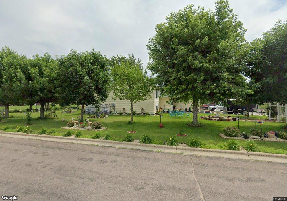
225 W 6th St S Melrose, MN 56352
Estimated Value: $266,000 - $296,877
3
Beds
2
Baths
1,552
Sq Ft
$182/Sq Ft
Est. Value
About This Home
This home is located at 225 W 6th St S, Melrose, MN 56352 and is currently estimated at $281,969, approximately $181 per square foot. 225 W 6th St S is a home located in Stearns County with nearby schools including Melrose Elementary School, Melrose Middle School, and Melrose Secondary School.
Ownership History
Date
Name
Owned For
Owner Type
Purchase Details
Closed on
May 15, 2000
Sold by
Tri-County Action Programs Inc
Bought by
Perez Marcelino
Current Estimated Value
Purchase Details
Closed on
Oct 25, 1999
Sold by
Hellermann Ralph
Bought by
Tri-County Action Programs Inc
Purchase Details
Closed on
Aug 6, 1993
Sold by
Hellermann Ralph
Bought by
Mayers Donald L
Create a Home Valuation Report for This Property
The Home Valuation Report is an in-depth analysis detailing your home's value as well as a comparison with similar homes in the area
Home Values in the Area
Average Home Value in this Area
Purchase History
| Date | Buyer | Sale Price | Title Company |
|---|---|---|---|
| Perez Marcelino | $82,900 | -- | |
| Tri-County Action Programs Inc | $20,000 | -- | |
| Mayers Donald L | $8,500 | -- |
Source: Public Records
Tax History Compared to Growth
Tax History
| Year | Tax Paid | Tax Assessment Tax Assessment Total Assessment is a certain percentage of the fair market value that is determined by local assessors to be the total taxable value of land and additions on the property. | Land | Improvement |
|---|---|---|---|---|
| 2025 | $2,898 | $303,200 | $26,400 | $276,800 |
| 2024 | $2,898 | $279,100 | $22,000 | $257,100 |
| 2023 | $2,548 | $266,200 | $20,600 | $245,600 |
| 2022 | $2,234 | $190,000 | $20,600 | $169,400 |
| 2021 | $2,074 | $190,000 | $20,600 | $169,400 |
| 2020 | $2,018 | $167,100 | $20,600 | $146,500 |
| 2019 | $1,842 | $160,300 | $20,600 | $139,700 |
| 2018 | $1,814 | $138,000 | $20,600 | $117,400 |
| 2017 | $1,746 | $121,200 | $20,600 | $100,600 |
| 2016 | $1,494 | $0 | $0 | $0 |
| 2015 | $1,510 | $0 | $0 | $0 |
| 2014 | -- | $0 | $0 | $0 |
Source: Public Records
Map
Nearby Homes
- TBD Kraft Dr
- 320 2nd Ave SW
- 113 4th St SW
- 76 Rose Park
- 100 Rose Park
- 129 Meadowlark Ln SW
- 241 Meadowlark Ln SW
- 410 2nd St NW
- 523 5th Ave SE
- TBD County Road 170
- 129 Highland Blvd
- 312 Highland Blvd
- 324 Highland Blvd
- 206 Highland Blvd
- 210 Highland Blvd
- 304 Highland Blvd
- 150 Highway 4 N
- 242 3rd Ave W
- 272 3rd Ave W
- 232 3rd Ave W
- 225 6th St SW
- 219 W 6th St S
- 219 6th St SW
- 622 622 N 3rd-Avenue-w
- 644 644 N 3rd-Avenue-w
- 222 5th St SW
- 226 6th St SW
- 214 214 W 5th-Street-s
- 631 631 N 3rd-Avenue-w
- 214 5th St SW
- 517 2nd Ave SW
- 219 219 W 6th-Street-s
- 210 6th St SW
- 615 3rd Ave SW
- 206 5th St SW
- 226 Kraft Dr SW
- 202 6th St SW
- 210 Kraft Dr SW
- 516 2nd Ave SW
- 118 5th St SW