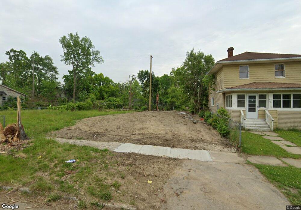
225 W Baker St Flint, MI 48505
King Avenue Plus NeighborhoodEstimated Value: $40,000 - $46,000
3
Beds
2
Baths
1,248
Sq Ft
$34/Sq Ft
Est. Value
About This Home
This home is located at 225 W Baker St, Flint, MI 48505 and is currently estimated at $43,000, approximately $34 per square foot. 225 W Baker St is a home located in Genesee County with nearby schools including Brownell STEM Academy, Flint Cultural Center Academy, and Greater Heights Academy.
Ownership History
Date
Name
Owned For
Owner Type
Purchase Details
Closed on
Dec 20, 2013
Sold by
Genesee County Treasurer
Bought by
Genesee County Land Bank
Current Estimated Value
Purchase Details
Closed on
Mar 11, 2011
Sold by
K & Real Estate Llc
Bought by
Trujillo Moses
Purchase Details
Closed on
Feb 14, 2011
Sold by
Payne Investments Llc
Bought by
K & D Real Estate Llc
Purchase Details
Closed on
Nov 24, 2010
Sold by
Cherry Deborah L
Bought by
Payne Investments Llc
Create a Home Valuation Report for This Property
The Home Valuation Report is an in-depth analysis detailing your home's value as well as a comparison with similar homes in the area
Home Values in the Area
Average Home Value in this Area
Purchase History
| Date | Buyer | Sale Price | Title Company |
|---|---|---|---|
| Genesee County Land Bank | -- | None Available | |
| Trujillo Moses | -- | None Available | |
| K & D Real Estate Llc | $950 | None Available | |
| Payne Investments Llc | $600 | None Available |
Source: Public Records
Tax History Compared to Growth
Tax History
| Year | Tax Paid | Tax Assessment Tax Assessment Total Assessment is a certain percentage of the fair market value that is determined by local assessors to be the total taxable value of land and additions on the property. | Land | Improvement |
|---|---|---|---|---|
| 2025 | -- | $0 | $0 | $0 |
| 2024 | -- | $0 | $0 | $0 |
| 2023 | -- | $0 | $0 | $0 |
| 2022 | $0 | $0 | $0 | $0 |
| 2021 | $0 | $0 | $0 | $0 |
| 2020 | $0 | $0 | $0 | $0 |
| 2019 | $0 | $0 | $0 | $0 |
| 2018 | $0 | $0 | $0 | $0 |
| 2017 | $0 | $0 | $0 | $0 |
| 2016 | $0 | $0 | $0 | $0 |
| 2015 | -- | $0 | $0 | $0 |
| 2014 | -- | $0 | $0 | $0 |
| 2012 | -- | $5,000 | $0 | $0 |
Source: Public Records
Map
Nearby Homes
- 115 W Baker St
- 506 Green St
- 311 W Genesee St
- 409 W Genesee St
- 2913
- 2913 Martin Luther King Ave
- 317 W Witherbee St
- 218 E Jackson Ave
- 200 W Mcclellan St
- 325 W Dewey St
- 325 W Paterson St
- 2718 N Chevrolet Ave
- 3002 N Chevrolet Ave
- 2245 Milbourne Ave
- 1101 W Rankin St
- 235 Page St
- 3002 Proctor St
- 1606 Garland St
- 3312 Buick St
- 1645 Seminole St
- 229 W Baker St
- 217 W Baker St
- 232 W Dayton St
- 215 W Baker St
- 212 W Dayton St
- 220 W Baker St
- 228 W Baker St
- 232 W Baker St
- 216 W Baker St
- 214 W Baker St
- 2515 Mason St
- 2511 Mason St
- 2507 Mason St
- 204 W Dayton St
- 210 W Baker St
- 205 W Baker St
- 2553 Mason St
- 225 W Dayton St
- 225 W Rankin St
- 221 W Rankin St