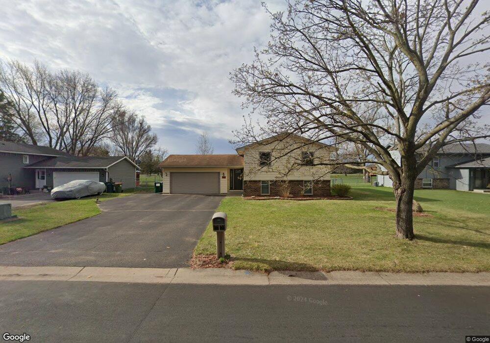
2250 112th Ln NW Coon Rapids, MN 55433
Estimated Value: $332,000 - $360,000
4
Beds
2
Baths
1,056
Sq Ft
$330/Sq Ft
Est. Value
About This Home
This home is located at 2250 112th Ln NW, Coon Rapids, MN 55433 and is currently estimated at $348,943, approximately $330 per square foot. 2250 112th Ln NW is a home located in Anoka County with nearby schools including Lucile Bruner Elementary School, Hamilton Elementary School, and Laughlin Junior/Senior High School.
Ownership History
Date
Name
Owned For
Owner Type
Purchase Details
Closed on
Nov 28, 2006
Sold by
Lloyd Malcolm J and Lloyd Suzanne A
Bought by
Fuller Benjamin R and Fuller Sara A
Current Estimated Value
Home Financials for this Owner
Home Financials are based on the most recent Mortgage that was taken out on this home.
Original Mortgage
$223,200
Outstanding Balance
$133,594
Interest Rate
6.33%
Mortgage Type
New Conventional
Estimated Equity
$215,349
Create a Home Valuation Report for This Property
The Home Valuation Report is an in-depth analysis detailing your home's value as well as a comparison with similar homes in the area
Home Values in the Area
Average Home Value in this Area
Purchase History
| Date | Buyer | Sale Price | Title Company |
|---|---|---|---|
| Fuller Benjamin R | $223,200 | -- |
Source: Public Records
Mortgage History
| Date | Status | Borrower | Loan Amount |
|---|---|---|---|
| Open | Fuller Benjamin R | $223,200 |
Source: Public Records
Tax History Compared to Growth
Tax History
| Year | Tax Paid | Tax Assessment Tax Assessment Total Assessment is a certain percentage of the fair market value that is determined by local assessors to be the total taxable value of land and additions on the property. | Land | Improvement |
|---|---|---|---|---|
| 2025 | $3,264 | $324,800 | $88,200 | $236,600 |
| 2024 | $3,264 | $315,200 | $91,400 | $223,800 |
| 2023 | $3,268 | $316,400 | $79,800 | $236,600 |
| 2022 | $2,996 | $315,900 | $70,400 | $245,500 |
| 2021 | $2,854 | $259,000 | $70,400 | $188,600 |
| 2020 | $2,917 | $241,700 | $65,100 | $176,600 |
| 2019 | $2,767 | $237,300 | $63,000 | $174,300 |
| 2018 | $2,709 | $219,300 | $0 | $0 |
| 2017 | $2,377 | $208,700 | $0 | $0 |
| 2016 | $2,159 | $176,700 | $0 | $0 |
| 2015 | -- | $176,700 | $49,500 | $127,200 |
| 2014 | -- | $142,200 | $38,300 | $103,900 |
Source: Public Records
Map
Nearby Homes
- 11409 Quinn St NW
- 11000 Swallow St NW
- 11424 Hanson Blvd NW
- 11444 Hanson Blvd NW
- 11036 Hanson Blvd NW Unit 20
- 2400 108th Ave NW
- 11350 Jay St NW
- 11361 Jay St NW
- 2201 108th Ave NW
- 11809 Zion St NW
- 2851 113th Ave NW
- 2721 109th Ave NW
- 2728 109th Ln NW
- 10648 Wren St NW
- 11835 Crocus St NW
- 1660 Northdale Blvd NW
- 11749 Crooked Lake Blvd NW
- 2862 116th Ave NW
- 11267 Robinson Dr NW
- 10616 Arrowhead St NW
- 2260 112th Ln NW
- 2240 112th Ln NW
- 2270 112th Ln NW
- 2251 112th Ln NW
- 2230 112th Ln NW
- 2261 112th Ln NW
- 2241 112th Ln NW
- 2300 112th Ln NW
- 2271 112th Ln NW
- 2231 112th Ln NW
- 2301 112th Ln NW
- 2310 112th Ln NW
- 11241 Swallow St NW
- 2240 113th Ave NW
- 11251 Swallow St NW
- 2248 113th Ave NW
- 11271 Uplander St NW
- 2232 113th Ave NW
- 11261 Swallow St NW
- 2256 113th Ave NW