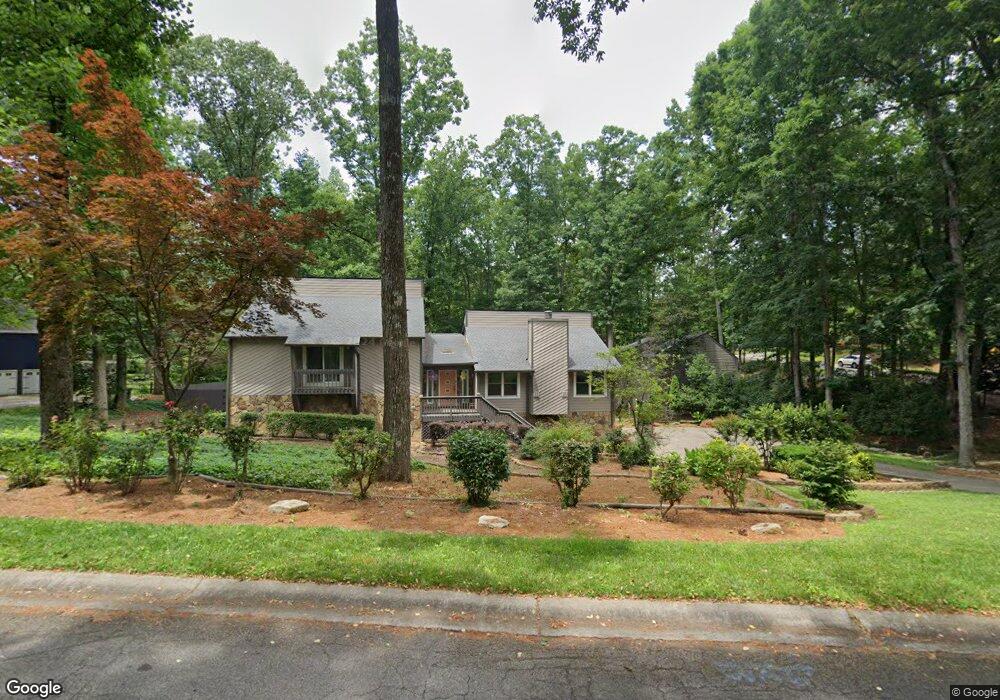
2250 Rolland St Marietta, GA 30062
East Cobb NeighborhoodEstimated Value: $580,063 - $623,000
3
Beds
3
Baths
2,324
Sq Ft
$261/Sq Ft
Est. Value
About This Home
This home is located at 2250 Rolland St, Marietta, GA 30062 and is currently estimated at $607,516, approximately $261 per square foot. 2250 Rolland St is a home located in Cobb County with nearby schools including Tritt Elementary School, Hightower Trail Middle School, and Pope High School.
Ownership History
Date
Name
Owned For
Owner Type
Purchase Details
Closed on
Nov 15, 1994
Sold by
Behm William F
Bought by
Simon Hal Sheri K
Current Estimated Value
Home Financials for this Owner
Home Financials are based on the most recent Mortgage that was taken out on this home.
Original Mortgage
$107,200
Interest Rate
8.92%
Create a Home Valuation Report for This Property
The Home Valuation Report is an in-depth analysis detailing your home's value as well as a comparison with similar homes in the area
Home Values in the Area
Average Home Value in this Area
Purchase History
| Date | Buyer | Sale Price | Title Company |
|---|---|---|---|
| Simon Hal Sheri K | $134,000 | -- |
Source: Public Records
Mortgage History
| Date | Status | Borrower | Loan Amount |
|---|---|---|---|
| Closed | Simon Hal Sheri K | $107,200 |
Source: Public Records
Tax History Compared to Growth
Tax History
| Year | Tax Paid | Tax Assessment Tax Assessment Total Assessment is a certain percentage of the fair market value that is determined by local assessors to be the total taxable value of land and additions on the property. | Land | Improvement |
|---|---|---|---|---|
| 2025 | $1,088 | $221,180 | $52,000 | $169,180 |
| 2024 | $1,102 | $224,476 | $48,000 | $176,476 |
| 2023 | $785 | $187,384 | $32,000 | $155,384 |
| 2022 | $991 | $187,384 | $32,000 | $155,384 |
| 2021 | $890 | $153,580 | $32,000 | $121,580 |
| 2020 | $857 | $142,572 | $28,000 | $114,572 |
| 2019 | $857 | $142,572 | $28,000 | $114,572 |
| 2018 | $809 | $126,376 | $28,000 | $98,376 |
| 2017 | $2,934 | $126,376 | $28,000 | $98,376 |
| 2016 | $2,755 | $117,932 | $28,000 | $89,932 |
| 2015 | $2,808 | $117,932 | $28,000 | $89,932 |
| 2014 | $2,248 | $92,208 | $0 | $0 |
Source: Public Records
Map
Nearby Homes
- 3761 Oak Ln
- 2225 Johnson Ferry Rd
- 3741 Bays Ferry Way
- 2237 Chadds Creek Dr
- 2567 Kingsley Dr NE
- 3917 Brintons Mill
- 3650 Oak Ln
- 2410 Kingsley Dr NE
- 4035 Willows Way Unit 1
- 2503 Regency Lake Dr
- 4013 Chelsea Ln
- 1942 Hunters Bend Ct
- 4055 Cloister Dr
- 3812 Mine Creek Ln
- 2259 Edgemere Lake Cir
- 2268 Woodsfield Ln NE
- 4031 Oak Forest Cir
- 2571 Walden Estates Dr
- 3842 Oak Ln
- 0 Rolland St Unit 8070072
- 2242 Rolland St
- 2247 Rolland St
- 2245 Rolland St
- 3822 Oak Ln
- 2230 Rolland St
- 3767 Oak Ln
- 2239 Rolland St
- 3765 Oak Ln
- 3769 Oak Ln
- 2146 Carlyle Dr
- 3771 Oak Ln
- 3812 Oak Ln
- 3763 Oak Ln
- 2154 Carlyle Dr
- 2247 Johnson Ferry Rd
- 2142 Carlyle Dr
- 3850 Oak Ln
- 3850 Oak Ln Unit 1