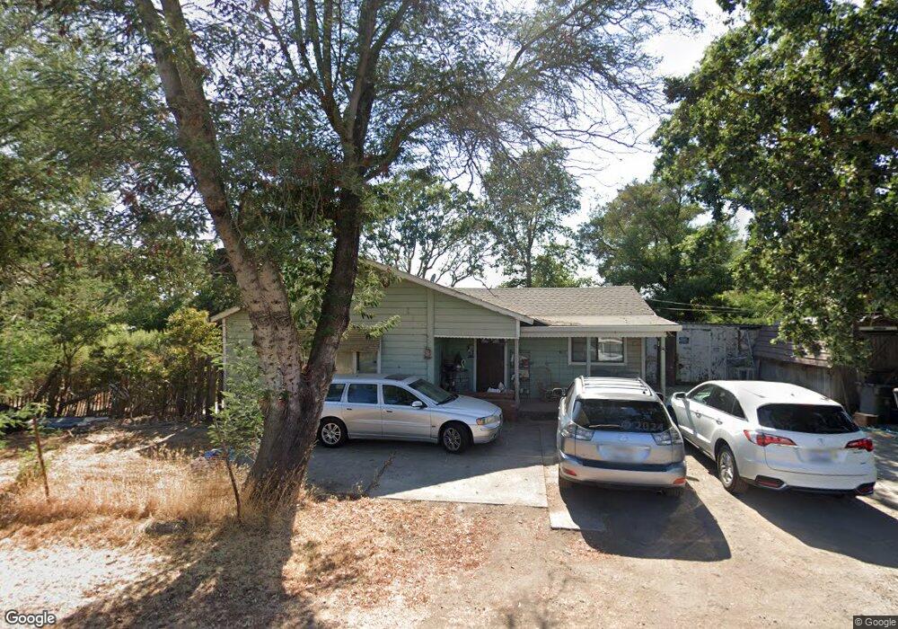
22515 Burndale Rd Sonoma, CA 95476
Estimated Value: $826,000 - $1,334,000
2
Beds
1
Bath
1,247
Sq Ft
$832/Sq Ft
Est. Value
About This Home
This home is located at 22515 Burndale Rd, Sonoma, CA 95476 and is currently estimated at $1,037,458, approximately $831 per square foot. 22515 Burndale Rd is a home located in Sonoma County with nearby schools including Prestwood Elementary School, Adele Harrison Middle School, and Creekside High School.
Ownership History
Date
Name
Owned For
Owner Type
Purchase Details
Closed on
Oct 5, 2001
Sold by
Pollick Joseph G and Pollick Sandra M
Bought by
Machado Cynthia S
Current Estimated Value
Home Financials for this Owner
Home Financials are based on the most recent Mortgage that was taken out on this home.
Original Mortgage
$279,000
Outstanding Balance
$115,018
Interest Rate
7.62%
Estimated Equity
$922,440
Create a Home Valuation Report for This Property
The Home Valuation Report is an in-depth analysis detailing your home's value as well as a comparison with similar homes in the area
Home Values in the Area
Average Home Value in this Area
Purchase History
| Date | Buyer | Sale Price | Title Company |
|---|---|---|---|
| Machado Cynthia S | $310,000 | Fidelity National Title Co |
Source: Public Records
Mortgage History
| Date | Status | Borrower | Loan Amount |
|---|---|---|---|
| Open | Machado Cynthia S | $279,000 |
Source: Public Records
Tax History Compared to Growth
Tax History
| Year | Tax Paid | Tax Assessment Tax Assessment Total Assessment is a certain percentage of the fair market value that is determined by local assessors to be the total taxable value of land and additions on the property. | Land | Improvement |
|---|---|---|---|---|
| 2025 | $5,543 | $457,953 | $339,779 | $118,174 |
| 2024 | $5,543 | $448,974 | $333,117 | $115,857 |
| 2023 | $5,543 | $440,172 | $326,586 | $113,586 |
| 2022 | $5,306 | $431,542 | $320,183 | $111,359 |
| 2021 | $5,199 | $423,081 | $313,905 | $109,176 |
| 2020 | $5,197 | $418,744 | $310,687 | $108,057 |
| 2019 | $5,093 | $410,535 | $304,596 | $105,939 |
| 2018 | $4,879 | $402,486 | $298,624 | $103,862 |
| 2017 | $4,810 | $394,595 | $292,769 | $101,826 |
| 2016 | $4,519 | $386,859 | $287,029 | $99,830 |
| 2015 | $4,377 | $381,049 | $282,718 | $98,331 |
| 2014 | $4,313 | $373,585 | $277,180 | $96,405 |
Source: Public Records
Map
Nearby Homes
- 2560 Knob Hill Rd
- 21925 Hyde Rd
- 2710 Knob Hill Rd
- 2575 Fremont Dr
- 2034 Fremont Dr
- 21278 Burndale Rd
- 21200 8th St E
- 21000 8th St E
- 0 8th St E Unit 325006549
- 21200 Silva Rd
- 1025 Napa Rd
- 23105 Millerick Rd
- 570 E Watmaugh Rd
- 19539 Arrowhead Mountain Rd
- 20742 Denmark Ct
- 20685 5th St E
- 20464 5th St E
- 23180 Maffei Rd
- 23300 23300 & 23500 Ramal Rd
- 22100 Arnold Dr
- 21700 Burndale Rd
- 21877 Burndale Rd
- 22752 Burndale Rd
- 22501 Burndale Rd
- 22522 Burndale Rd
- 22450 Burndale Rd
- 22500 Burndale Rd
- 22640 Burndale Rd
- 2575 Knob Hill Rd
- 2590 Knob Hill Rd
- 22705 Burndale Rd
- 22726 Burndale Rd
- 2606 Knob Hill Rd
- 22733 Burndale Rd
- 21911 Hyde Rd
- 2630 Knob Hill Rd
- 2635 Knob Hill Rd
- 22000 Burndale Rd