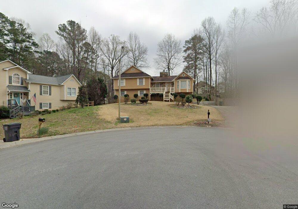
2252 Byron Ct SW Marietta, GA 30064
West Cobb NeighborhoodEstimated Value: $378,697 - $436,000
4
Beds
3
Baths
1,705
Sq Ft
$243/Sq Ft
Est. Value
About This Home
This home is located at 2252 Byron Ct SW, Marietta, GA 30064 and is currently estimated at $414,674, approximately $243 per square foot. 2252 Byron Ct SW is a home located in Cobb County with nearby schools including Dowell Elementary School, Lovinggood Middle School, and Hillgrove High School.
Ownership History
Date
Name
Owned For
Owner Type
Purchase Details
Closed on
Mar 31, 1999
Sold by
Ventura C Timothy and Ventura Laura K
Bought by
Lewis Michael J A and Lewis Cynth
Current Estimated Value
Home Financials for this Owner
Home Financials are based on the most recent Mortgage that was taken out on this home.
Original Mortgage
$141,462
Outstanding Balance
$34,529
Interest Rate
6.85%
Mortgage Type
FHA
Estimated Equity
$380,145
Purchase Details
Closed on
Jan 27, 1995
Sold by
Funderburke Danny G Janice K
Bought by
Ventura C Timothy Laura K
Home Financials for this Owner
Home Financials are based on the most recent Mortgage that was taken out on this home.
Original Mortgage
$115,550
Interest Rate
9.21%
Mortgage Type
FHA
Create a Home Valuation Report for This Property
The Home Valuation Report is an in-depth analysis detailing your home's value as well as a comparison with similar homes in the area
Home Values in the Area
Average Home Value in this Area
Purchase History
| Date | Buyer | Sale Price | Title Company |
|---|---|---|---|
| Lewis Michael J A | $142,500 | -- | |
| Ventura C Timothy Laura K | $118,500 | -- |
Source: Public Records
Mortgage History
| Date | Status | Borrower | Loan Amount |
|---|---|---|---|
| Open | Lewis Michael J A | $141,462 | |
| Previous Owner | Ventura C Timothy Laura K | $115,550 |
Source: Public Records
Tax History Compared to Growth
Tax History
| Year | Tax Paid | Tax Assessment Tax Assessment Total Assessment is a certain percentage of the fair market value that is determined by local assessors to be the total taxable value of land and additions on the property. | Land | Improvement |
|---|---|---|---|---|
| 2025 | $3,274 | $140,156 | $34,000 | $106,156 |
| 2024 | $3,216 | $137,344 | $26,000 | $111,344 |
| 2023 | $2,673 | $137,344 | $26,000 | $111,344 |
| 2022 | $2,659 | $110,744 | $16,000 | $94,744 |
| 2021 | $2,403 | $99,056 | $16,000 | $83,056 |
| 2020 | $2,226 | $90,936 | $10,000 | $80,936 |
| 2019 | $2,226 | $90,936 | $10,000 | $80,936 |
| 2018 | $1,969 | $79,224 | $10,000 | $69,224 |
| 2017 | $1,573 | $64,732 | $12,000 | $52,732 |
| 2016 | $1,575 | $64,732 | $12,000 | $52,732 |
| 2015 | $1,430 | $57,376 | $12,000 | $45,376 |
| 2014 | $1,131 | $46,884 | $0 | $0 |
Source: Public Records
Map
Nearby Homes
- 2040 Hardwood Cir SW Unit 3
- 2409 Caneridge Point SW
- 1985 Freestone Way
- 2117 Caneridge Dr SW
- 2009 Freestone Way
- Monteluce Plan at Freestone Station
- Hillside Plan at Freestone Station
- Oakshire Plan at Freestone Station
- Hendricks Plan at Freestone Station
- Hedgerow Plan at Freestone Station
- Antioch Plan at Freestone Station
- 1952 Freestone Way
- 2093 Breconridge Dr SW
- 1946 MacLand Rd SW
- 1830 MacLand Rd SW
- 2040 Freestone Way
- 1646 Desford Ct SW
- 2146 Caneridge Dr SW
- 2002 MacLand Square Dr Unit 1
- 2166 Derbyshire Dr SW
- 2254 Byron Ct SW
- 2250 Byron Ct SW
- 1974 Carithers Way
- 2256 Byron Ct SW
- 1978 Carithers Way
- 1975 Carithers Way
- 2253 Byron Ct SW
- 2258 Byron Ct SW
- 2257 Byron Ct SW
- 1837 Walker Ridge Dr SW Unit 4
- 1982 Carithers Way
- 1891 Keith Dr SW
- 1979 Carithers Way
- 1839 Walker Ridge Dr SW
- 2259 Byron Ct SW
- 2260 Byron Ct SW Unit 70
- 2260 Byron Ct SW
- 2510 Lorne Ct SW
- 1835 Walker Ridge Dr SW
- 2512 Lorne Ct SW