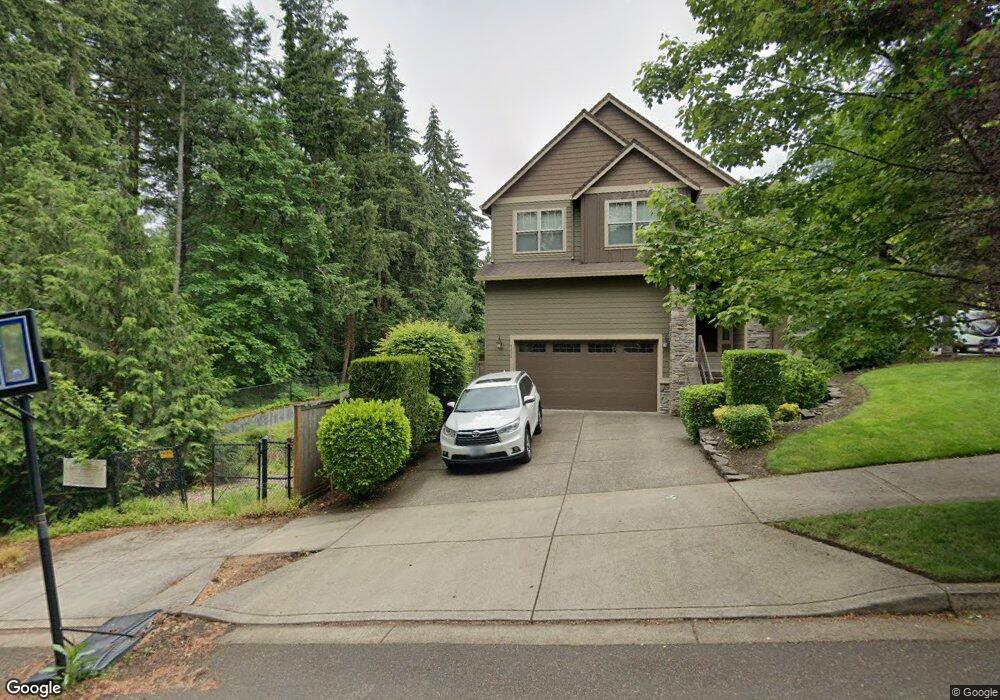
2252 Haskins Rd West Linn, OR 97068
Tanner Basin NeighborhoodEstimated Value: $965,630 - $1,206,000
4
Beds
3
Baths
3,100
Sq Ft
$351/Sq Ft
Est. Value
About This Home
This home is located at 2252 Haskins Rd, West Linn, OR 97068 and is currently estimated at $1,086,908, approximately $350 per square foot. 2252 Haskins Rd is a home located in Clackamas County with nearby schools including Willamette Primary School, Athey Creek Middle School, and West Linn High School.
Ownership History
Date
Name
Owned For
Owner Type
Purchase Details
Closed on
Mar 11, 2010
Sold by
Icon Construction & Development Llc
Bought by
Bullard Brian W and Bullard Erin
Current Estimated Value
Home Financials for this Owner
Home Financials are based on the most recent Mortgage that was taken out on this home.
Original Mortgage
$417,000
Outstanding Balance
$274,738
Interest Rate
4.94%
Mortgage Type
New Conventional
Estimated Equity
$812,170
Create a Home Valuation Report for This Property
The Home Valuation Report is an in-depth analysis detailing your home's value as well as a comparison with similar homes in the area
Home Values in the Area
Average Home Value in this Area
Purchase History
| Date | Buyer | Sale Price | Title Company |
|---|---|---|---|
| Bullard Brian W | $475,000 | Fidelity Natl Title Co Of Or |
Source: Public Records
Mortgage History
| Date | Status | Borrower | Loan Amount |
|---|---|---|---|
| Open | Bullard Brian W | $417,000 |
Source: Public Records
Tax History Compared to Growth
Tax History
| Year | Tax Paid | Tax Assessment Tax Assessment Total Assessment is a certain percentage of the fair market value that is determined by local assessors to be the total taxable value of land and additions on the property. | Land | Improvement |
|---|---|---|---|---|
| 2025 | $11,302 | $586,433 | -- | -- |
| 2024 | $10,879 | $569,353 | -- | -- |
| 2023 | $10,879 | $552,770 | $0 | $0 |
| 2022 | $10,268 | $536,670 | $0 | $0 |
| 2021 | $9,747 | $521,039 | $0 | $0 |
| 2020 | $9,704 | $505,864 | $0 | $0 |
| 2019 | $9,305 | $491,131 | $0 | $0 |
| 2018 | $8,873 | $476,826 | $0 | $0 |
| 2017 | $8,593 | $462,938 | $0 | $0 |
| 2016 | $8,252 | $449,454 | $0 | $0 |
| 2015 | $7,874 | $436,363 | $0 | $0 |
| 2014 | $7,422 | $423,653 | $0 | $0 |
Source: Public Records
Map
Nearby Homes
- 1808 Hall Ct
- 2378 Falcon Dr
- 3492 Vista Ridge Dr
- 2650 Lorinda Ln
- 2762 Dahlia Dr
- 3500 Riverknoll Way
- 4650 Summerlinn Way
- 2025 De Vries Way
- 6505 Summerlinn Way Unit 79
- 6735 Summerlinn Way Unit 87
- 6840 Summerlinn Way Unit 93
- 3850 Summerlinn Dr Unit 58
- 3496 Chaparrel Loop
- 22872 Weatherhill Rd
- 2315 5th Ave
- 3565 Summerlinn Dr Unit 64
- 2285 Satter St
- 3395 Summerlinn Dr Unit 24
- 2050 Alpine Dr
- 3135 Summerlinn Dr Unit 40
- 2254 Rogue Way
- 2262 Haskins Rd
- 2251 Rogue Way
- 3185 Haskins Ln
- 2274 Haskins Rd
- 2253 Rogue Way
- 2258 Rogue Way
- 2286 Haskins Rd
- 2269 Rogue Way
- 3165 Haskins Ln
- 2271 Rogue Way
- 2260 Rogue Way
- 2293 Rogue Way
- 2298 Haskins Rd
- 3200 Haskins Ln
- 2273 Rogue Way
- 2291 Rogue Way
- 2301 Rogue Way
- 2275 Rogue Way
- 2305 Rogue Way