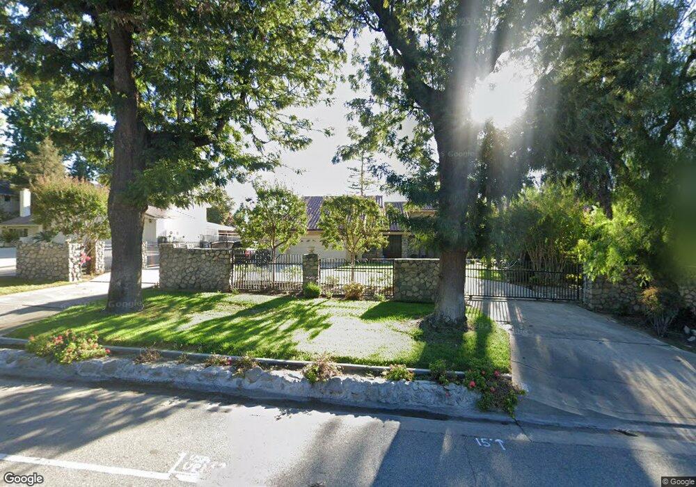
2252 N Euclid Ave Upland, CA 91784
Estimated Value: $1,158,290 - $1,528,000
4
Beds
3
Baths
2,594
Sq Ft
$534/Sq Ft
Est. Value
About This Home
This home is located at 2252 N Euclid Ave, Upland, CA 91784 and is currently estimated at $1,384,323, approximately $533 per square foot. 2252 N Euclid Ave is a home located in San Bernardino County with nearby schools including Magnolia Elementary, Pioneer Junior High School, and Upland High School.
Ownership History
Date
Name
Owned For
Owner Type
Purchase Details
Closed on
Sep 22, 2005
Sold by
Cox Wayne D
Bought by
Cox Wayne and Cox Rhonda
Current Estimated Value
Purchase Details
Closed on
Dec 16, 2003
Sold by
Cox Wayne D and Cox Rhonda K
Bought by
Cox Wayne
Home Financials for this Owner
Home Financials are based on the most recent Mortgage that was taken out on this home.
Original Mortgage
$480,000
Outstanding Balance
$208,522
Interest Rate
4.99%
Mortgage Type
Purchase Money Mortgage
Estimated Equity
$1,175,801
Purchase Details
Closed on
Sep 2, 2003
Sold by
Gibson Marvin
Bought by
Cox Wayne D and Cox Rhonda K
Purchase Details
Closed on
Mar 25, 2002
Sold by
Debano Joseph and Debano Pauline J
Bought by
Gibson Marvin
Home Financials for this Owner
Home Financials are based on the most recent Mortgage that was taken out on this home.
Original Mortgage
$400,000
Interest Rate
6.78%
Purchase Details
Closed on
Dec 5, 2000
Sold by
Kailani Holly
Bought by
Debano Joseph T and Debano Pauline J
Home Financials for this Owner
Home Financials are based on the most recent Mortgage that was taken out on this home.
Original Mortgage
$394,156
Interest Rate
5.32%
Purchase Details
Closed on
Oct 20, 2000
Sold by
Kailani Hadi
Bought by
Kailani Holly
Home Financials for this Owner
Home Financials are based on the most recent Mortgage that was taken out on this home.
Original Mortgage
$394,156
Interest Rate
5.32%
Purchase Details
Closed on
May 19, 1997
Sold by
California Federal Bank
Bought by
Kailani Hadi and Kailani Holly
Home Financials for this Owner
Home Financials are based on the most recent Mortgage that was taken out on this home.
Original Mortgage
$208,000
Interest Rate
7.91%
Purchase Details
Closed on
Apr 2, 1997
Sold by
Mahintorabi Mehrdad N
Bought by
California Federal Bank and First Nationwide Bank Fsb
Home Financials for this Owner
Home Financials are based on the most recent Mortgage that was taken out on this home.
Original Mortgage
$208,000
Interest Rate
7.91%
Create a Home Valuation Report for This Property
The Home Valuation Report is an in-depth analysis detailing your home's value as well as a comparison with similar homes in the area
Home Values in the Area
Average Home Value in this Area
Purchase History
| Date | Buyer | Sale Price | Title Company |
|---|---|---|---|
| Cox Wayne | -- | Ticor Title Co | |
| Cox Wayne | -- | Ticor Title Co | |
| Cox Wayne D | -- | Ticor Title Co | |
| Gibson Marvin | $475,000 | Ticor Title | |
| Debano Joseph T | $438,000 | Fidelity National Title Ins | |
| Kailani Holly | -- | -- | |
| Kailani Hadi | $260,000 | First American Title Ins Co | |
| California Federal Bank | $281,019 | First American Title Ins Co |
Source: Public Records
Mortgage History
| Date | Status | Borrower | Loan Amount |
|---|---|---|---|
| Open | Cox Wayne | $480,000 | |
| Previous Owner | Gibson Marvin | $400,000 | |
| Previous Owner | Debano Joseph T | $394,156 | |
| Previous Owner | Kailani Hadi | $208,000 | |
| Closed | Kailani Hadi | $26,000 | |
| Closed | Cox Wayne | $105,000 |
Source: Public Records
Tax History Compared to Growth
Tax History
| Year | Tax Paid | Tax Assessment Tax Assessment Total Assessment is a certain percentage of the fair market value that is determined by local assessors to be the total taxable value of land and additions on the property. | Land | Improvement |
|---|---|---|---|---|
| 2025 | $7,283 | $688,865 | $241,104 | $447,761 |
| 2024 | $7,283 | $675,357 | $236,376 | $438,981 |
| 2023 | $7,174 | $662,115 | $231,741 | $430,374 |
| 2022 | $7,018 | $649,132 | $227,197 | $421,935 |
| 2021 | $7,010 | $636,404 | $222,742 | $413,662 |
| 2020 | $6,819 | $629,878 | $220,458 | $409,420 |
| 2019 | $6,795 | $617,527 | $216,135 | $401,392 |
| 2018 | $6,627 | $605,419 | $211,897 | $393,522 |
| 2017 | $6,435 | $593,548 | $207,742 | $385,806 |
| 2016 | $6,198 | $581,910 | $203,669 | $378,241 |
| 2015 | $6,056 | $573,169 | $200,610 | $372,559 |
| 2014 | $5,899 | $561,941 | $196,680 | $365,261 |
Source: Public Records
Map
Nearby Homes
- 2241 N 1st Ave
- 2162 N Euclid Ave
- 211 Deborah Ct
- 477 Paxton Ct
- 275 E 24th St
- 0 Vista Dr
- 701 W 24th St
- 2335 N San Antonio Ave
- 666 W 21st St
- 860 Emerson St
- 2464 Prospect Dr
- 880 E 24th St
- 2421 Cliff Rd
- 2420 San Antonio Crescent E
- 937 Emerson St
- 2419 San Antonio Crescent W
- 2479 Cliff Rd
- 2487 Cliff Rd
- 2501 Cliff Rd
- 1931 N Redding Way
- 2260 N Euclid Ave
- 2248 N Euclid Ave
- 2270 N Euclid Ave
- 2247 N 1st Ave
- 2257 N 1st Ave
- 2265 N 1st Ave
- 2230 N Euclid Ave
- 2278 N Euclid Ave
- 2233 N 1st Ave
- 59 Revere St
- 2222 N Euclid Ave
- 2286 N Euclid Ave
- 2255 N Euclid Ave
- 2225 N 1st Ave
- 2243 N Euclid Ave
- 2263 N Euclid Ave
- 2235 N Euclid Ave
- 2271 N Euclid Ave
- 71 Revere St
- 2256 N 1st Ave