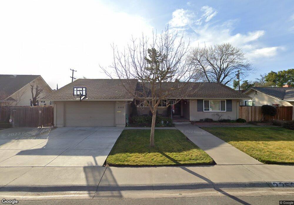
2252 Sheridan Way Unit 18 Stockton, CA 95207
Lincoln Village NeighborhoodEstimated Value: $374,000 - $557,000
3
Beds
2
Baths
2,164
Sq Ft
$224/Sq Ft
Est. Value
About This Home
This home is located at 2252 Sheridan Way Unit 18, Stockton, CA 95207 and is currently estimated at $483,879, approximately $223 per square foot. 2252 Sheridan Way Unit 18 is a home located in San Joaquin County with nearby schools including Tully C. Knoles School, Sierra Middle School, and Lincoln High School.
Ownership History
Date
Name
Owned For
Owner Type
Purchase Details
Closed on
Sep 21, 2006
Sold by
Ratto Greg L and Ratto Janet L
Bought by
Ratto Gregory Lynn and Ratto Janet Lynne
Current Estimated Value
Purchase Details
Closed on
Oct 7, 1994
Sold by
Pettine Elizabeth J and The Elizabeth J Pettine Trust
Bought by
Ratto Greg L and Ratto Janet L
Home Financials for this Owner
Home Financials are based on the most recent Mortgage that was taken out on this home.
Original Mortgage
$113,000
Interest Rate
8.5%
Create a Home Valuation Report for This Property
The Home Valuation Report is an in-depth analysis detailing your home's value as well as a comparison with similar homes in the area
Home Values in the Area
Average Home Value in this Area
Purchase History
| Date | Buyer | Sale Price | Title Company |
|---|---|---|---|
| Ratto Gregory Lynn | -- | None Available | |
| Ratto Greg L | $178,000 | North American Title Company |
Source: Public Records
Mortgage History
| Date | Status | Borrower | Loan Amount |
|---|---|---|---|
| Closed | Ratto Greg L | $113,000 |
Source: Public Records
Tax History Compared to Growth
Tax History
| Year | Tax Paid | Tax Assessment Tax Assessment Total Assessment is a certain percentage of the fair market value that is determined by local assessors to be the total taxable value of land and additions on the property. | Land | Improvement |
|---|---|---|---|---|
| 2025 | $5,340 | $298,947 | $92,370 | $206,577 |
| 2024 | $5,180 | $293,086 | $90,559 | $202,527 |
| 2023 | $5,076 | $287,340 | $88,784 | $198,556 |
| 2022 | $4,867 | $281,707 | $87,044 | $194,663 |
| 2021 | $4,783 | $276,185 | $85,338 | $190,847 |
| 2020 | $4,861 | $273,354 | $84,463 | $188,891 |
| 2019 | $4,810 | $267,995 | $82,807 | $185,188 |
| 2018 | $4,706 | $262,741 | $81,184 | $181,557 |
| 2017 | $4,641 | $257,591 | $79,593 | $177,998 |
| 2016 | $4,209 | $252,541 | $78,032 | $174,509 |
| 2014 | $4,386 | $243,876 | $75,355 | $168,521 |
Source: Public Records
Map
Nearby Homes
- 2252 W Benjamin Holt Dr
- 2447 Calhoun Way
- 2039 W Benjamin Holt Dr
- 2014 Douglas Rd
- 1864 Polk Way
- 1860 Douglas Rd
- 1929 W Swain Rd
- 2252 Canyon Creek Dr
- 1703 Polk Way
- 2914 Prentiss Ct
- 6415 Plymouth Rd
- 2128 Canyon Creek Dr
- 1720 Mcclellan Way
- 1707 W Swain Rd Unit 5
- 2009 Cedar Ridge Dr
- 2922 Prentiss Ct
- 2005 Cedar Ridge Dr
- 2921 Rutledge Ct
- 2935 Prentiss Ct Unit 1844
- 1633 Porter Way
- 2238 Sheridan Way
- 2264 Sheridan Way
- 2243 Rutledge Way
- 2255 Rutledge Way
- 2231 Rutledge Way
- 2305 Rutledge Way
- 2259 Sheridan Way Unit 18
- 2247 Sheridan Way
- 2306 Sheridan Way
- 2224 Sheridan Way
- 2303 Sheridan Way
- 2219 Rutledge Way Unit 18
- 2233 Sheridan Way
- 2317 Rutledge Way
- 2320 Sheridan Way Unit 18
- 2246 Rutledge Way Unit 18
- 2319 Sheridan Way
- 2258 Rutledge Way
- 2208 Sheridan Way
- 2219 Sheridan Way