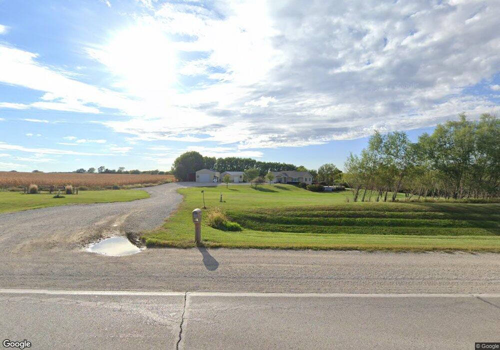
2253 Highway 169 Unit US Winterset, IA 50273
Estimated Value: $519,051 - $605,000
4
Beds
5
Baths
1,422
Sq Ft
$391/Sq Ft
Est. Value
About This Home
This home is located at 2253 Highway 169 Unit US, Winterset, IA 50273 and is currently estimated at $555,684, approximately $390 per square foot. 2253 Highway 169 Unit US is a home located in Madison County with nearby schools including Winterset Elementary School, Winterset Middle School, and Winterset Junior High School.
Ownership History
Date
Name
Owned For
Owner Type
Purchase Details
Closed on
Apr 9, 2021
Sold by
Teulson Gregory W and Teulson Jackie
Bought by
Teulson Gregory W and Teulson Jackie
Current Estimated Value
Purchase Details
Closed on
Apr 11, 2012
Sold by
Tuttle Dale E and Tuttle Nancy L
Bought by
Trulson Gregory W
Create a Home Valuation Report for This Property
The Home Valuation Report is an in-depth analysis detailing your home's value as well as a comparison with similar homes in the area
Home Values in the Area
Average Home Value in this Area
Purchase History
| Date | Buyer | Sale Price | Title Company |
|---|---|---|---|
| Teulson Gregory W | -- | None Available | |
| Trulson Gregory W | -- | None Available |
Source: Public Records
Tax History Compared to Growth
Tax History
| Year | Tax Paid | Tax Assessment Tax Assessment Total Assessment is a certain percentage of the fair market value that is determined by local assessors to be the total taxable value of land and additions on the property. | Land | Improvement |
|---|---|---|---|---|
| 2025 | $6,016 | $468,300 | $57,400 | $410,900 |
| 2024 | $5,998 | $447,300 | $67,300 | $380,000 |
| 2023 | $5,726 | $447,300 | $67,300 | $380,000 |
| 2022 | $5,582 | $355,400 | $67,300 | $288,100 |
| 2021 | $5,582 | $355,400 | $67,300 | $288,100 |
| 2020 | $5,664 | $334,500 | $49,900 | $284,600 |
| 2019 | $5,404 | $308,900 | $0 | $0 |
| 2018 | $4,334 | $254,100 | $0 | $0 |
| 2017 | $4,208 | $242,500 | $0 | $0 |
| 2016 | $3,992 | $242,500 | $0 | $0 |
| 2015 | $3,798 | $234,800 | $0 | $0 |
| 2014 | $3,798 | $234,800 | $0 | $0 |
Source: Public Records
Map
Nearby Homes
- 1624 W Summit St Unit 109
- 1624 W Summit St Unit 134
- 1024 W Summit St
- 114 S 14th Ave
- 1021 W South St
- 827 W Fremont St
- 212 N 14th Ave
- 516 S 8th Ave
- 309 N 15th Ave
- 400 N 14th Ave
- 513 W Hutchings St
- 516 W Summit St
- 501 W Hutchings St
- 721 W Court Ave
- 724 W Jefferson St
- 310 W Washington St
- 204 W Washington St
- 1011 N 14th Ave
- 66 E High St
- 315 N 4th Ave
- 2217 183rd Lot 47d Covered Bridge Estateshwy169 Ct
- 2223 Kippy Ln
- 2262 Highway 169 Unit US
- 2262 Highway 169
- 2214 Kippy Ln
- 2060 226th Ct
- 2061 226th Ct
- 2238 Kippy Ln
- Lot 2 226th Ct Kippy Ridge Estates Lot #2 Ct
- 0 Kippy Ln
- lot 9 Kippy Ln
- Lot 15-16 Kippy Ln
- 2075 226th Ct
- 2244 Kippy Ln
- 2259 Kippy Ln
- 2081 226th Ct
- 0 226th Ct
- 2078 226th Ct
- LOT 9 Kippy Ridge Estates
- 2259 Kippy Ridge Ct