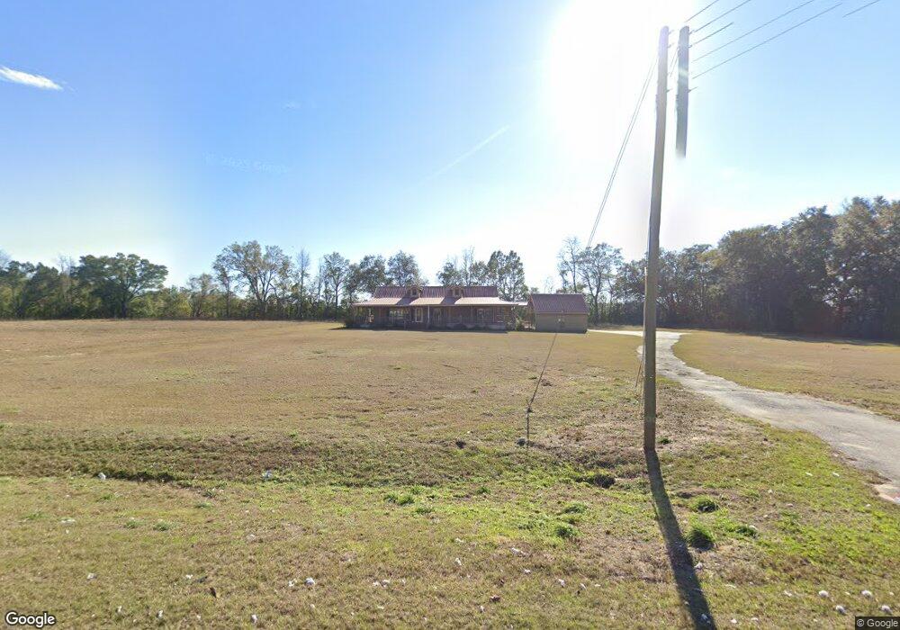
2255 Dothan Rd Bainbridge, GA 39817
Estimated Value: $228,000 - $411,105
3
Beds
2
Baths
1,932
Sq Ft
$151/Sq Ft
Est. Value
About This Home
This home is located at 2255 Dothan Rd, Bainbridge, GA 39817 and is currently estimated at $292,026, approximately $151 per square foot. 2255 Dothan Rd is a home located in Decatur County with nearby schools including Bainbridge High School.
Ownership History
Date
Name
Owned For
Owner Type
Purchase Details
Closed on
May 1, 2024
Sold by
Taylor Martha Pelham
Bought by
Burns Bruce Daniel and Adams Burns Charles
Current Estimated Value
Purchase Details
Closed on
Dec 5, 2023
Sold by
Holtzclaw Joey L
Bought by
Farmers & Merchants Bank
Purchase Details
Closed on
Sep 5, 2006
Sold by
Powell Judy T
Bought by
Holtzclaw Joey L and Holtzclaw Sheila M
Home Financials for this Owner
Home Financials are based on the most recent Mortgage that was taken out on this home.
Original Mortgage
$109,409
Interest Rate
6.52%
Mortgage Type
New Conventional
Create a Home Valuation Report for This Property
The Home Valuation Report is an in-depth analysis detailing your home's value as well as a comparison with similar homes in the area
Purchase History
| Date | Buyer | Sale Price | Title Company |
|---|---|---|---|
| Burns Bruce Daniel | -- | -- | |
| Farmers & Merchants Bank | $265,000 | -- | |
| Holtzclaw Joey L | $120,000 | -- |
Source: Public Records
Mortgage History
| Date | Status | Borrower | Loan Amount |
|---|---|---|---|
| Previous Owner | Holtzclaw Joey L | $109,409 |
Source: Public Records
Tax History
| Year | Tax Paid | Tax Assessment Tax Assessment Total Assessment is a certain percentage of the fair market value that is determined by local assessors to be the total taxable value of land and additions on the property. | Land | Improvement |
|---|---|---|---|---|
| 2025 | $4,133 | $138,359 | $7,096 | $131,263 |
| 2024 | $3,813 | $126,598 | $7,096 | $119,502 |
| 2023 | $3,626 | $126,598 | $7,096 | $119,502 |
| 2022 | $3,195 | $111,808 | $7,096 | $104,712 |
| 2021 | $2,987 | $102,751 | $7,096 | $95,655 |
| 2020 | $2,798 | $91,579 | $7,096 | $84,483 |
| 2019 | $2,633 | $83,182 | $7,451 | $75,731 |
| 2018 | $2,600 | $83,182 | $7,451 | $75,731 |
| 2017 | $2,610 | $83,182 | $7,451 | $75,731 |
| 2016 | $2,547 | $83,182 | $7,451 | $75,731 |
| 2015 | $2,582 | $83,182 | $7,451 | $75,731 |
| 2014 | $2,253 | $83,182 | $7,451 | $75,731 |
| 2013 | -- | $83,182 | $7,450 | $75,731 |
Source: Public Records
Map
Nearby Homes
- 850 Zorn Rd
- Lot 12 Dow Jones Rd
- 1019 Zorn Rd
- 125 John Sam Rd
- 1624 Bethel Rd
- 00 Dothan Rd
- Lot Griffin St
- 000 Conger Dr
- 709 N Miller Ave
- 604 Martin St
- TBD LOT 99 & 10 Seminole Ridge S D
- 2400 Airport Rd Unit 6
- 627 John Sam Rd
- 000 US Highway 27
- 0 Pine St Unit 10993
- 909 Cox Ave
- 719 W Shotwell St
- 415 Charles St
- 212 Michaels Way
- 306 S Broad St
Your Personal Tour Guide
Ask me questions while you tour the home.