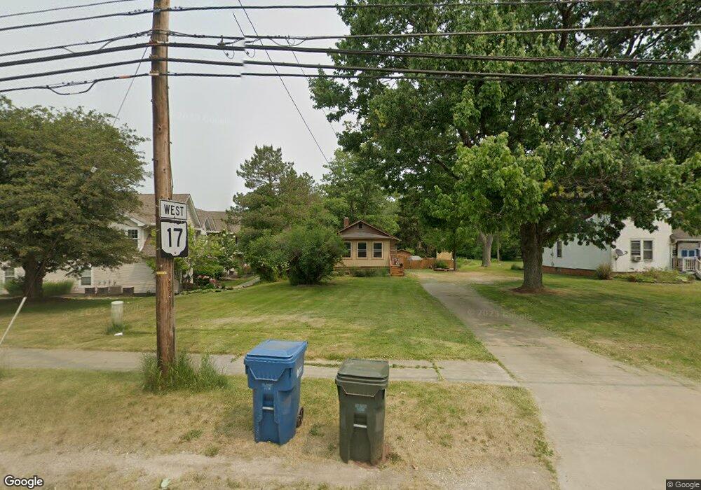
22570 Brookpark Rd Cleveland, OH 44126
Estimated Value: $199,205 - $257,000
2
Beds
1
Bath
748
Sq Ft
$304/Sq Ft
Est. Value
About This Home
This home is located at 22570 Brookpark Rd, Cleveland, OH 44126 and is currently estimated at $227,301, approximately $303 per square foot. 22570 Brookpark Rd is a home located in Cuyahoga County with nearby schools including Gilles-Sweet Elementary School, Lewis F Mayer Middle School, and Fairview High School.
Ownership History
Date
Name
Owned For
Owner Type
Purchase Details
Closed on
Dec 29, 2008
Sold by
Tollis Terry Z
Bought by
Tintelnot Richard A
Current Estimated Value
Home Financials for this Owner
Home Financials are based on the most recent Mortgage that was taken out on this home.
Original Mortgage
$92,900
Outstanding Balance
$61,813
Interest Rate
6.19%
Mortgage Type
Seller Take Back
Estimated Equity
$165,488
Purchase Details
Closed on
Dec 3, 1997
Sold by
Westlake Campus Realty
Bought by
Terry Tollis Trustee
Purchase Details
Closed on
Nov 14, 1989
Sold by
Schneider Wilma R
Bought by
Rispo Investment Co
Purchase Details
Closed on
Jan 1, 1975
Bought by
Schneider Wilma R
Create a Home Valuation Report for This Property
The Home Valuation Report is an in-depth analysis detailing your home's value as well as a comparison with similar homes in the area
Home Values in the Area
Average Home Value in this Area
Purchase History
| Date | Buyer | Sale Price | Title Company |
|---|---|---|---|
| Tintelnot Richard A | -- | None Available | |
| Terry Tollis Trustee | $116,400 | -- | |
| Rispo Investment Co | $48,000 | -- | |
| Schneider Wilma R | -- | -- |
Source: Public Records
Mortgage History
| Date | Status | Borrower | Loan Amount |
|---|---|---|---|
| Open | Tintelnot Richard A | $92,900 |
Source: Public Records
Tax History Compared to Growth
Tax History
| Year | Tax Paid | Tax Assessment Tax Assessment Total Assessment is a certain percentage of the fair market value that is determined by local assessors to be the total taxable value of land and additions on the property. | Land | Improvement |
|---|---|---|---|---|
| 2024 | $4,043 | $56,805 | $19,040 | $37,765 |
| 2023 | $3,732 | $44,840 | $11,450 | $33,390 |
| 2022 | $3,643 | $44,840 | $11,450 | $33,390 |
| 2021 | $3,711 | $44,840 | $11,450 | $33,390 |
| 2020 | $3,415 | $36,160 | $9,240 | $26,920 |
| 2019 | $3,049 | $103,300 | $26,400 | $76,900 |
| 2018 | $2,861 | $36,160 | $9,240 | $26,920 |
| 2017 | $2,794 | $30,530 | $9,280 | $21,250 |
| 2016 | $2,776 | $30,530 | $9,280 | $21,250 |
| 2015 | $2,676 | $30,530 | $9,280 | $21,250 |
| 2014 | $2,676 | $29,650 | $9,000 | $20,650 |
Source: Public Records
Map
Nearby Homes
- 22537 Lenox Dr
- 22636 Mastick Rd
- 22640 Lenox Dr
- 22934 Mastick Rd Unit 102
- 22250 Mastick Rd
- 22276 Sycamore Dr
- 22439 Haber Dr
- 22895 Mastick Rd
- 5951 Rockport Ln
- 23052 Mastick Rd
- 4530 Clague Rd
- 22534 Bard Ave
- 4666 Brendan Cir
- 4590 Brendan Ln
- 22503 Sandy Ln
- 5300 Sherwood Dr
- 4550 Georgette Ave
- 4505 Oak Cir
- 4849 Grace Rd Unit 121
- 21877 Seabury Ave
- 22566 Brookpark Rd
- 22549 Lenox Dr Unit 5527
- 22539 Lenox Dr Unit G80
- 22539 Lenox Dr Unit 513
- 22549 Lenox Dr Unit 527
- 22537 Lenox Dr Unit 521
- 22561 Lenox Dr Unit 522
- 22561 Lenox Dr Unit 522
- 22561 Lenox Dr
- 22565 Lenox Dr Unit 520
- 22565 Lenox Dr Unit 520
- 22565 Lenox Dr
- 22516 Mastick Rd
- 22551 Lenox Dr Unit 516
- 22551 Lenox Dr Unit G90
- 22551 Lenox Dr
- 22490 Mastick Rd
- 22546 Lenox Dr Unit 425
- 22560 Lenox Dr Unit 412
- 22556 Lenox Dr Unit 414