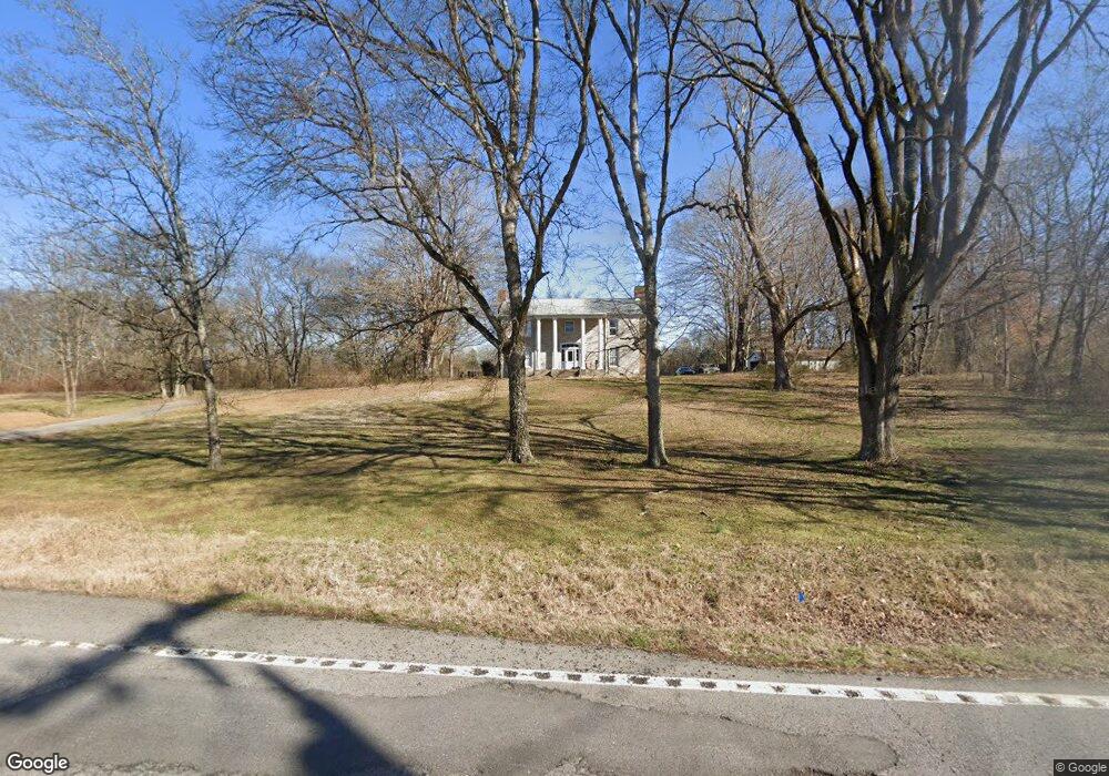
2258 Highway 25 Cottontown, TN 37048
Estimated Value: $707,258 - $881,000
--
Bed
2
Baths
3,216
Sq Ft
$251/Sq Ft
Est. Value
About This Home
This home is located at 2258 Highway 25, Cottontown, TN 37048 and is currently estimated at $806,565, approximately $250 per square foot. 2258 Highway 25 is a home located in Sumner County with nearby schools including Howard Elementary School, Rucker Stewart Middle School, and Station Camp High School.
Ownership History
Date
Name
Owned For
Owner Type
Purchase Details
Closed on
Mar 28, 2019
Sold by
Lennon John Robert and Lennon Rachal M
Bought by
Soranno Jennifer and Coyne Patrick
Current Estimated Value
Home Financials for this Owner
Home Financials are based on the most recent Mortgage that was taken out on this home.
Original Mortgage
$359,920
Outstanding Balance
$316,434
Interest Rate
4.3%
Mortgage Type
New Conventional
Estimated Equity
$490,131
Purchase Details
Closed on
Feb 19, 2002
Sold by
Crossley Susan O and Crossley Patrick P
Bought by
Lennon John Robert and Lennon Rachal M
Home Financials for this Owner
Home Financials are based on the most recent Mortgage that was taken out on this home.
Original Mortgage
$176,000
Interest Rate
6.81%
Create a Home Valuation Report for This Property
The Home Valuation Report is an in-depth analysis detailing your home's value as well as a comparison with similar homes in the area
Home Values in the Area
Average Home Value in this Area
Purchase History
| Date | Buyer | Sale Price | Title Company |
|---|---|---|---|
| Soranno Jennifer | $449,900 | Magnolia Title & Escrow Inc | |
| Lennon John Robert | $230,000 | -- |
Source: Public Records
Mortgage History
| Date | Status | Borrower | Loan Amount |
|---|---|---|---|
| Open | Soranno Jennifer | $359,920 | |
| Previous Owner | Lennon John Robert | $176,000 |
Source: Public Records
Tax History Compared to Growth
Tax History
| Year | Tax Paid | Tax Assessment Tax Assessment Total Assessment is a certain percentage of the fair market value that is determined by local assessors to be the total taxable value of land and additions on the property. | Land | Improvement |
|---|---|---|---|---|
| 2024 | $2,152 | $151,425 | $84,150 | $67,275 |
| 2023 | $1,714 | $76,125 | $37,900 | $38,225 |
| 2022 | $1,722 | $76,125 | $37,900 | $38,225 |
| 2021 | $1,722 | $76,125 | $37,900 | $38,225 |
| 2020 | $1,722 | $76,125 | $37,900 | $38,225 |
| 2019 | $1,722 | $0 | $0 | $0 |
| 2018 | $1,669 | $0 | $0 | $0 |
| 2017 | $1,669 | $0 | $0 | $0 |
| 2016 | $1,669 | $0 | $0 | $0 |
| 2015 | -- | $0 | $0 | $0 |
| 2014 | -- | $0 | $0 | $0 |
Source: Public Records
Map
Nearby Homes
- 2197 Tennessee 25
- 150 Nolen Cir
- 2450 Highway 25
- 0 Bugg Hollow Rd Unit RTC2996373
- 0 Bugg Hollow Rd Unit RTC2996368
- 2548 Highway 25
- 2562 Tennessee 25
- 680 Harvey Pvt Ln
- 114 Awesome Ave
- 665 Harvey Pvt Ln
- 1050 Franklin Rd
- 675 Harvey Pvt Ln
- 0 Franklin Rd
- 406 Cummings Ln
- 1869 Tennessee 25
- 0 Pee Dee Branch Rd
- 315 Cummings Ln
- 308 Collier Ln
- 481 Brazier Ln
- 2045 Liberty Ln
- 2241 Highway 25
- 2239 Highway 25
- 0 Tennessee 25
- 2247 Tennessee 25
- 2258 25w Hwy
- 2234 25w Hwy
- 2265 Highway 25
- 2234 Highway 25
- 2238 Highway 25
- 130 Hilltop Ln
- 2268 Highway 25
- 2221 Highway 25
- 0 Hwy 31 W
- 2218 Highway 25
- 2315 Highway 25
- 2214 25w Hwy
- 3043 Tennessee 25
- 0 Tennessee 25
- 0A Tennessee 25
- 0B Tennessee 25