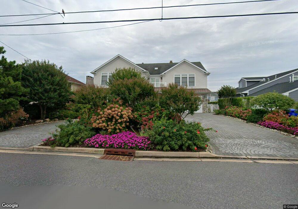
226 Curtis Point Dr Mantoloking, NJ 08738
Estimated Value: $3,487,000 - $4,559,000
7
Beds
5
Baths
6,175
Sq Ft
$624/Sq Ft
Est. Value
About This Home
This home is located at 226 Curtis Point Dr, Mantoloking, NJ 08738 and is currently estimated at $3,852,874, approximately $623 per square foot. 226 Curtis Point Dr is a home located in Ocean County with nearby schools including Emma Havens Young Elementary School, Lake Riviera Middle School, and Brick Township High School.
Ownership History
Date
Name
Owned For
Owner Type
Purchase Details
Closed on
Oct 27, 2008
Sold by
Gamarello Martin and Gamarello Grace
Bought by
Nogueiras Properties Ii Llc
Current Estimated Value
Purchase Details
Closed on
Mar 31, 1999
Sold by
Soloway Stella E
Bought by
Gamarello Martin and Gamarello Grace
Home Financials for this Owner
Home Financials are based on the most recent Mortgage that was taken out on this home.
Original Mortgage
$220,000
Interest Rate
7.25%
Mortgage Type
Stand Alone First
Create a Home Valuation Report for This Property
The Home Valuation Report is an in-depth analysis detailing your home's value as well as a comparison with similar homes in the area
Home Values in the Area
Average Home Value in this Area
Purchase History
| Date | Buyer | Sale Price | Title Company |
|---|---|---|---|
| Nogueiras Properties Ii Llc | $1,750,000 | None Available | |
| Gamarello Martin | $420,000 | -- |
Source: Public Records
Mortgage History
| Date | Status | Borrower | Loan Amount |
|---|---|---|---|
| Previous Owner | Gamarello Martin | $220,000 |
Source: Public Records
Tax History Compared to Growth
Tax History
| Year | Tax Paid | Tax Assessment Tax Assessment Total Assessment is a certain percentage of the fair market value that is determined by local assessors to be the total taxable value of land and additions on the property. | Land | Improvement |
|---|---|---|---|---|
| 2025 | $35,480 | $1,373,600 | $730,100 | $643,500 |
| 2024 | $33,722 | $1,373,600 | $730,100 | $643,500 |
| 2023 | $33,282 | $1,373,600 | $730,100 | $643,500 |
| 2022 | $33,282 | $1,373,600 | $730,100 | $643,500 |
| 2021 | $32,582 | $1,373,600 | $730,100 | $643,500 |
| 2020 | $32,170 | $1,373,600 | $730,100 | $643,500 |
| 2019 | $31,634 | $1,373,600 | $730,100 | $643,500 |
| 2018 | $30,906 | $1,373,600 | $730,100 | $643,500 |
| 2017 | $30,068 | $1,373,600 | $730,100 | $643,500 |
| 2016 | $29,917 | $1,373,600 | $730,100 | $643,500 |
| 2015 | $29,134 | $1,373,600 | $730,100 | $643,500 |
| 2014 | $28,901 | $1,180,500 | $730,100 | $450,400 |
Source: Public Records
Map
Nearby Homes
- 233 Curtis Point Dr
- 122 Squan Beach Dr
- 275 Curtis Point Dr
- 150 Sunset Ln
- 304 Schooner Ln
- 1519 Runyon Ln
- 308 Cove Dr
- 1318 Ocean Ave
- 366 Highway 35 N
- 1207 Ocean Ave
- 1201 Ocean Ave
- 438 Highway 35 N Unit 1304
- 12 Shell Rd
- 1097 Barnegat Ln
- 124 Saint Lawrence Blvd
- 64 W Granada Dr
- 45 W Granada Dr
- 515 New Jersey 35
- 1063 Ocean Ave
- 108 Rochester Dr
- 224 Curtis Point Dr
- 230 Curtis Point Dr
- 234 Curtis Point Dr
- 220 Curtis Point Dr
- 229 Curtis Point Dr
- 225 Curtis Point Dr
- 231 Curtis Point Dr
- 223 Curtis Point Dr
- 236 Curtis Point Dr
- 216 Curtis Point Dr
- 131 Squan Beach Dr
- 133 Squan Beach Dr
- 219 Curtis Point Dr
- 135 Squan Beach Dr
- 129 Squan Beach Dr
- 238 Curtis Point Dr
- 137 Squan Beach Dr
- 214 Curtis Point Dr
- 125 Squan Beach Dr
- 237 Curtis Point Dr