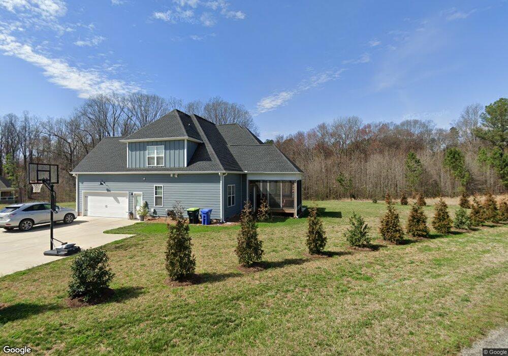
226 Eagle Ln Lexington, NC 27295
Estimated Value: $480,000 - $619,000
4
Beds
3
Baths
3,942
Sq Ft
$137/Sq Ft
Est. Value
About This Home
This home is located at 226 Eagle Ln, Lexington, NC 27295 and is currently estimated at $539,781, approximately $136 per square foot. 226 Eagle Ln is a home with nearby schools including Tyro Elementary School, Tyro Middle School, and West Davidson High School.
Ownership History
Date
Name
Owned For
Owner Type
Purchase Details
Closed on
Apr 20, 2020
Sold by
M & J Developers Inc
Bought by
Welborn William Brent and Welbron Mary Cameron
Current Estimated Value
Home Financials for this Owner
Home Financials are based on the most recent Mortgage that was taken out on this home.
Original Mortgage
$337,565
Outstanding Balance
$297,900
Interest Rate
3.2%
Mortgage Type
FHA
Estimated Equity
$241,881
Purchase Details
Closed on
Aug 14, 2019
Sold by
Evergrowing Real Estate Investments Llc
Bought by
M & J Developers Inc
Home Financials for this Owner
Home Financials are based on the most recent Mortgage that was taken out on this home.
Original Mortgage
$297,600
Interest Rate
3.7%
Mortgage Type
Construction
Purchase Details
Closed on
Sep 22, 2011
Sold by
York Land Development Llc
Bought by
Lsb Properties Inc
Create a Home Valuation Report for This Property
The Home Valuation Report is an in-depth analysis detailing your home's value as well as a comparison with similar homes in the area
Home Values in the Area
Average Home Value in this Area
Purchase History
| Date | Buyer | Sale Price | Title Company |
|---|---|---|---|
| Welborn William Brent | $382,500 | None Available | |
| M & J Developers Inc | $15,000 | None Available | |
| Lsb Properties Inc | $700,000 | None Available |
Source: Public Records
Mortgage History
| Date | Status | Borrower | Loan Amount |
|---|---|---|---|
| Open | Welborn William Brent | $337,565 | |
| Previous Owner | M & J Developers Inc | $297,600 |
Source: Public Records
Tax History
| Year | Tax Paid | Tax Assessment Tax Assessment Total Assessment is a certain percentage of the fair market value that is determined by local assessors to be the total taxable value of land and additions on the property. | Land | Improvement |
|---|---|---|---|---|
| 2025 | $2,135 | $349,610 | $0 | $0 |
| 2024 | $2,135 | $349,610 | $0 | $0 |
| 2023 | $2,133 | $349,340 | $0 | $0 |
| 2022 | $2,133 | $349,340 | $0 | $0 |
| 2021 | $2,133 | $349,340 | $0 | $0 |
| 2020 | $1,247 | $204,180 | $0 | $0 |
| 2019 | $217 | $35,000 | $0 | $0 |
| 2018 | $217 | $35,000 | $0 | $0 |
| 2017 | $217 | $35,000 | $0 | $0 |
| 2016 | $217 | $35,000 | $0 | $0 |
| 2015 | $217 | $35,000 | $0 | $0 |
| 2014 | $260 | $42,000 | $0 | $0 |
Source: Public Records
Map
Nearby Homes
- 149 Deerwood Dr
- 5218 Muirfield Dr
- 221 Estelle Dr
- 000 Manteo Rd
- 450 Beaver Creek Rd
- 450 Beaver Creek Rd Unit 14
- 951 Helmstetler Rd
- 104 Cherokee Dr
- 102 Tomahawk Trail
- 33 Lantern Ln
- 2001 Sunshine Ln
- 2004 Sunrise Cir
- 1000 Caden Village Cir
- 192 Swans Way
- 300 Waylon Ct
- 307 Waylon Ct
- 287 Waylon Ct
- 275 Waylon Ct
- 264 Waylon Ct
- 263 Waylon Ct
- 211 Comanche
- 116 Eagle Ln
- 202 Eagle Ln
- 112 Comanche Trail
- 110 Comanche Trail
- 114 Comanche Trail
- 170 Eagle Ln
- 108 Comanche Trail
- 207 Eagle Ln
- 175 Eagle Ln
- 106 Comanche Trail
- 109 Comanche Trail
- 111 Comanche Trail
- 5707 Gleneagle Ln
- 5809 Prestwick Ct
- 105 Comanche Trail
- 5705 Gleneagle Ln
- 5805 Prestwick Ct
- 104 Comanche Trail
- 5601 Birkdale Dr
Your Personal Tour Guide
Ask me questions while you tour the home.