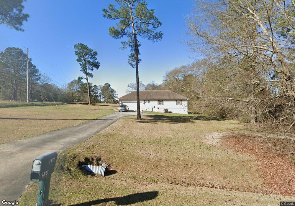
226 Olivia Cir Macon, GA 31211
Estimated Value: $214,933 - $286,000
--
Bed
2
Baths
2,097
Sq Ft
$116/Sq Ft
Est. Value
About This Home
This home is located at 226 Olivia Cir, Macon, GA 31211 and is currently estimated at $243,733, approximately $116 per square foot. 226 Olivia Cir is a home located in Jones County with nearby schools including Mattie Wells Elementary School, Clifton Ridge Middle School, and Jones County High School.
Ownership History
Date
Name
Owned For
Owner Type
Purchase Details
Closed on
Jan 16, 2014
Sold by
River Edge Behavioral Heal
Bought by
Georgia Affordable Housing Sol
Current Estimated Value
Purchase Details
Closed on
Mar 25, 2011
Sold by
The Bank Of Ny Co Na
Bought by
River Edge Behavioral Health Center
Purchase Details
Closed on
Oct 5, 2010
Sold by
Jackson Barbara
Bought by
The Bank Of New York Mellon
Purchase Details
Closed on
May 11, 2001
Sold by
Warren Ray
Bought by
Jackson Barbara
Purchase Details
Closed on
Jul 21, 2000
Sold by
Giles J Paul
Bought by
Warren Ray
Create a Home Valuation Report for This Property
The Home Valuation Report is an in-depth analysis detailing your home's value as well as a comparison with similar homes in the area
Home Values in the Area
Average Home Value in this Area
Purchase History
| Date | Buyer | Sale Price | Title Company |
|---|---|---|---|
| Georgia Affordable Housing Sol | -- | -- | |
| River Edge Behavioral Health Center | $72,000 | -- | |
| The Bank Of New York Mellon | $71,500 | -- | |
| Jackson Barbara | -- | -- | |
| Warren Ray | $17,900 | -- |
Source: Public Records
Tax History Compared to Growth
Tax History
| Year | Tax Paid | Tax Assessment Tax Assessment Total Assessment is a certain percentage of the fair market value that is determined by local assessors to be the total taxable value of land and additions on the property. | Land | Improvement |
|---|---|---|---|---|
| 2024 | -- | $72,660 | $9,600 | $63,060 |
| 2023 | $2,275 | $63,211 | $9,600 | $53,611 |
| 2022 | $2,275 | $63,211 | $9,600 | $53,611 |
| 2021 | $2,275 | $63,211 | $9,600 | $53,611 |
| 2020 | $2,275 | $63,211 | $9,600 | $53,611 |
| 2019 | $2,275 | $63,211 | $9,600 | $53,611 |
| 2018 | $2,275 | $63,211 | $9,600 | $53,611 |
| 2017 | $2,275 | $63,211 | $9,600 | $53,611 |
| 2016 | -- | $63,211 | $9,600 | $53,611 |
| 2015 | -- | $63,211 | $9,600 | $53,611 |
| 2014 | -- | $63,211 | $9,600 | $53,611 |
Source: Public Records
Map
Nearby Homes
- 225 Olivia Cir
- 227 Dusty Ln
- 118 Oakwood Dr
- 3608 Joycliff Rd
- 687 Jasmine Dr
- 699 Jasmine Dr
- 699 Jasmine Dr Unit C48
- Birch Plan at Clifton Ridge
- Lane Plan at Clifton Ridge
- Benton Plan at Clifton Ridge
- Duke Plan at Clifton Ridge
- Brooke Plan at Clifton Ridge
- Delilah Plan at Clifton Ridge
- 1042 Sun Valley Ct Unit C58
- 135 Sun Valley Dr
- 3320 Joycliff Rd
- 131 Sun Valley Dr
- 0 Kings Ct N Unit 10639310
- 194 Baker Rd
- 191 Dusty Ln
- 147 John Michael Dr
- 158 Meadow Dr
- 153 John Michael Dr
- 155 Meadow Dr
- 154 Meadow Dr
- 137 John Michael Dr
- 152 Meadow Dr
- 151 Meadow Dr
- 215 Dusty Ln
- 157 John Michael Dr
- 148 John Michael Dr
- 0 John Michael Dr
- 147 Meadow Dr
- 131 John Michael Dr
- 148 Meadow Dr
- 508 Dusty Ln
- 136 John Michael Dr
- 221 Dusty Ln
- 163 John Michael Dr