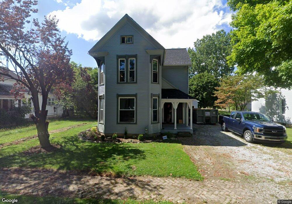
226 S Hazel St Upper Sandusky, OH 43351
Estimated Value: $159,000 - $205,568
3
Beds
2
Baths
1,568
Sq Ft
$114/Sq Ft
Est. Value
About This Home
This home is located at 226 S Hazel St, Upper Sandusky, OH 43351 and is currently estimated at $178,642, approximately $113 per square foot. 226 S Hazel St is a home located in Wyandot County with nearby schools including Upper Sandusky High School and St. Peter Elementary School.
Ownership History
Date
Name
Owned For
Owner Type
Purchase Details
Closed on
Dec 8, 2023
Sold by
Barnett Scott
Bought by
Conway Steven J and Conway Amy M
Current Estimated Value
Purchase Details
Closed on
Apr 26, 2023
Sold by
Shefiff Of Wyandot County
Bought by
Schmidt-Best Jennifer J
Purchase Details
Closed on
Jun 4, 2018
Sold by
Best Jasen E
Bought by
Schmidt Jennifer J and Schmidt Best Jennifer J
Purchase Details
Closed on
Jan 21, 2013
Sold by
Schmidt Jennifer J and Schmidt Best Jennifer J
Bought by
Schmidt Best Jennifer J and Best Jasen E
Home Financials for this Owner
Home Financials are based on the most recent Mortgage that was taken out on this home.
Original Mortgage
$73,575
Interest Rate
3.34%
Purchase Details
Closed on
Feb 25, 2005
Sold by
West Chad A and West Renae E
Bought by
Needs David M
Purchase Details
Closed on
Jan 5, 2003
Bought by
Needs David M
Create a Home Valuation Report for This Property
The Home Valuation Report is an in-depth analysis detailing your home's value as well as a comparison with similar homes in the area
Home Values in the Area
Average Home Value in this Area
Purchase History
| Date | Buyer | Sale Price | Title Company |
|---|---|---|---|
| Conway Steven J | $125 | None Listed On Document | |
| Schmidt-Best Jennifer J | $73,900 | None Listed On Document | |
| Schmidt Jennifer J | -- | None Available | |
| Schmidt Best Jennifer J | -- | None Available | |
| Needs David M | $47,300 | None Available | |
| Needs David M | $47,300 | -- | |
| Needs David M | $47,300 | -- |
Source: Public Records
Mortgage History
| Date | Status | Borrower | Loan Amount |
|---|---|---|---|
| Previous Owner | Schmidt Best Jennifer J | $73,575 |
Source: Public Records
Tax History
| Year | Tax Paid | Tax Assessment Tax Assessment Total Assessment is a certain percentage of the fair market value that is determined by local assessors to be the total taxable value of land and additions on the property. | Land | Improvement |
|---|---|---|---|---|
| 2025 | $1,443 | $47,970 | $3,510 | $44,460 |
| 2024 | $1,340 | $42,130 | $2,950 | $39,180 |
| 2023 | $1,340 | $42,130 | $2,950 | $39,180 |
| 2022 | $1,456 | $32,160 | $2,400 | $29,760 |
| 2021 | $1,071 | $32,160 | $2,400 | $29,760 |
| 2020 | $1,071 | $32,160 | $2,400 | $29,760 |
| 2019 | $1,069 | $32,160 | $2,400 | $29,760 |
| 2018 | $991 | $30,380 | $2,800 | $27,580 |
| 2017 | $1,007 | $30,380 | $2,800 | $27,580 |
| 2016 | $943 | $30,380 | $2,800 | $27,580 |
| 2015 | -- | $29,320 | $2,800 | $26,520 |
| 2014 | -- | $29,320 | $2,800 | $26,520 |
| 2013 | -- | $29,320 | $2,800 | $26,520 |
Source: Public Records
Map
Nearby Homes
- 225 S Hazel St
- 326 S 8th St
- 387 S Warpole St
- 137 N 8th St
- 386 W Finley St
- 430 S Sandusky Ave
- 116 E Walker St
- 379 W Spring St
- 333 N 5th St
- 314 N 4th St
- 334 N 4th St
- 445 N Sandusky Ave
- 479 N 5th St
- 9768 County Highway 111
- 432 E Bigelow St
- 105 Old Lincoln Hwy
- 479 Front St
- 123 Rivers Edge Ln
- 101 Rivers Edge Ln
- 381 & 383 W Johnson St
- 232 S Hazel St
- 514 W Hicks St
- 520 W Hicks St
- 214 S Hazel St
- 231 S Hazel St
- 221 S Hazel St
- 415 W Johnson St
- 415 W Johnson St
- 235 S Hazel St
- 215 S Hazel St
- 524 W Hicks St
- 207 S Hazel St
- 302 S Hazel St
- 419 W Johnson St
- 407 W Johnson St
- 403 W Johnson St
- 530 W Hicks St
- 433 W Hicks St
- 515 W Hicks St
- 346 W Hicks St
Your Personal Tour Guide
Ask me questions while you tour the home.