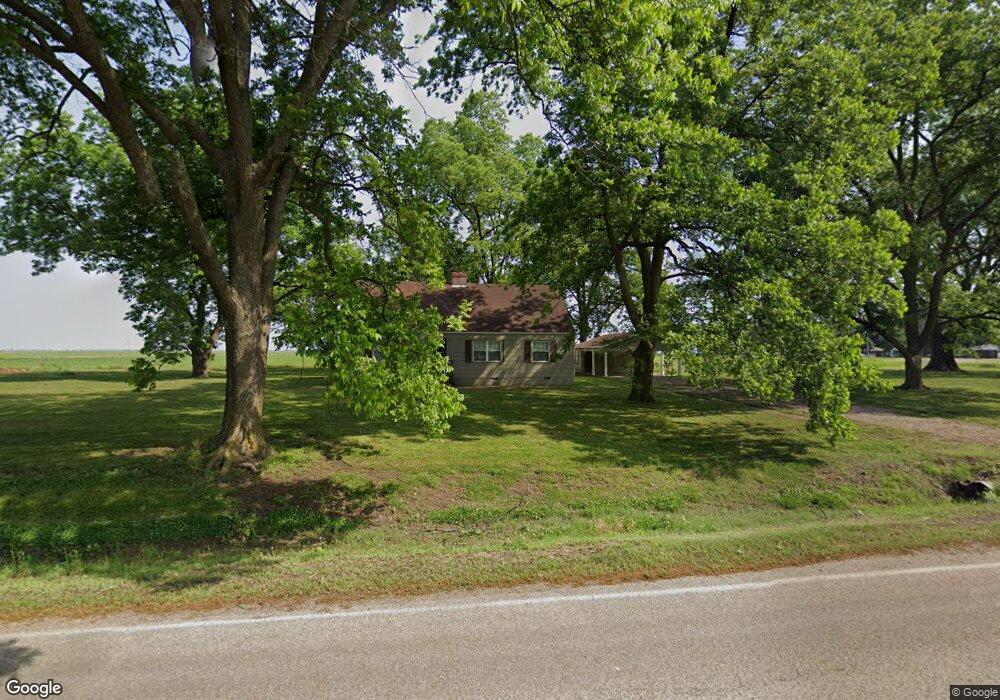
226 State Highway 14 Wilson, AR 72395
Estimated Value: $49,714 - $243,000
--
Bed
--
Bath
1,564
Sq Ft
$89/Sq Ft
Est. Value
About This Home
This home is located at 226 State Highway 14, Wilson, AR 72395 and is currently estimated at $138,679, approximately $88 per square foot. 226 State Highway 14 is a home with nearby schools including Rivercrest Elementary School and The Delta School.
Ownership History
Date
Name
Owned For
Owner Type
Purchase Details
Closed on
Nov 12, 2024
Sold by
Lawrence Land Holdings Llc
Bought by
Lee Wilson & Company Llc
Current Estimated Value
Purchase Details
Closed on
Jan 2, 2014
Sold by
M K W Association Of Farmers
Bought by
Lawrence Land Holdings Llc
Purchase Details
Closed on
Jan 1, 2014
Sold by
M K W Association Of Farmers
Bought by
Lawrence Land Holdings Llc
Purchase Details
Closed on
Jan 2, 2007
Sold by
Wilson Lee & Company
Bought by
M K W Association Of Farmers
Purchase Details
Closed on
Jan 1, 2007
Sold by
Wilson Lee & Company
Bought by
M K W Association Of Farmers
Create a Home Valuation Report for This Property
The Home Valuation Report is an in-depth analysis detailing your home's value as well as a comparison with similar homes in the area
Home Values in the Area
Average Home Value in this Area
Purchase History
| Date | Buyer | Sale Price | Title Company |
|---|---|---|---|
| Lee Wilson & Company Llc | -- | None Listed On Document | |
| Lawrence Land Holdings Llc | -- | -- | |
| Lawrence Land Holdings Llc | -- | -- | |
| M K W Association Of Farmers | -- | -- | |
| M K W Association Of Farmers | -- | -- |
Source: Public Records
Tax History Compared to Growth
Tax History
| Year | Tax Paid | Tax Assessment Tax Assessment Total Assessment is a certain percentage of the fair market value that is determined by local assessors to be the total taxable value of land and additions on the property. | Land | Improvement |
|---|---|---|---|---|
| 2024 | $273 | $5,744 | $1,000 | $4,744 |
| 2023 | $273 | $5,744 | $1,000 | $4,744 |
| 2022 | $273 | $5,744 | $1,000 | $4,744 |
| 2021 | $337 | $5,784 | $1,000 | $4,784 |
| 2020 | -- | $5,784 | $1,000 | $4,784 |
| 2019 | -- | -- | $1,000 | $4,784 |
| 2018 | -- | -- | $1,000 | $4,784 |
| 2017 | -- | -- | $1,000 | $5,945 |
| 2015 | -- | -- | $1,000 | $5,946 |
| 2013 | -- | -- | $1,000 | $5,946 |
Source: Public Records
Map
Nearby Homes
- 4877 S Highway 61
- 4877 U S 61
- 303 Oak St
- 201 N Market St
- 309 Senter Ave
- 1 Cedar St
- 5948 S Co Road 375
- 314 Main St
- 405 Blackwell St
- 0 E Johnson Ave
- 0 Shippen Ave Unit 22016399
- 132 Ken Dr
- 130 Diane Dr
- 123 Kristi Dr
- 110 Carriage Dr
- 106 W Cheryl St
- 101 Carriage Dr
- 109 Newport Dr
- 1199 W Highway 119
- 111 Colonial Rd
- 244 State Highway 14
- 157 Highway 14
- 250 State Highway 14
- 280 State Highway 14
- 101 Laurel St
- 100 Laurel St
- 202 Raintree Dr
- 102 Laurel St
- 103 Laurel St
- 105 Laurel St
- 106 Laurel St
- 206 Raintree Dr
- 107 Laurel St
- 208 Raintree Dr
- 157 State Highway 14
- 207 Raintree Dr
- 210 Raintree Dr
- 209 Raintree Dr
- 1097 W State Highway 119
- 3992 S County Road 391