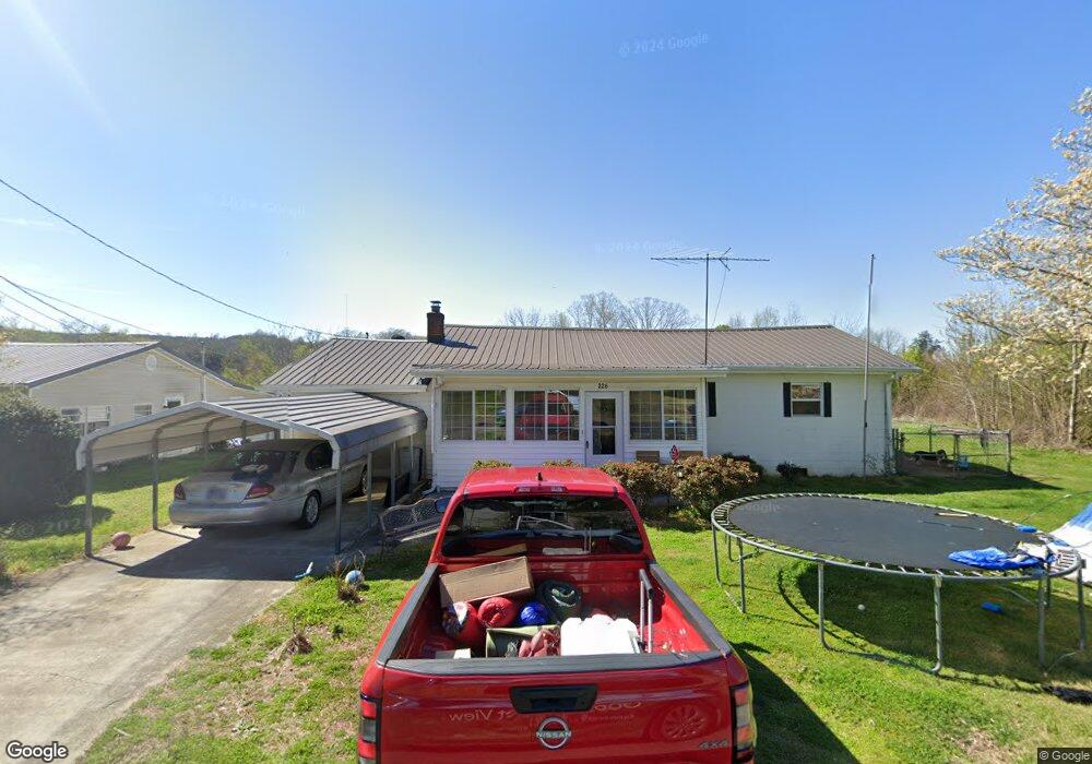
226 Stout St Tellico Plains, TN 37385
Estimated Value: $136,816 - $193,000
--
Bed
1
Bath
1,280
Sq Ft
$124/Sq Ft
Est. Value
About This Home
This home is located at 226 Stout St, Tellico Plains, TN 37385 and is currently estimated at $158,204, approximately $123 per square foot. 226 Stout St is a home located in Monroe County with nearby schools including Tellico Plains Elementary School, Tellico Plains Junior High School, and Tellico Plains High School.
Ownership History
Date
Name
Owned For
Owner Type
Purchase Details
Closed on
Dec 23, 2019
Sold by
Mckenzie Michael Lynn and Herndon Susan Jane
Bought by
Boyd Carrie L
Current Estimated Value
Home Financials for this Owner
Home Financials are based on the most recent Mortgage that was taken out on this home.
Original Mortgage
$79,005
Outstanding Balance
$69,831
Interest Rate
3.73%
Mortgage Type
New Conventional
Estimated Equity
$88,373
Purchase Details
Closed on
Sep 30, 2009
Sold by
Mckenzie Austin
Bought by
Mckenzie Austin
Purchase Details
Closed on
Jun 15, 1992
Bought by
Mckenzie Austin and Mckenzie Mazel
Purchase Details
Closed on
Nov 27, 1989
Purchase Details
Closed on
Mar 1, 1980
Bought by
Hurst Brady Hurst Mildred
Purchase Details
Closed on
Oct 15, 1979
Purchase Details
Closed on
Jun 15, 1966
Create a Home Valuation Report for This Property
The Home Valuation Report is an in-depth analysis detailing your home's value as well as a comparison with similar homes in the area
Home Values in the Area
Average Home Value in this Area
Purchase History
| Date | Buyer | Sale Price | Title Company |
|---|---|---|---|
| Boyd Carrie L | $75,000 | Admiral Title Inc | |
| Mckenzie Austin | $50,000 | -- | |
| Mckenzie Austin | $20,000 | -- | |
| -- | $5,000 | -- | |
| Hurst Brady Hurst Mildred | -- | -- | |
| -- | -- | -- | |
| -- | -- | -- |
Source: Public Records
Mortgage History
| Date | Status | Borrower | Loan Amount |
|---|---|---|---|
| Open | Boyd Carrie L | $79,005 |
Source: Public Records
Tax History Compared to Growth
Tax History
| Year | Tax Paid | Tax Assessment Tax Assessment Total Assessment is a certain percentage of the fair market value that is determined by local assessors to be the total taxable value of land and additions on the property. | Land | Improvement |
|---|---|---|---|---|
| 2024 | $504 | $29,325 | $3,500 | $25,825 |
| 2023 | $504 | $27,425 | $3,500 | $23,925 |
| 2022 | $558 | $20,800 | $1,850 | $18,950 |
| 2021 | $558 | $20,800 | $1,850 | $18,950 |
| 2020 | $558 | $20,800 | $1,850 | $18,950 |
| 2019 | $504 | $20,800 | $1,850 | $18,950 |
| 2018 | $504 | $20,800 | $1,850 | $18,950 |
| 2017 | $502 | $19,600 | $1,325 | $18,275 |
| 2016 | $502 | $19,600 | $1,325 | $18,275 |
| 2015 | $502 | $19,600 | $1,325 | $18,275 |
| 2014 | $502 | $19,582 | $0 | $0 |
Source: Public Records
Map
Nearby Homes
- 410 Scott St
- 217 Loomis St
- 207 Loomis St
- 0 Highway 68 Unit 24267548
- 0 Highway 68 Unit 1316540
- 0 Highway 68 Unit 1316530
- 150 4th St
- 903 Veterans Memorial Dr
- 390 Cherohala Skyway
- 115 Willowbrook Dr
- 104 Hereford St
- 135 H & H Rd
- 206 Cherohala Skyway
- 2 Cherohala Skyway
- 0 Poplar Rd Unit 1293124
- 0 Unicoi Church Rd
- 0 Lake Heights Rd Unit 1310060
- 6915 Tennessee 360
- 117 Indian Ridge Dr
- 125 Indian Ridge Dr
- 228 Stout St
- 222 Stout St
- 225 Stout St
- 216 Swainson St
- 221 Stout St
- 211 Stout St
- 208 Swainson St
- 243 S Babcock St
- 203 Swainson St
- 245 S Babcock St
- 217 Stout St
- 209 Swainson St
- 209 Swainson St Unit 805-R
- 223 Stout St
- 213 Swainson St
- 233 S Babcock St
- 0 Babcock St S Unit 20181657
- 0 Babcock St S Unit 667290
- 213 Stout St
- 210 Stout St