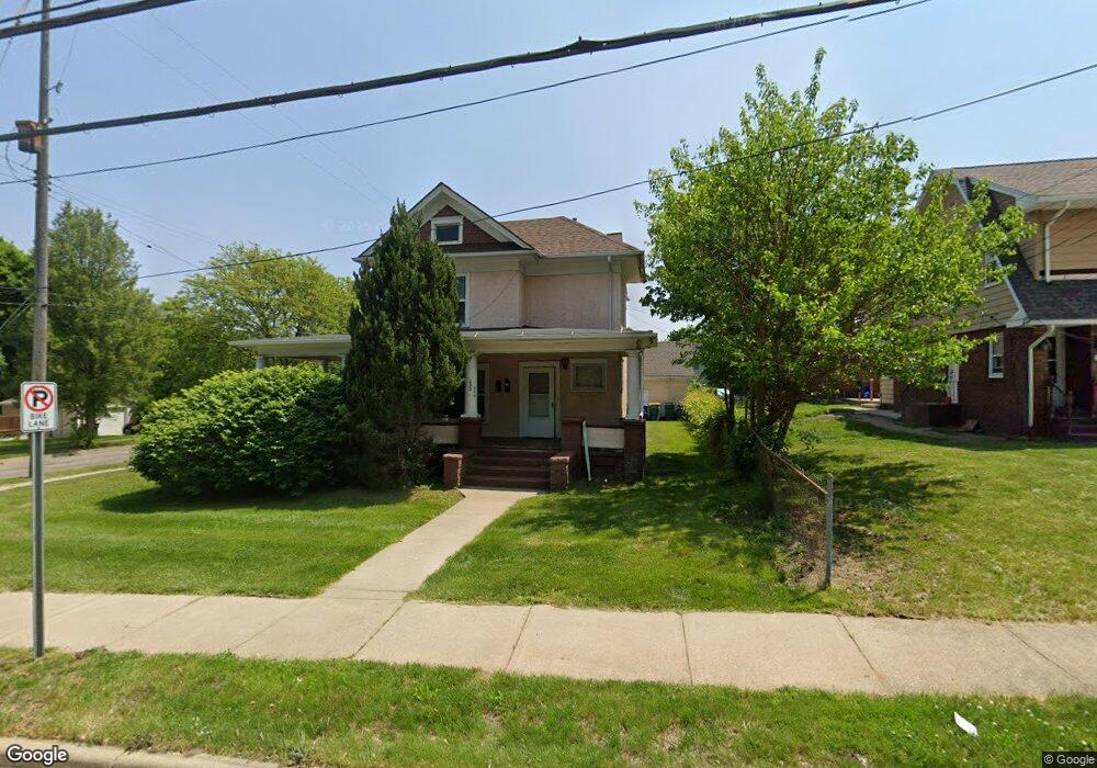
226 Washington Ave N Battle Creek, MI 49037
North Central NeighborhoodEstimated Value: $79,000
7
Beds
3
Baths
2,120
Sq Ft
$37/Sq Ft
Est. Value
About This Home
This home is located at 226 Washington Ave N, Battle Creek, MI 49037 and is currently priced at $79,000, approximately $37 per square foot. 226 Washington Ave N is a home located in Calhoun County with nearby schools including Ann J. Kellogg School, Northwestern Middle School, and Battle Creek Central High School.
Ownership History
Date
Name
Owned For
Owner Type
Purchase Details
Closed on
Jan 24, 2019
Sold by
Cright Aldino and The Jones Family Revocable Liv
Bought by
Jones Number One Son Llc
Current Estimated Value
Purchase Details
Closed on
Jun 30, 2005
Sold by
Option One Mortgage Corp
Bought by
Wells Fargo Bank Minnesota Na and Option One Mortgage Loan Trust 2003-2 As
Purchase Details
Closed on
Oct 29, 2004
Sold by
Wright Burns Paula
Bought by
Option One Mortgage Corp
Purchase Details
Closed on
Feb 26, 2003
Sold by
Adair Timothy L and Adair Suaanne L
Bought by
Wright-Burns Paula
Purchase Details
Closed on
Oct 3, 2001
Sold by
Tillman Charles H and Tillman Ardella
Bought by
Adair Timothy L
Create a Home Valuation Report for This Property
The Home Valuation Report is an in-depth analysis detailing your home's value as well as a comparison with similar homes in the area
Home Values in the Area
Average Home Value in this Area
Purchase History
| Date | Buyer | Sale Price | Title Company |
|---|---|---|---|
| Jones Number One Son Llc | -- | None Available | |
| Wells Fargo Bank Minnesota Na | -- | E Title Agency | |
| Option One Mortgage Corp | $67,721 | -- | |
| Wright-Burns Paula | $72,500 | -- | |
| Adair Timothy L | $55,000 | -- |
Source: Public Records
Tax History Compared to Growth
Tax History
| Year | Tax Paid | Tax Assessment Tax Assessment Total Assessment is a certain percentage of the fair market value that is determined by local assessors to be the total taxable value of land and additions on the property. | Land | Improvement |
|---|---|---|---|---|
| 2023 | -- | $0 | $0 | $0 |
| 2022 | $988 | $45,471 | $0 | $0 |
| 2021 | $1,638 | $32,816 | $0 | $0 |
| 2020 | $1,620 | $27,925 | $0 | $0 |
| 2019 | $1,796 | $24,427 | $0 | $0 |
| 2018 | $1,796 | $25,648 | $660 | $24,988 |
| 2017 | $2,122 | $36,120 | $0 | $0 |
| 2016 | $2,117 | $34,650 | $0 | $0 |
| 2015 | $2,108 | $32,802 | $3,275 | $29,527 |
| 2014 | $2,108 | $32,802 | $3,275 | $29,527 |
Source: Public Records
Map
Nearby Homes
- 46 Walter Ave
- 216 Kendall St N
- 52 Roseneath Ave
- 266 North Ave
- 16 Eagle St
- 224 Hubbard St
- 0 W Jackson 061 St Unit 22040291
- V/L W Michigan 055 Ave
- 35 Hubbard St
- 188 Roseneath Ave
- 253 Greenwood Ave
- 273 Garfield Ave
- 0 W Vanburen 032 St Unit 22040288
- 51 Latta St
- 5 Beglin Ct
- 16 Wood St S
- 562 Van Buren St W
- 122 North Ave
- 0 W Vanburen 025 St Unit 22040286
- 0 W Vanburen 027 St Unit 22040287
- 222 Washington Ave N
- 232 Washington Ave N
- 16 Walter Ave
- 214 Washington Ave N
- 225 Washington Ave N
- 37 Buckeye St
- 244 Washington Ave N
- 233 Washington Ave N
- 229 Washington Ave N
- 237 Washington Ave N
- 19 Walter Ave
- 32 Walter Ave
- 16 Ann Ave
- 29 Walter Ave
- 255 Washington Ave N
- 20 Buckeye St
- 17 Greenwood Ave
- 20 Ann Ave
- 21 Hanover St
- 16 Buckeye St