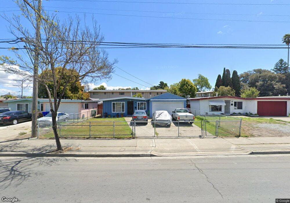
2260 Rumrill Blvd San Pablo, CA 94806
Estimated Value: $496,000 - $632,000
3
Beds
2
Baths
1,540
Sq Ft
$371/Sq Ft
Est. Value
About This Home
This home is located at 2260 Rumrill Blvd, San Pablo, CA 94806 and is currently estimated at $571,092, approximately $370 per square foot. 2260 Rumrill Blvd is a home located in Contra Costa County with nearby schools including Lake Elementary School, Walter T. Helms Middle School, and Richmond High School.
Ownership History
Date
Name
Owned For
Owner Type
Purchase Details
Closed on
Jul 9, 2007
Sold by
Reed Silas and Reed Frannie Michelle
Bought by
Reed Silas and Reed Frannie Michelle
Current Estimated Value
Home Financials for this Owner
Home Financials are based on the most recent Mortgage that was taken out on this home.
Original Mortgage
$260,000
Outstanding Balance
$162,594
Interest Rate
6.51%
Mortgage Type
Stand Alone Refi Refinance Of Original Loan
Estimated Equity
$408,498
Purchase Details
Closed on
Oct 3, 1995
Sold by
Gallagher William F and Gallagher Loweta C
Bought by
Reed Silas and Michelle Reed F
Home Financials for this Owner
Home Financials are based on the most recent Mortgage that was taken out on this home.
Original Mortgage
$97,607
Interest Rate
7.67%
Mortgage Type
FHA
Create a Home Valuation Report for This Property
The Home Valuation Report is an in-depth analysis detailing your home's value as well as a comparison with similar homes in the area
Home Values in the Area
Average Home Value in this Area
Purchase History
| Date | Buyer | Sale Price | Title Company |
|---|---|---|---|
| Reed Silas | -- | Financial Title Company | |
| Reed Silas | $98,500 | Northwestern Title Company |
Source: Public Records
Mortgage History
| Date | Status | Borrower | Loan Amount |
|---|---|---|---|
| Open | Reed Silas | $260,000 | |
| Closed | Reed Silas | $97,607 |
Source: Public Records
Tax History
| Year | Tax Paid | Tax Assessment Tax Assessment Total Assessment is a certain percentage of the fair market value that is determined by local assessors to be the total taxable value of land and additions on the property. | Land | Improvement |
|---|---|---|---|---|
| 2025 | $4,284 | $237,649 | $110,460 | $127,189 |
| 2024 | $4,092 | $232,991 | $108,295 | $124,696 |
| 2023 | $4,092 | $228,423 | $106,172 | $122,251 |
| 2022 | $4,022 | $223,945 | $104,091 | $119,854 |
| 2021 | $3,986 | $219,554 | $102,050 | $117,504 |
| 2019 | $3,780 | $213,044 | $99,024 | $114,020 |
| 2018 | $3,625 | $208,868 | $97,083 | $111,785 |
| 2017 | $3,521 | $204,774 | $95,180 | $109,594 |
| 2016 | $3,450 | $200,760 | $93,314 | $107,446 |
| 2015 | $3,415 | $197,746 | $91,913 | $105,833 |
| 2014 | $3,387 | $193,873 | $90,113 | $103,760 |
Source: Public Records
Map
Nearby Homes
- 2190 Giant Rd
- 113 Westgate Cir
- 1780 Road 20
- 2600 Giant Rd Unit 37
- 2036 Brookside Dr
- 1034 Trenton Blvd
- 1945 21st St
- 1413 Post Ave
- 812 Market Ave
- 2011 Market Ave Unit 317
- 2729 18th St
- 1971 23rd St
- 2796 13th St
- 1800 Post Ave
- 2717 10th St
- 110 Del Alba St
- 2856 15th St
- 2857 16th St
- 112 Serra Way Unit 19
- 2138 Market Ave
- 2250 Rumrill Blvd
- 2270 Rumrill Blvd
- 2240 Rumrill Blvd
- 1300 Road 20
- 1308 Road 20
- 2230 Rumrill Blvd
- 1314 Road 20
- 2220 Rumrill Blvd
- 1318 Road 20
- 2210 Rumrill Blvd
- 1313 Road 20
- 1335 Brookside Dr
- 1331 Brookside Dr
- 1324 Road 20
- 1341 Brookside Dr
- 1058 Barbara Ln
- 1327 Brookside Dr
- 1052 Barbara Ln
- 1305 Brookside Dr
- 1044 Barbara Ln
Your Personal Tour Guide
Ask me questions while you tour the home.