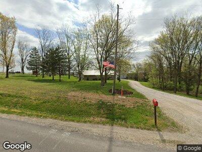
2260 State Route P New Franklin, MO 65274
Estimated Value: $320,000 - $365,000
3
Beds
2
Baths
1,400
Sq Ft
$249/Sq Ft
Est. Value
About This Home
This home is located at 2260 State Route P, New Franklin, MO 65274 and is currently estimated at $348,458, approximately $248 per square foot. 2260 State Route P is a home located in Howard County with nearby schools including New Franklin Elementary School, New Franklin Middle/High School, and Grace N Glory Christian Academy.
Ownership History
Date
Name
Owned For
Owner Type
Purchase Details
Closed on
Sep 8, 2010
Sold by
Craig Steve A and Craig Rebecca A
Bought by
Boley Clint and Fuemmeler Brette
Current Estimated Value
Home Financials for this Owner
Home Financials are based on the most recent Mortgage that was taken out on this home.
Original Mortgage
$116,871
Outstanding Balance
$78,824
Interest Rate
4.48%
Mortgage Type
FHA
Estimated Equity
$269,634
Create a Home Valuation Report for This Property
The Home Valuation Report is an in-depth analysis detailing your home's value as well as a comparison with similar homes in the area
Home Values in the Area
Average Home Value in this Area
Purchase History
| Date | Buyer | Sale Price | Title Company |
|---|---|---|---|
| Boley Clint | -- | -- |
Source: Public Records
Mortgage History
| Date | Status | Borrower | Loan Amount |
|---|---|---|---|
| Open | Boley Clint | $116,871 |
Source: Public Records
Tax History Compared to Growth
Tax History
| Year | Tax Paid | Tax Assessment Tax Assessment Total Assessment is a certain percentage of the fair market value that is determined by local assessors to be the total taxable value of land and additions on the property. | Land | Improvement |
|---|---|---|---|---|
| 2024 | $1,485 | $20,600 | $0 | $0 |
| 2023 | $1,485 | $20,600 | $0 | $0 |
| 2022 | $1,485 | $20,600 | $0 | $0 |
| 2021 | $1,166 | $20,600 | $0 | $0 |
| 2020 | $1,403 | $20,600 | $0 | $0 |
| 2019 | $1,173 | $20,600 | $0 | $0 |
| 2018 | $1,166 | $20,600 | $0 | $0 |
| 2017 | $1,156 | $20,600 | $0 | $0 |
| 2016 | $1,155 | $20,600 | $0 | $0 |
| 2015 | -- | $20,600 | $0 | $0 |
| 2014 | -- | $20,600 | $0 | $0 |
| 2013 | -- | $20,590 | $0 | $0 |
| 2012 | -- | $20,590 | $0 | $0 |
Source: Public Records
Map
Nearby Homes
- 116 E Market St
- Lot 2- 5 95ac Raybar Dr
- Lot 4- 6 44ac Raybar Dr
- Lot 1- 5 35ac Raybar Dr
- Lot #1 Rosewood Estates Cr 334b Unit Phase 3
- Lot #2 Rosewood Estates Cr 334b Unit Phase 3
- 532 W Broadway
- 0 Rural St
- TBD Rural St
- 112 Bell St
- 122 ACRES County Road 442
- 611 High St
- 7 Boller Dr
- 706 E Spring St
- 00000 Guyer's Ford Rd
- 43 Meadowlake Ln
- 42 Meadowlake Ln
- 41 Meadowlake Ln
- 627 Locust St
- 525 6th St