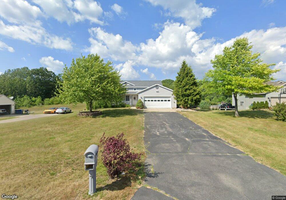
2261 Avalon View Dr NE Unit 82 Cedar Springs, MI 49319
Estimated Value: $310,000 - $354,000
2
Beds
1
Bath
1,161
Sq Ft
$278/Sq Ft
Est. Value
About This Home
This home is located at 2261 Avalon View Dr NE Unit 82, Cedar Springs, MI 49319 and is currently estimated at $322,982, approximately $278 per square foot. 2261 Avalon View Dr NE Unit 82 is a home located in Kent County with nearby schools including Cedar Trails Elementary School, Red Hawk Intermediate School, and Beach Elementary School.
Ownership History
Date
Name
Owned For
Owner Type
Purchase Details
Closed on
Sep 25, 2024
Sold by
West Diana and West Steve
Bought by
Spicer Nathaniel and Spicer Adelyn
Current Estimated Value
Home Financials for this Owner
Home Financials are based on the most recent Mortgage that was taken out on this home.
Original Mortgage
$265,500
Outstanding Balance
$262,782
Interest Rate
6.49%
Mortgage Type
New Conventional
Estimated Equity
$60,200
Purchase Details
Closed on
Jan 12, 2006
Sold by
Sable Developing Inc
Bought by
West Steve and West Diana
Home Financials for this Owner
Home Financials are based on the most recent Mortgage that was taken out on this home.
Original Mortgage
$139,950
Interest Rate
9.5%
Mortgage Type
Fannie Mae Freddie Mac
Create a Home Valuation Report for This Property
The Home Valuation Report is an in-depth analysis detailing your home's value as well as a comparison with similar homes in the area
Home Values in the Area
Average Home Value in this Area
Purchase History
| Date | Buyer | Sale Price | Title Company |
|---|---|---|---|
| Spicer Nathaniel | $295,000 | Sun Title | |
| West Steve | $139,955 | Crowne Title Agency Inc |
Source: Public Records
Mortgage History
| Date | Status | Borrower | Loan Amount |
|---|---|---|---|
| Open | Spicer Nathaniel | $265,500 | |
| Previous Owner | West Steve | $139,950 |
Source: Public Records
Tax History Compared to Growth
Tax History
| Year | Tax Paid | Tax Assessment Tax Assessment Total Assessment is a certain percentage of the fair market value that is determined by local assessors to be the total taxable value of land and additions on the property. | Land | Improvement |
|---|---|---|---|---|
| 2025 | $1,897 | $146,400 | $0 | $0 |
| 2024 | $1,897 | $133,600 | $0 | $0 |
| 2023 | $1,813 | $118,100 | $0 | $0 |
| 2022 | $1,956 | $101,200 | $0 | $0 |
| 2021 | $1,971 | $96,500 | $0 | $0 |
| 2020 | $1,732 | $90,000 | $0 | $0 |
| 2019 | $21,713 | $87,100 | $0 | $0 |
| 2018 | $1,887 | $78,600 | $0 | $0 |
| 2017 | $1,835 | $72,600 | $0 | $0 |
| 2016 | $1,766 | $68,400 | $0 | $0 |
| 2015 | -- | $68,400 | $0 | $0 |
| 2013 | -- | $60,400 | $0 | $0 |
Source: Public Records
Map
Nearby Homes
- 14551 Algoma Ave NE
- 13633 Iris Ln
- 2980 18 Mile Rd NE
- The Georgetown Plan at Saddlebrook
- The Grayson Plan at Saddlebrook
- The Brinley Plan at Saddlebrook
- The Taylor Plan at Saddlebrook
- The Mayfair Plan at Saddlebrook
- The Balsam Plan at Saddlebrook
- The Wisteria Plan at Saddlebrook
- The Stockton Plan at Saddlebrook
- The Maxwell Plan at Saddlebrook
- The Rowen Plan at Saddlebrook
- The Amber Plan at Saddlebrook
- The Stafford Plan at Saddlebrook
- 2329 Quarter Horse Dr NE Unit 35
- 2103 Quarter Horse Dr NE
- 13671 Starflower
- 3567 Hollyfield Dr
- 2217 Quarter Horse Dr NE Unit 27
- 2261 Avalon View Dr NE Unit 50
- 2269 Avalon View Dr NE Unit 51
- 2253 Avalon View Dr NE Unit 49
- 2277 Avalon View Dr NE Unit 52
- 2256 Avalon View Dr NE Unit 81
- 2268 Avalon View Dr NE Unit 82
- 2244 Avalon View Dr NE Unit 80
- 13880 Pointe Ct N
- 13880 Pointe North Ct NE Unit 9
- 2227 Avalon View Dr NE Unit 47
- 2281 Avalon View Dr NE Unit 53
- 13885 Pointe Ct N
- 13885 Pointe North Ct NE Unit 8
- 2230 Avalon View Dr NE Unit 79
- 2280 Avalon View Dr NE Unit 55
- 2219 Avalon View Dr NE Unit 46
- 2287 Avalon View Dr NE Unit 54
- 2363 Winston View Dr NE Unit 56
- 13855 Algoma Ave NE
- 2211 Avalon View Dr NE Unit 45