Estimated Value: $163,000 - $274,000
3
Beds
2
Baths
1,616
Sq Ft
$146/Sq Ft
Est. Value
About This Home
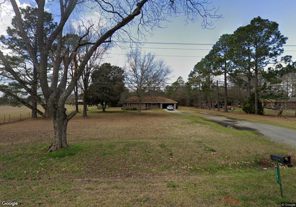
This home is located at 2261 Us Highway 41 N, Perry, GA 31069 and is currently estimated at $235,776, approximately $145 per square foot. 2261 Us Highway 41 N is a home located in Houston County with nearby schools including Langston Road Elementary School, Mossy Creek Middle School, and Perry High School.
Ownership History
Date
Name
Owned For
Owner Type
Purchase Details
Closed on
Mar 10, 1995
Sold by
Brown Clarence R and Brown Vera W
Bought by
Brown Susan R
Current Estimated Value
Purchase Details
Closed on
Jun 28, 1988
Sold by
Lee James R and Lee Gail
Bought by
Brown Clarence R and Brown Vera W
Purchase Details
Closed on
Jan 5, 1985
Sold by
Hardy Alton and Hardy Sidney C
Bought by
Lee James R and Lee Gail
Purchase Details
Closed on
Apr 3, 1984
Bought by
Hardy Alton and Hardy Sidney C
Create a Home Valuation Report for This Property
The Home Valuation Report is an in-depth analysis detailing your home's value as well as a comparison with similar homes in the area
Home Values in the Area
Average Home Value in this Area
Purchase History
| Date | Buyer | Sale Price | Title Company |
|---|---|---|---|
| Brown Susan R | -- | -- | |
| Brown Clarence R | -- | -- | |
| Lee James R | -- | -- | |
| Hardy Alton | -- | -- |
Source: Public Records
Tax History Compared to Growth
Tax History
| Year | Tax Paid | Tax Assessment Tax Assessment Total Assessment is a certain percentage of the fair market value that is determined by local assessors to be the total taxable value of land and additions on the property. | Land | Improvement |
|---|---|---|---|---|
| 2024 | $997 | $50,760 | $11,720 | $39,040 |
| 2023 | $977 | $49,520 | $11,720 | $37,800 |
| 2022 | $894 | $46,080 | $11,720 | $34,360 |
| 2021 | $849 | $44,040 | $11,720 | $32,320 |
| 2020 | $830 | $43,080 | $11,720 | $31,360 |
| 2019 | $830 | $43,080 | $11,720 | $31,360 |
| 2018 | $830 | $43,080 | $11,720 | $31,360 |
| 2017 | $830 | $43,080 | $11,720 | $31,360 |
| 2016 | $832 | $43,080 | $11,720 | $31,360 |
| 2015 | $832 | $43,080 | $11,720 | $31,360 |
| 2014 | -- | $43,080 | $11,720 | $31,360 |
| 2013 | -- | $43,080 | $11,720 | $31,360 |
Source: Public Records
Map
Nearby Homes
- 124 Lake Lillian Dr
- 204 Chimney Rock Rd
- 502 Arons Ct
- 309 Bermuda Ridge
- 220 Overton Dr
- Savannah Plan at Bankstone Landing
- Newport Plan at Bankstone Landing
- Delaware Plan at Bankstone Landing
- 0 Hwy 41 & Langston Rd Unit M170042
- 161 Overton Dr
- 103 Breakwater Way
- 107 Breakwater Way
- 219 Overton Dr
- 111 Breakwater Way
- 0 Langston Rd Unit 16828609
- 2360 U S 41
- 118 Bramblewood Way
- 128 Bramblewood Ln
- 124 Bramblewood Ln
- 149 MacK Thompson Road Common
- 2267 Us Highway 41 N
- 2319 Us Highway 41 N
- 2271 Us Highway 41 N
- 2266 Us Highway 41 N
- 2253 Us Highway 41 N
- 2272 Us Highway 41 N
- 101 Lakeview Terrace
- 103 Lakeview Terrace
- 103 Country Squire Rd
- 101 Country Squire Rd
- 107 Country Squire Rd
- 118 Fox Run Dr
- 2278 Us Highway 41 N
- 105 Lakeview Terrace
- 2256 Us Highway 41 N
- 109 Country Squire Rd
- 100 Lakeview Terrace
- 117 Fox Run Dr
- 111 Country Squire Rd
- 102 Lakeview Terrace