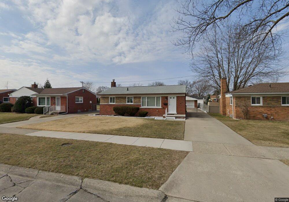
22617 Hill St Unit Bldg-Unit Warren, MI 48091
Southwest Warren NeighborhoodEstimated Value: $180,000 - $211,000
3
Beds
2
Baths
939
Sq Ft
$207/Sq Ft
Est. Value
About This Home
This home is located at 22617 Hill St Unit Bldg-Unit, Warren, MI 48091 and is currently estimated at $194,185, approximately $206 per square foot. 22617 Hill St Unit Bldg-Unit is a home located in Macomb County with nearby schools including Mound Park Elementary School, Schofield Elementary School, and Westview Elementary School.
Ownership History
Date
Name
Owned For
Owner Type
Purchase Details
Closed on
Jul 26, 2021
Sold by
Chowdhury Suheda Y
Bought by
Chowdhury Nurul Ahmed
Current Estimated Value
Purchase Details
Closed on
Mar 16, 2018
Sold by
Wilkowski Theresa A and Wilkowski Dennis A
Bought by
Chowdhury Suheda Y
Home Financials for this Owner
Home Financials are based on the most recent Mortgage that was taken out on this home.
Original Mortgage
$94,050
Interest Rate
4.32%
Mortgage Type
New Conventional
Create a Home Valuation Report for This Property
The Home Valuation Report is an in-depth analysis detailing your home's value as well as a comparison with similar homes in the area
Home Values in the Area
Average Home Value in this Area
Purchase History
| Date | Buyer | Sale Price | Title Company |
|---|---|---|---|
| Chowdhury Nurul Ahmed | $180,000 | Reputation First Ttl Agcy Ll | |
| Chowdhury Suheda Y | $99,000 | None Available |
Source: Public Records
Mortgage History
| Date | Status | Borrower | Loan Amount |
|---|---|---|---|
| Previous Owner | Chowdhury Suheda Y | $94,050 |
Source: Public Records
Tax History Compared to Growth
Tax History
| Year | Tax Paid | Tax Assessment Tax Assessment Total Assessment is a certain percentage of the fair market value that is determined by local assessors to be the total taxable value of land and additions on the property. | Land | Improvement |
|---|---|---|---|---|
| 2025 | $3,844 | $78,590 | $0 | $0 |
| 2024 | $3,741 | $72,450 | $0 | $0 |
| 2023 | $3,538 | $70,560 | $0 | $0 |
| 2022 | $3,341 | $61,630 | $0 | $0 |
| 2021 | $2,322 | $58,040 | $0 | $0 |
| 2020 | $2,220 | $52,570 | $0 | $0 |
| 2019 | $2,087 | $38,620 | $0 | $0 |
| 2018 | $0 | $26,940 | $0 | $0 |
| 2017 | $1,182 | $26,330 | $2,940 | $23,390 |
| 2016 | $1,155 | $26,330 | $0 | $0 |
| 2015 | -- | $24,360 | $0 | $0 |
| 2012 | -- | $24,410 | $0 | $0 |
Source: Public Records
Map
Nearby Homes
- 22644 Hill St
- 22595 Curie Ave
- 22355 Curie Ave
- 22549 Panama Ave
- 22847 Panama Ave
- 5430 E 9 Mile Rd
- 23220 Audrey Ave
- 23223 Panama Ave
- 23311 Panama Ave
- 5217 Mart Ct
- 23466 Audrey Ave
- 23344 Panama Ave
- 21820 Cunningham Ave
- 22321 Logue Ave
- 23740 Masch Ave
- 21441 Atlantic Ave
- 21410 Panama St
- 21222 Audrey Ave
- 21234 Cyman Ave
- 21137 Curie Ave
- 22617 Hill St
- 22631 Hill St
- 22603 Hill St
- 22645 Hill St
- 22555 Hill St
- 22614 Audrey Ave
- 22628 Audrey Ave
- 22542 Audrey Ave
- 22541 Hill St
- 22701 Hill St
- 22642 Audrey Ave
- 22616 Hill St
- 22528 Audrey Ave
- 22602 Hill St
- 22630 Hill St
- 22715 Hill St
- 22527 Hill St
- 22554 Hill St
- 22700 Audrey Ave
- 22514 Audrey Ave