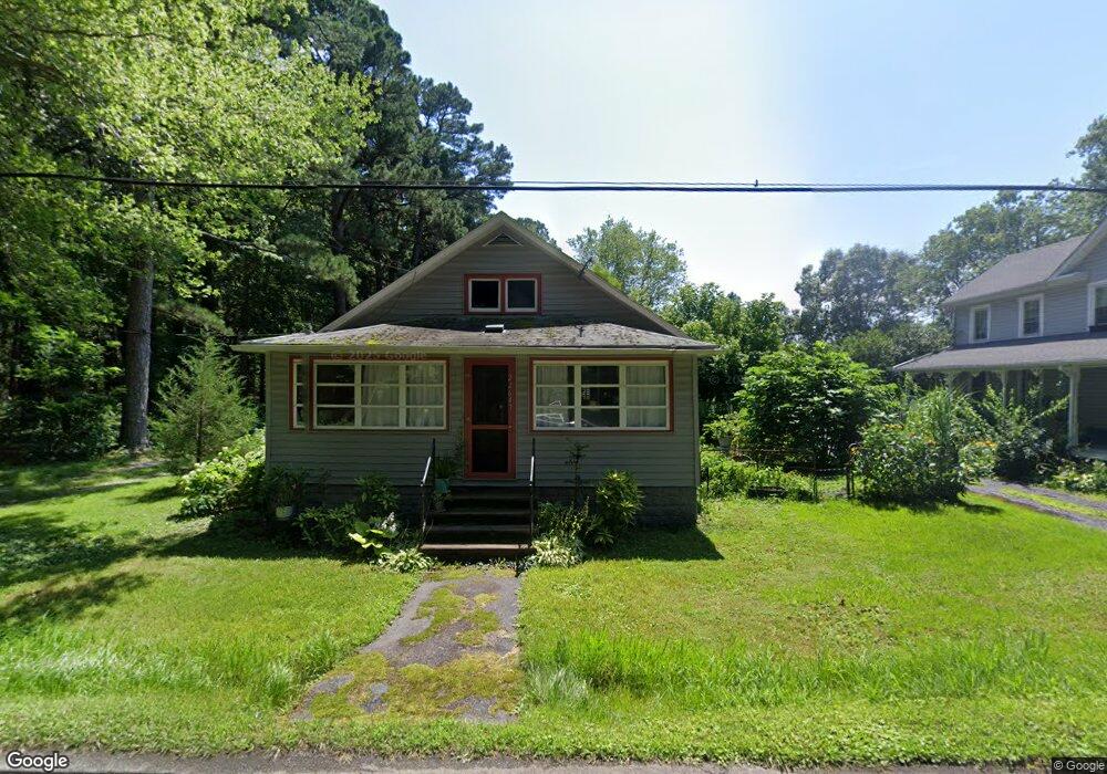
22647 Pot Pie Rd Wittman, MD 21676
Estimated Value: $180,000 - $310,000
--
Bed
1
Bath
1,004
Sq Ft
$218/Sq Ft
Est. Value
About This Home
This home is located at 22647 Pot Pie Rd, Wittman, MD 21676 and is currently estimated at $219,335, approximately $218 per square foot. 22647 Pot Pie Rd is a home located in Talbot County with nearby schools including Tilghman Elementary School, St. Michaels Middle/High School, and Easton High School.
Ownership History
Date
Name
Owned For
Owner Type
Purchase Details
Closed on
Sep 12, 2024
Sold by
Wilder Dorothy G
Bought by
Connolly Mark A
Current Estimated Value
Purchase Details
Closed on
Jul 30, 2013
Sold by
Heinsohn Monica D and Heinsohn Jeffrey A
Bought by
Wilder Dorothy G
Purchase Details
Closed on
Apr 29, 2013
Sold by
Heinsohn Monica D
Bought by
Heinsohn Monica D and Heinsohn Jeffrey A
Purchase Details
Closed on
Oct 27, 2008
Sold by
Dyott Perry H
Bought by
Heinsohn Monica D
Purchase Details
Closed on
Sep 10, 2008
Sold by
Dyott Perry H
Bought by
Heinsohn Monica D
Create a Home Valuation Report for This Property
The Home Valuation Report is an in-depth analysis detailing your home's value as well as a comparison with similar homes in the area
Home Values in the Area
Average Home Value in this Area
Purchase History
| Date | Buyer | Sale Price | Title Company |
|---|---|---|---|
| Connolly Mark A | -- | None Listed On Document | |
| Wilder Dorothy G | $90,000 | Venture Title Company | |
| Heinsohn Monica D | -- | None Available | |
| Heinsohn Monica D | -- | -- | |
| Heinsohn Monica D | -- | -- |
Source: Public Records
Tax History Compared to Growth
Tax History
| Year | Tax Paid | Tax Assessment Tax Assessment Total Assessment is a certain percentage of the fair market value that is determined by local assessors to be the total taxable value of land and additions on the property. | Land | Improvement |
|---|---|---|---|---|
| 2025 | $468 | $128,200 | $56,900 | $71,300 |
| 2024 | $468 | $123,533 | $0 | $0 |
| 2023 | $387 | $118,867 | $0 | $0 |
| 2022 | $334 | $114,200 | $56,900 | $57,300 |
| 2021 | $309 | $114,200 | $56,900 | $57,300 |
| 2020 | $309 | $114,200 | $56,900 | $57,300 |
| 2019 | $286 | $126,500 | $69,900 | $56,600 |
| 2018 | $271 | $124,633 | $0 | $0 |
| 2017 | $268 | $122,767 | $0 | $0 |
| 2016 | $837 | $120,900 | $0 | $0 |
| 2015 | $773 | $120,900 | $0 | $0 |
| 2014 | $773 | $120,900 | $0 | $0 |
Source: Public Records
Map
Nearby Homes
- 8698 Cummings Rd
- 22381 Cooper Ln
- 22349 Cooper Ln
- 8781 Tilghman Island Rd
- 9262 Macks Ln
- 8620 Bozman Neavitt Rd
- 00 New Rd
- 9681 Macks Ln
- 0 Bozman Neavitt Rd Unit MDTA2011976
- 8013 Ruby Harrison Rd
- 8000 Bozman Neavitt Rd
- 8034 Bozman Neavitt Rd
- 7983 Bozman Neavitt Rd
- 9998 Wades Farm Ln
- 22540 Hardcastle Ln
- 23854 Mount Misery Rd
- 21869 Albie Rd
- 7649 Cooper Point Rd
- 7651 Main St
- 7683 Tilghman Island Rd
- 22639 Pot Pie Rd
- 22629 Pot Pie Rd
- 8817 Cummings Rd
- 8829 Cummings Rd
- 8805 Cummings Rd
- 22623 Pot Pie Rd
- 8791 Cummings Rd
- 22619 Pot Pie Rd
- 8808 Cummings Rd
- 8814 Cummings Rd
- 22611 Pot Pie Rd
- 8794 Fairbank Ln
- 8796 Cummings Rd
- 8788 Fairbank Ln
- 8830 Cummings Rd
- 8800 Cummings Rd
- 0 Cummings Rd Unit TA8717322
- 22601 Pot Pie Rd
- 22606 Pot Pie Rd
- 8784 Cummings Rd