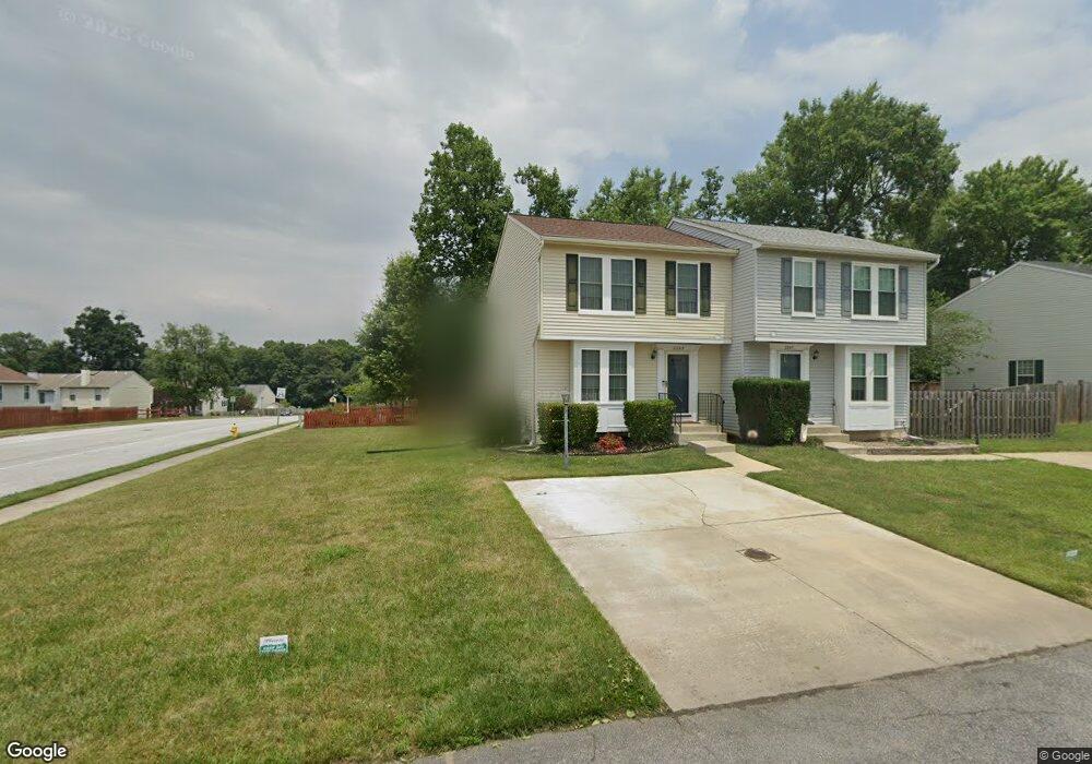
2265 Lea Ct Odenton, MD 21113
Estimated Value: $359,961 - $433,000
--
Bed
3
Baths
1,206
Sq Ft
$337/Sq Ft
Est. Value
About This Home
This home is located at 2265 Lea Ct, Odenton, MD 21113 and is currently estimated at $405,990, approximately $336 per square foot. 2265 Lea Ct is a home located in Anne Arundel County with nearby schools including Waugh Chapel Elementary School, Arundel Middle School, and Arundel High School.
Ownership History
Date
Name
Owned For
Owner Type
Purchase Details
Closed on
Jul 16, 2025
Sold by
Mazzuca Richard J and Mazzuca Bonnie J
Bought by
Richie And Robby Trust and Mazzuca
Current Estimated Value
Purchase Details
Closed on
Sep 27, 1994
Sold by
Ryland Grp Inc The
Bought by
Mazzuca Richard J
Home Financials for this Owner
Home Financials are based on the most recent Mortgage that was taken out on this home.
Original Mortgage
$140,125
Interest Rate
8.56%
Purchase Details
Closed on
Jun 29, 1994
Sold by
Woodbridge Constr Corp
Bought by
The Ryland Group Inc
Create a Home Valuation Report for This Property
The Home Valuation Report is an in-depth analysis detailing your home's value as well as a comparison with similar homes in the area
Home Values in the Area
Average Home Value in this Area
Purchase History
| Date | Buyer | Sale Price | Title Company |
|---|---|---|---|
| Richie And Robby Trust | -- | None Listed On Document | |
| Mazzuca Richard J | $147,635 | -- | |
| The Ryland Group Inc | $80,750 | -- |
Source: Public Records
Mortgage History
| Date | Status | Borrower | Loan Amount |
|---|---|---|---|
| Previous Owner | The Ryland Group Inc | $140,125 |
Source: Public Records
Tax History Compared to Growth
Tax History
| Year | Tax Paid | Tax Assessment Tax Assessment Total Assessment is a certain percentage of the fair market value that is determined by local assessors to be the total taxable value of land and additions on the property. | Land | Improvement |
|---|---|---|---|---|
| 2025 | $2,856 | $337,900 | $173,300 | $164,600 |
| 2024 | $2,856 | $320,333 | $0 | $0 |
| 2023 | $2,346 | $302,767 | $0 | $0 |
| 2022 | $2,569 | $285,200 | $168,300 | $116,900 |
| 2021 | $5,043 | $275,300 | $0 | $0 |
| 2020 | $2,433 | $265,400 | $0 | $0 |
| 2019 | $2,389 | $255,500 | $142,600 | $112,900 |
| 2018 | $2,591 | $255,500 | $142,600 | $112,900 |
| 2017 | $2,268 | $255,500 | $0 | $0 |
| 2016 | -- | $260,200 | $0 | $0 |
| 2015 | -- | $256,767 | $0 | $0 |
| 2014 | -- | $253,333 | $0 | $0 |
Source: Public Records
Map
Nearby Homes
- 655 Cadbury Dr
- 1311 Tenbrook Rd
- 620 Cadbury Dr
- 810 Lamoka Dr
- 652 Chapelview Dr
- 560 Edwards Dr
- 634 Riden St
- 1511 Criterion Dr
- 1210 Garnet Ct Unit 1
- 936 Autumnwood Dr
- 1206 Topaz Ct
- 982 Summer Hill Dr
- 8739 Bright Meadow Ct
- 1612 Winesapp Dr
- 2442 Winding Ridge Rd
- 1359 Rosanna Dr
- 1017 Meandering Way
- 8539 Pine Meadows Dr
- 1002 Red Harvest Rd
- 712 Thornwood Dr
- 2269 Lea Ct
- 2263 Grand Ct
- 2261 Grand Ct
- 2279 Lea Ct
- 2259 Grand Ct
- 2271 Lea Ct
- 2277 Lea Ct
- 835 Cinnamon Ct
- 2276 Indian Summer Dr
- 2257 Grand Ct
- 2275 Lea Ct
- 2278 Indian Summer Dr
- 2273 Lea Ct
- 829 Cinnamon Ct
- 2280 Indian Summer Dr
- 825 Sunflower Dr
- 2249 Grand Ct
- 827 Sunflower Dr
- 834 Nutmeg Ct
- 2251 Grand Ct