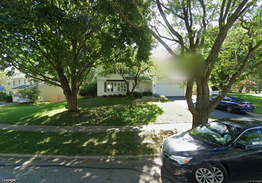
2265 Pontiac Cir Naperville, IL 60565
Old Farm NeighborhoodEstimated Value: $471,000 - $526,000
4
Beds
3
Baths
2,080
Sq Ft
$242/Sq Ft
Est. Value
About This Home
This home is located at 2265 Pontiac Cir, Naperville, IL 60565 and is currently estimated at $502,490, approximately $241 per square foot. 2265 Pontiac Cir is a home located in Will County with nearby schools including Kingsley Elementary School, Lincoln Jr. High School, and Naperville Central High School.
Ownership History
Date
Name
Owned For
Owner Type
Purchase Details
Closed on
Mar 8, 1994
Sold by
Barry Andrew J and Barry Donna M
Bought by
Mcdonald David A and Mcdonald Jeanne M
Current Estimated Value
Home Financials for this Owner
Home Financials are based on the most recent Mortgage that was taken out on this home.
Original Mortgage
$137,600
Interest Rate
7.84%
Purchase Details
Closed on
Mar 27, 1991
Bought by
Mcdonald David
Create a Home Valuation Report for This Property
The Home Valuation Report is an in-depth analysis detailing your home's value as well as a comparison with similar homes in the area
Home Values in the Area
Average Home Value in this Area
Purchase History
| Date | Buyer | Sale Price | Title Company |
|---|---|---|---|
| Mcdonald David A | $172,000 | -- | |
| Mcdonald David | $155,000 | -- |
Source: Public Records
Mortgage History
| Date | Status | Borrower | Loan Amount |
|---|---|---|---|
| Previous Owner | Mcdonald David A | $137,600 |
Source: Public Records
Tax History Compared to Growth
Tax History
| Year | Tax Paid | Tax Assessment Tax Assessment Total Assessment is a certain percentage of the fair market value that is determined by local assessors to be the total taxable value of land and additions on the property. | Land | Improvement |
|---|---|---|---|---|
| 2024 | $9,395 | $153,620 | $39,115 | $114,505 |
| 2023 | $9,395 | $138,222 | $35,194 | $103,028 |
| 2022 | $8,998 | $138,460 | $35,254 | $103,206 |
| 2021 | $8,498 | $129,462 | $32,963 | $96,499 |
| 2020 | $8,174 | $125,205 | $31,879 | $93,326 |
| 2019 | $7,792 | $119,243 | $30,361 | $88,882 |
| 2018 | $7,428 | $114,130 | $29,059 | $85,071 |
| 2017 | $7,141 | $108,180 | $27,544 | $80,636 |
| 2016 | $7,276 | $108,400 | $27,600 | $80,800 |
| 2015 | $7,160 | $108,000 | $27,900 | $80,100 |
| 2014 | $7,160 | $108,000 | $27,900 | $80,100 |
| 2013 | $7,160 | $99,100 | $25,600 | $73,500 |
Source: Public Records
Map
Nearby Homes
- 2167 Countryside Cir
- 2337 Worthing Dr Unit 102A
- 221 Hampshire Ct Unit 201D
- 343 Danbury Dr Unit 6B
- 284 Westbrook Cir
- 2132 Berkley Ct Unit 201A
- 445 Travelaire Ave
- 47 Glencoe Ct Unit 102D
- 23 Glencoe Ct Unit 202B
- 2471 Kingsley Dr
- 1921 Wisteria Ct Unit 3
- 2279 Kaskaskia Ct
- 2276 Kaskaskia Ct
- 36 Oak Bluff Ct
- 2421 River Woods Dr
- 35 Foxcroft Rd Unit 123
- 44 Oak Bluff Ct
- 2206 Gleneagles Dr
- 51 Ford Ln
- 2734 Alyssa Dr
- 2273 Pontiac Cir
- 2256 Pontiac Cir
- 2244 Pontiac Cir
- 2277 Pontiac Cir
- 271 Pebblestone Rd
- 2261 Pontiac Cir
- 2264 Pontiac Cir
- 2272 Pontiac Cir
- 2257 Pontiac Cir Unit 3C
- 2240 Pontiac Cir
- 2268 Pontiac Cir
- 2276 Pontiac Cir
- 267 Pebblestone Rd Unit 3C
- 2253 Pontiac Cir Unit 3C
- 2281 Pontiac Cir
- 2249 Pontiac Cir
- 2245 Pontiac Cir Unit 3C
- 2280 Pontiac Cir Unit 3C
- 2155 Countryside Cir
- 2157 Countryside Cir