Estimated Value: $760,000
--
Bed
1
Bath
1,209
Sq Ft
$629/Sq Ft
Est. Value
About This Home
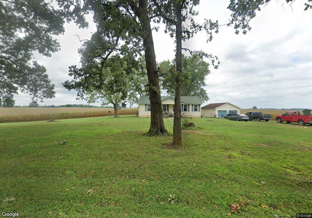
This home is located at 2269 Bourne Rd, Adams, TN 37010 and is currently estimated at $760,000, approximately $628 per square foot. 2269 Bourne Rd is a home located in Robertson County with nearby schools including Jo Byrns Elementary School and Jo Byrns High School.
Ownership History
Date
Name
Owned For
Owner Type
Purchase Details
Closed on
Oct 29, 2021
Sold by
Bourne John L and Estate Of John I Bourne Jr
Bought by
Sholar Paula D
Current Estimated Value
Purchase Details
Closed on
Aug 9, 2017
Sold by
Bourne Mark E
Bought by
Bourne John I
Purchase Details
Closed on
Mar 9, 2016
Sold by
Bourne Buford W Estate
Bought by
Bourne John I and Bourne Mark E
Purchase Details
Closed on
Apr 13, 2004
Sold by
Bourne John I and Bourne Ludell
Bought by
Bourne Buford W
Purchase Details
Closed on
Apr 10, 2003
Sold by
Bourne Mark E
Bought by
Bourne Ludell C
Purchase Details
Closed on
May 23, 1985
Bought by
Bourne John I
Create a Home Valuation Report for This Property
The Home Valuation Report is an in-depth analysis detailing your home's value as well as a comparison with similar homes in the area
Home Values in the Area
Average Home Value in this Area
Purchase History
| Date | Buyer | Sale Price | Title Company |
|---|---|---|---|
| Sholar Paula D | -- | None Available | |
| Bourne John I | $30,000 | None Available | |
| Bourne John I | -- | -- | |
| Bourne Buford W | -- | -- | |
| Bourne Ludell C | $30,000 | -- | |
| Bourne John I | -- | -- |
Source: Public Records
Tax History Compared to Growth
Tax History
| Year | Tax Paid | Tax Assessment Tax Assessment Total Assessment is a certain percentage of the fair market value that is determined by local assessors to be the total taxable value of land and additions on the property. | Land | Improvement |
|---|---|---|---|---|
| 2024 | $1,346 | $74,750 | $73,575 | $1,175 |
| 2023 | $1,346 | $74,750 | $73,575 | $1,175 |
| 2022 | $1,484 | $57,600 | $56,575 | $1,025 |
| 2021 | $1,484 | $57,600 | $56,575 | $1,025 |
| 2020 | $1,484 | $57,600 | $56,575 | $1,025 |
| 2019 | $1,484 | $57,600 | $56,575 | $1,025 |
| 2018 | $1,484 | $57,600 | $56,575 | $1,025 |
| 2017 | $1,880 | $60,925 | $47,050 | $13,875 |
| 2016 | $1,880 | $179,025 | $165,150 | $13,875 |
| 2015 | $1,803 | $60,925 | $47,050 | $13,875 |
| 2014 | $1,803 | $60,925 | $47,050 | $13,875 |
Source: Public Records
Map
Nearby Homes
- 2 J Bourne Rd
- 1 J Bourne Rd
- 1097 Landing Ln
- 1073 Landing Ln
- 1085 Landing Ln
- 1057 Landing Ln
- 1015 Landing Ln
- 1035 Landing Ln
- 1047 Landing Ln
- 7898 Highway 41 N
- 204 Winters St
- 104 E Pond St
- 258 Woodruff Rd
- 7618 U S 41
- 10 Sturgeon Creek Rd
- 1986 Route 76
- 7 Sturgeon Creek Rd
- 9 Sturgeon Creek Rd
- 9b Sturgeon Creek Rd
- 7a Sturgeon Creek Rd
- 2269 Bourne Rd
- 2268 Bourne Rd
- 2262 Bourne Rd
- 5964 Keysburg Rd
- 2254 Bourne Rd
- 5980 Keysburg Rd
- 6007 Keysburg Rd
- 2232 Bourne Rd
- 2209 Bourne Rd
- 6037 Keysburg Rd
- 5915 Keysburg Rd
- 2208 Bourne Rd
- 5911 Keysburg Rd
- 2184 Bourne Rd
- 3688 Hugh Gill Rd
- 3741 Hugh Gill Rd
- 3769 Hugh Gill Rd
- 2386 Hugh Gill Rd
- 2369 Hugh Gill Rd
- 2379 Hugh Gill Rd