Estimated Value: $199,000 - $353,217
--
Bed
1
Bath
1,901
Sq Ft
$132/Sq Ft
Est. Value
About This Home
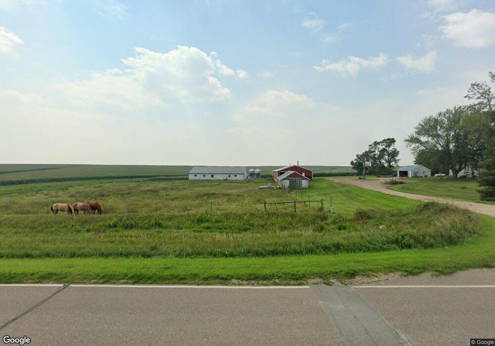
This home is located at 2269 Hickory Ave, Doon, IA 51235 and is currently estimated at $251,304, approximately $132 per square foot. 2269 Hickory Ave is a home located in Lyon County with nearby schools including Central Lyon Elementary School and Central Lyon Senior High School.
Ownership History
Date
Name
Owned For
Owner Type
Purchase Details
Closed on
Jan 4, 2017
Sold by
Groot Chase A De and Groot Beth L De
Bought by
Maasen Mark
Current Estimated Value
Home Financials for this Owner
Home Financials are based on the most recent Mortgage that was taken out on this home.
Original Mortgage
$80,000
Outstanding Balance
$65,785
Interest Rate
4.13%
Mortgage Type
New Conventional
Estimated Equity
$185,519
Purchase Details
Closed on
Aug 11, 2011
Sold by
Soodsma Travis and Soodsma Brittany
Bought by
Degroot Chase A and Degroot Beth L
Home Financials for this Owner
Home Financials are based on the most recent Mortgage that was taken out on this home.
Original Mortgage
$76,000
Interest Rate
4.55%
Mortgage Type
New Conventional
Purchase Details
Closed on
Mar 16, 2009
Sold by
Soodsma Dan and Soodsma Jennifer
Bought by
Soodsma Travis and Soodsma Brittany
Create a Home Valuation Report for This Property
The Home Valuation Report is an in-depth analysis detailing your home's value as well as a comparison with similar homes in the area
Home Values in the Area
Average Home Value in this Area
Purchase History
| Date | Buyer | Sale Price | Title Company |
|---|---|---|---|
| Maasen Mark | $100,000 | None Available | |
| Degroot Chase A | $95,000 | None Available | |
| Soodsma Travis | $120,000 | None Available |
Source: Public Records
Mortgage History
| Date | Status | Borrower | Loan Amount |
|---|---|---|---|
| Open | Maasen Mark | $80,000 | |
| Previous Owner | Degroot Chase A | $76,000 |
Source: Public Records
Tax History Compared to Growth
Tax History
| Year | Tax Paid | Tax Assessment Tax Assessment Total Assessment is a certain percentage of the fair market value that is determined by local assessors to be the total taxable value of land and additions on the property. | Land | Improvement |
|---|---|---|---|---|
| 2025 | $2,130 | $238,880 | $6,910 | $231,970 |
| 2024 | $2,130 | $197,960 | $5,740 | $192,220 |
| 2023 | $2,056 | $197,960 | $5,740 | $192,220 |
| 2022 | $1,906 | $145,420 | $4,230 | $141,190 |
| 2021 | $1,906 | $145,420 | $4,230 | $141,190 |
| 2020 | $1,824 | $123,190 | $4,410 | $118,780 |
| 2019 | $1,672 | $125,611 | $0 | $0 |
| 2018 | $1,110 | $85,691 | $0 | $0 |
| 2017 | $1,110 | $97,932 | $0 | $0 |
| 2016 | $1,194 | $97,932 | $0 | $0 |
| 2015 | $1,194 | $98,873 | $0 | $0 |
| 2014 | $1,158 | $98,873 | $0 | $0 |
Source: Public Records
Map
Nearby Homes
- 2438 Harrison Ave
- 3726 250th St
- 706 6th Ave N
- 303 N 1st St Unit LotWP001
- 303 N 1st St
- 601 Mill Pond Rd Unit 2
- 601 Mill Pond Rd Unit 1
- 507 Mill Pond Rd
- 1964 Fir Ave
- 0 Kennedy Ave at 230th St
- 603 Mill Pond Rd
- 505 Mill Pond Rd Unit 2
- 505 Mill Pond Rd Unit 1
- 805 Mill Pond Rd
- 803 Mill Pond Rd
- 801 Mill Pond Rd
- 707 Mill Pond Rd
- 501 Mill Pond Rd
- 405 Mill Pond Rd
- 804 Mill Pond Rd