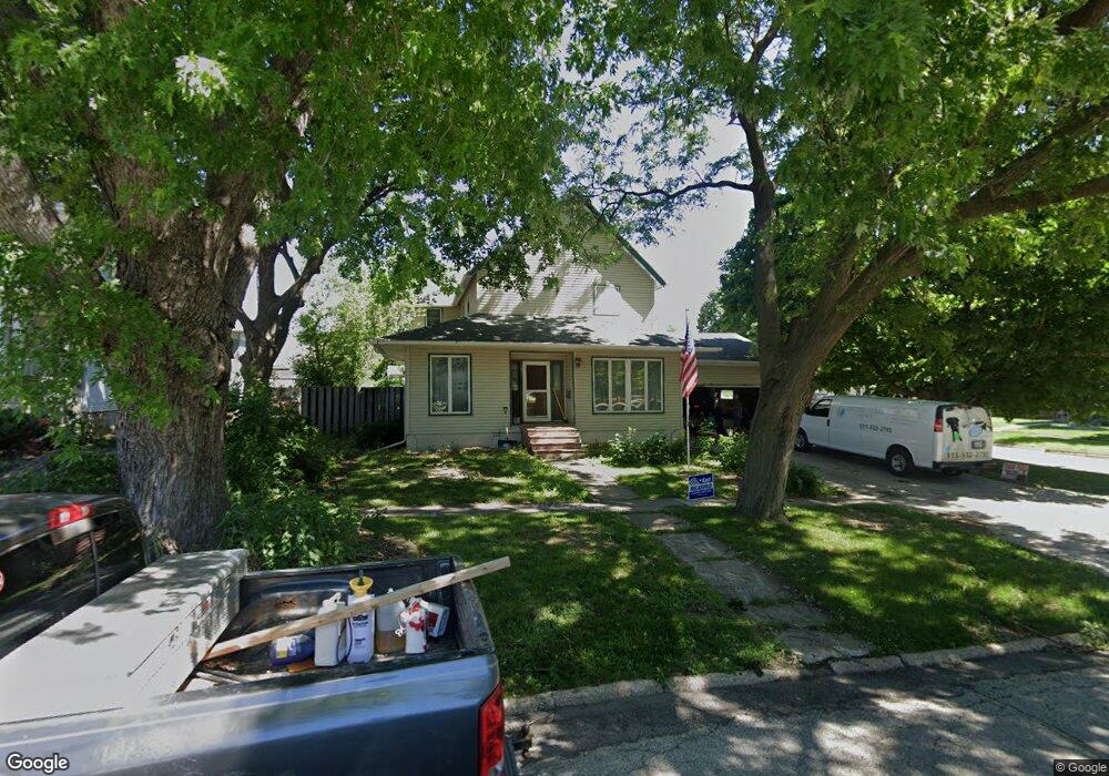
227 1st Ave NE Clarion, IA 50525
Estimated Value: $200,000 - $245,496
4
Beds
4
Baths
2,909
Sq Ft
$78/Sq Ft
Est. Value
About This Home
This home is located at 227 1st Ave NE, Clarion, IA 50525 and is currently estimated at $228,124, approximately $78 per square foot. 227 1st Ave NE is a home located in Wright County with nearby schools including Clarion-Goldfield-Dows Elementary School, Clarion-Goldfield-Dows Middle School, and Clarion-Goldfield-Dows High School.
Ownership History
Date
Name
Owned For
Owner Type
Purchase Details
Closed on
May 5, 2015
Sold by
Brinton Robert W and Brinton Pamela J
Bought by
Smith Amy D
Current Estimated Value
Home Financials for this Owner
Home Financials are based on the most recent Mortgage that was taken out on this home.
Original Mortgage
$112,917
Outstanding Balance
$86,987
Interest Rate
3.68%
Mortgage Type
FHA
Estimated Equity
$141,137
Create a Home Valuation Report for This Property
The Home Valuation Report is an in-depth analysis detailing your home's value as well as a comparison with similar homes in the area
Home Values in the Area
Average Home Value in this Area
Purchase History
| Date | Buyer | Sale Price | Title Company |
|---|---|---|---|
| Smith Amy D | $114,875 | None Available |
Source: Public Records
Mortgage History
| Date | Status | Borrower | Loan Amount |
|---|---|---|---|
| Open | Smith Amy D | $112,917 |
Source: Public Records
Tax History Compared to Growth
Tax History
| Year | Tax Paid | Tax Assessment Tax Assessment Total Assessment is a certain percentage of the fair market value that is determined by local assessors to be the total taxable value of land and additions on the property. | Land | Improvement |
|---|---|---|---|---|
| 2025 | $4,208 | $246,700 | $8,300 | $238,400 |
| 2024 | $4,208 | $229,900 | $8,300 | $221,600 |
| 2023 | $4,182 | $229,900 | $8,300 | $221,600 |
| 2022 | $3,504 | $192,900 | $8,300 | $184,600 |
| 2021 | $3,504 | $164,500 | $8,300 | $156,200 |
| 2020 | $3,461 | $164,500 | $8,300 | $156,200 |
| 2019 | $3,154 | $149,300 | $0 | $0 |
| 2018 | $3,174 | $149,300 | $0 | $0 |
| 2017 | $2,996 | $141,800 | $0 | $0 |
| 2016 | $2,872 | $141,800 | $0 | $0 |
| 2015 | $2,926 | $141,800 | $0 | $0 |
| 2014 | $2,926 | $120,000 | $0 | $0 |
Source: Public Records
Map
Nearby Homes
- 212 3rd Ave NE
- 421 2nd Ave NE
- 603 1st Ave NE
- 314 1st St NW
- 614 Central Ave E
- 719 2nd St NE
- 903 2nd Ave NE
- 620 Maple Ln
- 909 1st Ave SE
- 904 3rd Ave NE
- 213 8th St SE
- 1003 2nd Ave NE
- 708 2nd St SW
- 219 8th Ave SE
- 1000 1st St SE
- 306 White Fox Dr
- 1221 S Main St
- 2412 188th St
- 2405 186th St Unit 1
- 2405 186th St Unit 2
- 214 2nd St NE
- 301 1st Ave NE
- 221 1st Ave NE
- 221 1st Ave NE
- 302 2nd Ave NE
- 226 2nd Ave NE
- 214 2nd Ave NE
- 304 1st Ave NE
- 303 1st Ave NE
- 226 1st Ave NE
- 209 1st Ave NE
- 220 1st Ave NE
- 208 2nd Ave NE
- 310 1st Ave NE
- 310 2nd Ave NE
- 225 2nd Ave NE
- 303 2nd Ave NE
- 221 2nd Ave NE
- 221 Central Ave E
- 316 1st Ave NE