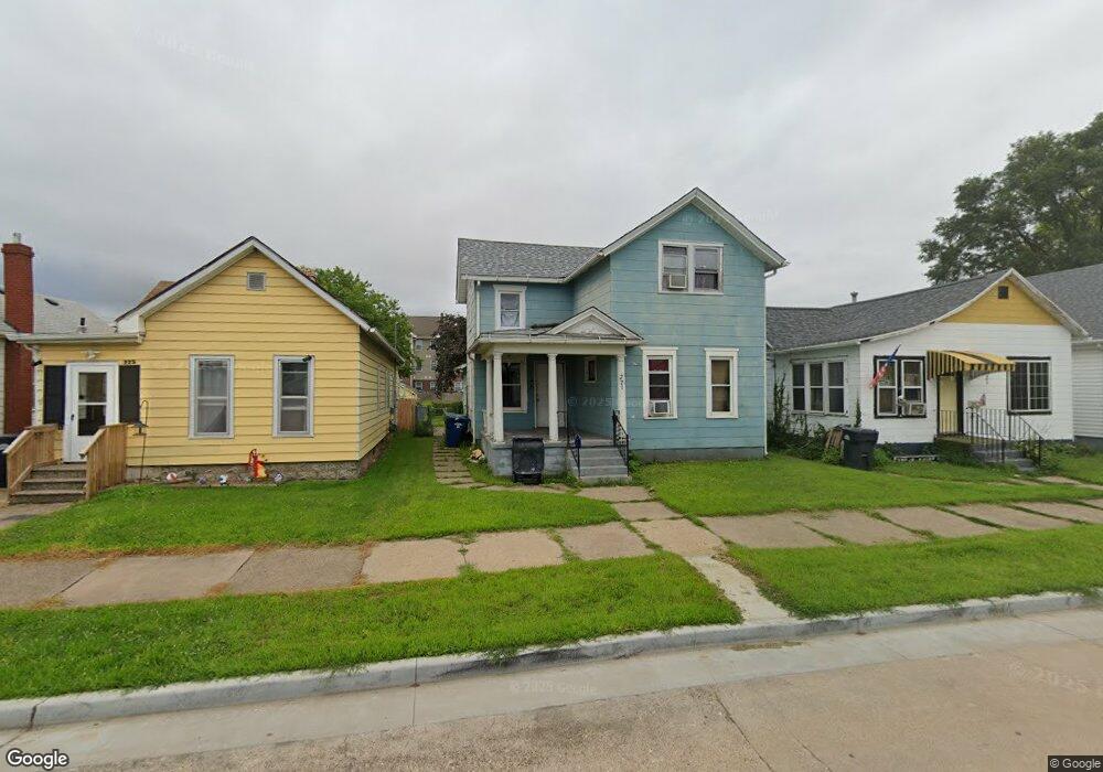
227 5th Ave N Clinton, IA 52732
Estimated Value: $68,787 - $84,000
3
Beds
2
Baths
1,320
Sq Ft
$59/Sq Ft
Est. Value
About This Home
This home is located at 227 5th Ave N, Clinton, IA 52732 and is currently estimated at $77,697, approximately $58 per square foot. 227 5th Ave N is a home located in Clinton County with nearby schools including Jefferson Elementary School, Clinton Middle School, and Clinton High School.
Ownership History
Date
Name
Owned For
Owner Type
Purchase Details
Closed on
Dec 7, 2022
Sold by
227Fif732 Trust
Bought by
Weigant Eugene
Current Estimated Value
Purchase Details
Closed on
Mar 22, 2019
Sold by
Wells Fargo Bank Na
Bought by
Equity & Help Inc
Purchase Details
Closed on
Oct 30, 2009
Sold by
Kelly Betty Ruth
Bought by
Chambers Ausha S
Home Financials for this Owner
Home Financials are based on the most recent Mortgage that was taken out on this home.
Original Mortgage
$57,832
Interest Rate
5.07%
Mortgage Type
FHA
Create a Home Valuation Report for This Property
The Home Valuation Report is an in-depth analysis detailing your home's value as well as a comparison with similar homes in the area
Home Values in the Area
Average Home Value in this Area
Purchase History
| Date | Buyer | Sale Price | Title Company |
|---|---|---|---|
| Weigant Eugene | $3,000 | -- | |
| Equity & Help Inc | $16,550 | -- | |
| Chambers Ausha S | $59,000 | None Available |
Source: Public Records
Mortgage History
| Date | Status | Borrower | Loan Amount |
|---|---|---|---|
| Previous Owner | Chambers Ausha S | $57,832 |
Source: Public Records
Tax History Compared to Growth
Tax History
| Year | Tax Paid | Tax Assessment Tax Assessment Total Assessment is a certain percentage of the fair market value that is determined by local assessors to be the total taxable value of land and additions on the property. | Land | Improvement |
|---|---|---|---|---|
| 2024 | $1,052 | $56,480 | $5,790 | $50,690 |
| 2023 | $1,150 | $56,480 | $5,790 | $50,690 |
| 2022 | $1,126 | $51,529 | $4,798 | $46,731 |
| 2021 | $1,190 | $51,529 | $4,798 | $46,731 |
| 2020 | $1,190 | $51,529 | $4,798 | $46,731 |
| 2019 | $2,536 | $51,529 | $0 | $0 |
| 2018 | $1,196 | $51,529 | $0 | $0 |
| 2017 | $1,326 | $51,529 | $0 | $0 |
| 2016 | $1,190 | $51,529 | $0 | $0 |
| 2015 | $1,190 | $51,529 | $0 | $0 |
| 2014 | $1,196 | $51,529 | $0 | $0 |
| 2013 | $1,178 | $0 | $0 | $0 |
Source: Public Records
Map
Nearby Homes
- 312 N 3rd St
- 704 N 3rd St
- 348 6th Ave N
- 620 N 4th St
- 237 1st Ave
- 728 Park Place
- 226 2nd Ave S
- 500 4th Ave N
- 504 6th Ave N
- 828 Park Place
- 510 6th Ave N
- 244 3rd Ave S Unit 1
- 924 N 3rd St
- 923 Pershing Blvd
- 700 N Bluff Blvd
- 1013 N 2nd St
- 515 1st Ave
- 1022 Pershing Blvd
- 515 Woodland Dr
- 1022 Hickory Hill Ct