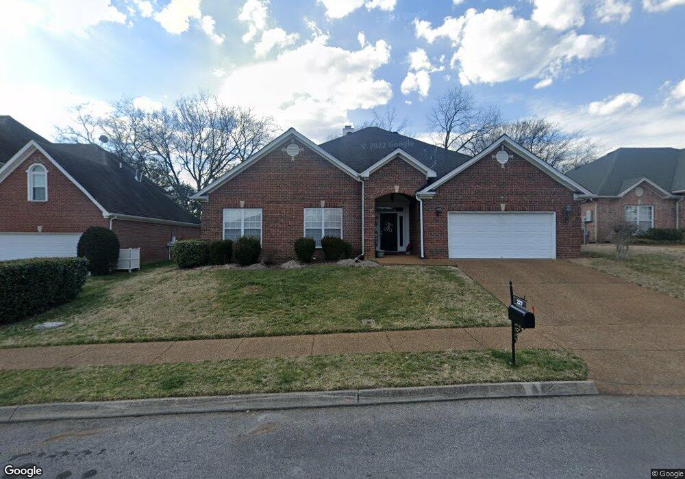
227 Bancroft Cove Unit CV227 Franklin, TN 37064
West Franklin NeighborhoodEstimated Value: $803,403 - $909,000
Studio
4
Baths
2,999
Sq Ft
$280/Sq Ft
Est. Value
About This Home
This home is located at 227 Bancroft Cove Unit CV227, Franklin, TN 37064 and is currently estimated at $838,851, approximately $279 per square foot. 227 Bancroft Cove Unit CV227 is a home located in Williamson County with nearby schools including Poplar Grove K-4, Poplar Grove 5-8, and Franklin High School.
Ownership History
Date
Name
Owned For
Owner Type
Purchase Details
Closed on
Sep 28, 2000
Sold by
Continental Development Construction Inc
Bought by
Farnsworth Rickey D and Farnsworth Patricia A
Current Estimated Value
Home Financials for this Owner
Home Financials are based on the most recent Mortgage that was taken out on this home.
Original Mortgage
$204,000
Outstanding Balance
$73,402
Interest Rate
7.92%
Estimated Equity
$765,449
Create a Home Valuation Report for This Property
The Home Valuation Report is an in-depth analysis detailing your home's value as well as a comparison with similar homes in the area
Home Values in the Area
Average Home Value in this Area
Purchase History
| Date | Buyer | Sale Price | Title Company |
|---|---|---|---|
| Farnsworth Rickey D | $255,000 | Southeast Title Of Tn Inc |
Source: Public Records
Mortgage History
| Date | Status | Borrower | Loan Amount |
|---|---|---|---|
| Open | Farnsworth Rickey D | $204,000 |
Source: Public Records
Tax History
| Year | Tax Paid | Tax Assessment Tax Assessment Total Assessment is a certain percentage of the fair market value that is determined by local assessors to be the total taxable value of land and additions on the property. | Land | Improvement |
|---|---|---|---|---|
| 2025 | $3,536 | $206,100 | $68,750 | $137,350 |
| 2024 | $3,536 | $124,900 | $27,500 | $97,400 |
| 2023 | $3,399 | $124,900 | $27,500 | $97,400 |
| 2022 | $3,399 | $124,900 | $27,500 | $97,400 |
| 2021 | $3,399 | $124,900 | $27,500 | $97,400 |
| 2020 | $3,103 | $96,150 | $19,125 | $77,025 |
| 2019 | $3,103 | $96,150 | $19,125 | $77,025 |
| 2018 | $3,035 | $96,150 | $19,125 | $77,025 |
| 2017 | $2,987 | $96,150 | $19,125 | $77,025 |
Source: Public Records
Map
Nearby Homes
- 5003 Rizer Point Dr
- 230 Lancelot Ln
- 1015 Del Rio Ct
- 1216 Reese Dr
- 1801 Franklin Hills Ln
- 509 Alexander Dr
- 104 Meredith Place
- 2962 Del Rio Pike
- 5029 Owenruth Dr
- 4064 Penfield Dr
- 4072 Penfield Dr
- 5037 Owenruth Dr
- 5041 Owenruth Dr
- 800 Del Rio Pike
- 813 Ronald Dr
- 132 Alexander Dr
- 806 Edwards Dr
- 718 Del Rio Pike
- 708 Del Rio Pike
- 1141 Magnolia Dr
- 229 Bancroft Cove Unit CV229
- 225 Bancroft Cove
- 231 Bancroft Cove
- 223 Bancroft Cove
- 226 Bancroft Cove
- 222 Bancroft Cove
- 220 Bancroft Cove
- 527 Bancroft Way
- 221 Bancroft Cove
- 525 Bancroft Way
- 529 Bancroft Way
- 102 Berwick Place
- 218 Bancroft Cove
- 523 Bancroft Way
- 219 Bancroft Cove
- 233 Bancroft Cove
- 531 Bancroft Way
- 216 Bancroft Cove
- 104 Berwick Place
- 521 Bancroft Way