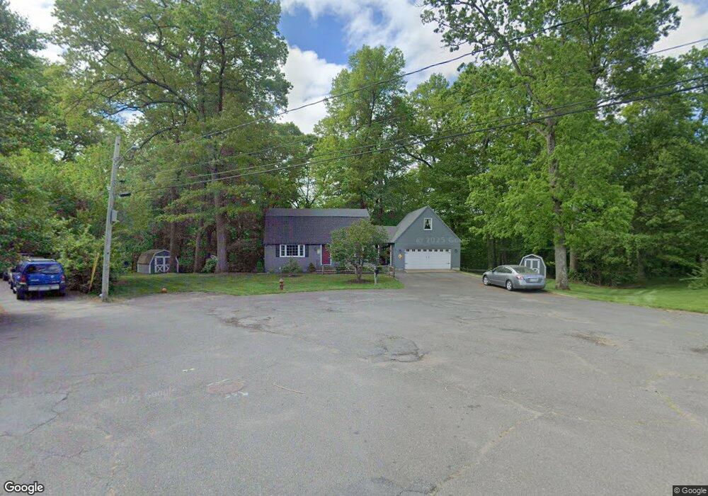
227 Barbara St Westfield, MA 01085
Estimated Value: $427,000 - $480,000
3
Beds
2
Baths
1,984
Sq Ft
$223/Sq Ft
Est. Value
About This Home
This home is located at 227 Barbara St, Westfield, MA 01085 and is currently estimated at $441,898, approximately $222 per square foot. 227 Barbara St is a home located in Hampden County with nearby schools including Westfield High School and Saint Mary High School.
Ownership History
Date
Name
Owned For
Owner Type
Purchase Details
Closed on
Sep 19, 1977
Bought by
Stroetzel Michael G and Stroetzel Deborah P
Current Estimated Value
Create a Home Valuation Report for This Property
The Home Valuation Report is an in-depth analysis detailing your home's value as well as a comparison with similar homes in the area
Home Values in the Area
Average Home Value in this Area
Purchase History
| Date | Buyer | Sale Price | Title Company |
|---|---|---|---|
| Stroetzel Michael G | -- | -- |
Source: Public Records
Mortgage History
| Date | Status | Borrower | Loan Amount |
|---|---|---|---|
| Open | Stroetzel Michael G | $60,000 | |
| Closed | Stroetzel Michael G | $80,000 | |
| Closed | Stroetzel Michael G | $42,000 |
Source: Public Records
Tax History Compared to Growth
Tax History
| Year | Tax Paid | Tax Assessment Tax Assessment Total Assessment is a certain percentage of the fair market value that is determined by local assessors to be the total taxable value of land and additions on the property. | Land | Improvement |
|---|---|---|---|---|
| 2025 | $5,234 | $344,800 | $127,900 | $216,900 |
| 2024 | $5,230 | $327,500 | $116,600 | $210,900 |
| 2023 | $4,837 | $296,200 | $110,900 | $185,300 |
| 2022 | $4,837 | $261,600 | $98,700 | $162,900 |
| 2021 | $4,684 | $248,100 | $93,100 | $155,000 |
| 2020 | $4,549 | $236,300 | $93,100 | $143,200 |
| 2019 | $4,445 | $226,000 | $88,700 | $137,300 |
| 2018 | $4,375 | $226,000 | $88,700 | $137,300 |
| 2017 | $4,300 | $221,400 | $90,000 | $131,400 |
| 2016 | $4,304 | $221,400 | $90,000 | $131,400 |
| 2015 | $3,990 | $215,200 | $90,000 | $125,200 |
| 2014 | $2,984 | $215,200 | $90,000 | $125,200 |
Source: Public Records
Map
Nearby Homes
- 194 Lockhouse Rd
- 19 Arch Rd
- 351 N Elm St
- 14 Lynnwood Dr
- 13 Furrow St
- 10 Ethan Ave
- 99 Woodmont St
- 26 Deepwoods Dr
- 4 Columbia St
- 0 Cabot Rd
- 0 Holyoke Rd
- 70 Yeoman Ave
- 40 Prospect St Unit 2F
- 28 Union St
- 22 Root Rd
- Lot 3 Montgomery
- 119 Union St Unit 4
- 49 Pochassic St
- 868 Southampton Rd Unit 18
- 28 1st Ave