227 Barton Rd Greenfield, MA 01301
Estimated Value: $399,000 - $589,000
3
Beds
2
Baths
2,724
Sq Ft
$183/Sq Ft
Est. Value
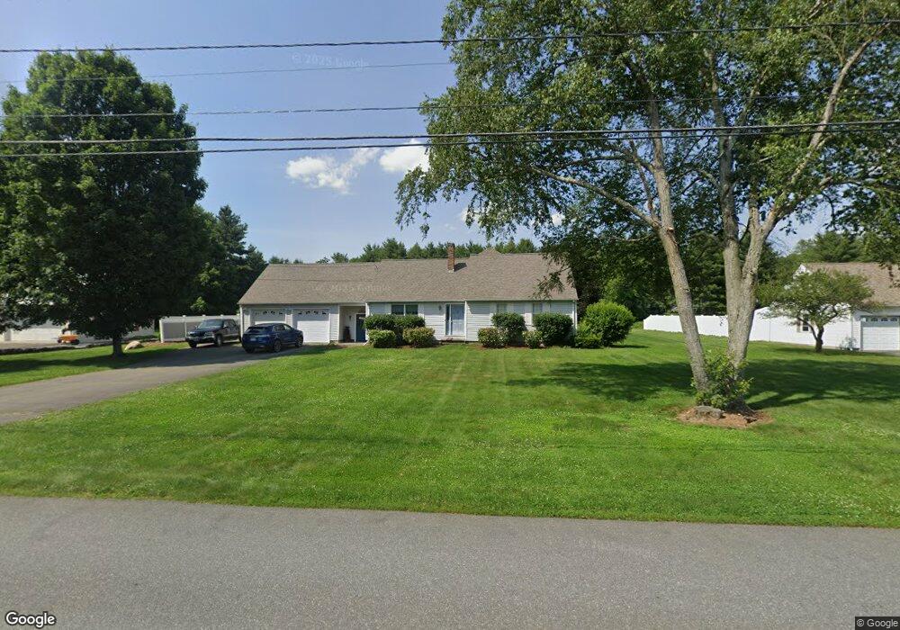
About This Home
This home is located at 227 Barton Rd, Greenfield, MA 01301 and is currently estimated at $497,801, approximately $182 per square foot. 227 Barton Rd is a home located in Franklin County with nearby schools including Greenfield Center School and Stoneleigh-Burnham School.
Ownership History
Date
Name
Owned For
Owner Type
Purchase Details
Closed on
Nov 17, 1987
Sold by
Stotz Isabelle Est
Bought by
Smith Edward M
Current Estimated Value
Home Financials for this Owner
Home Financials are based on the most recent Mortgage that was taken out on this home.
Original Mortgage
$65,000
Interest Rate
11.13%
Mortgage Type
Purchase Money Mortgage
Create a Home Valuation Report for This Property
The Home Valuation Report is an in-depth analysis detailing your home's value as well as a comparison with similar homes in the area
Home Values in the Area
Average Home Value in this Area
Purchase History
| Date | Buyer | Sale Price | Title Company |
|---|---|---|---|
| Smith Edward M | $125,000 | -- |
Source: Public Records
Mortgage History
| Date | Status | Borrower | Loan Amount |
|---|---|---|---|
| Open | Smith Edward M | $125,000 | |
| Closed | Smith Edward M | $15,000 | |
| Closed | Smith Edward M | $65,000 | |
| Closed | Smith Edward M | $65,000 |
Source: Public Records
Tax History
| Year | Tax Paid | Tax Assessment Tax Assessment Total Assessment is a certain percentage of the fair market value that is determined by local assessors to be the total taxable value of land and additions on the property. | Land | Improvement |
|---|---|---|---|---|
| 2025 | $9,616 | $491,600 | $82,700 | $408,900 |
| 2024 | $9,816 | $481,400 | $70,400 | $411,000 |
| 2023 | $8,778 | $446,700 | $70,400 | $376,300 |
| 2022 | $8,863 | $397,100 | $70,500 | $326,600 |
| 2021 | $8,647 | $372,400 | $74,500 | $297,900 |
| 2020 | $7,970 | $347,600 | $74,500 | $273,100 |
| 2019 | $7,587 | $339,300 | $64,900 | $274,400 |
| 2018 | $6,947 | $309,700 | $63,700 | $246,000 |
| 2017 | $6,730 | $309,700 | $63,700 | $246,000 |
| 2016 | $6,761 | $310,000 | $63,700 | $246,300 |
| 2015 | $6,791 | $301,700 | $65,300 | $236,400 |
| 2014 | $5,141 | $250,400 | $65,300 | $185,100 |
Source: Public Records
Map
Nearby Homes
- 85 Verde Dr
- 25 Barton Rd
- 696 Bernardston Rd
- 001 Adams Rd
- 9 Hancock Ln
- 108 Nelson Rd
- 111 South St
- 47 Cross St
- 75 South St Unit 3
- 132 Poplar St
- 539 Fox Hill Rd
- 18 Lillian St
- 77 Summer St
- 151 Smead Hill Rd
- 20 Dunnell Rd
- 0 Fox Hill Rd Unit 73477185
- 171 Cleveland St
- 372 Federal St
- 37 Cleveland St
- 714 Colrain Rd
- 219 Barton Rd
- 233 Barton Rd
- 230 Barton Rd
- 224 Barton Rd
- 234 Barton Rd
- 726 Country Club Rd
- 220 Barton Rd
- 724 Country Club Rd
- 734 Country Club Rd
- 214 Barton Rd
- 209 Barton Rd
- 44 Brookside Ave
- 714 Country Club Rd
- 48 Brookside Ave
- 42 Brookside Ave
- 40 Brookside Ave
- 742 Country Club Rd
- 733 Country Club Rd
- 708 Country Club Rd
- 205 Barton Rd
Your Personal Tour Guide
Ask me questions while you tour the home.