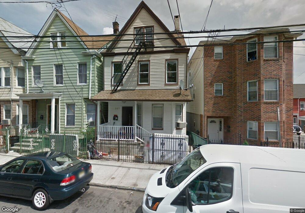
227 Garside St Newark, NJ 07104
Mount Pleasant-Lower Broadway NeighborhoodEstimated Value: $391,000 - $499,000
--
Bed
--
Bath
1,741
Sq Ft
$258/Sq Ft
Est. Value
About This Home
This home is located at 227 Garside St, Newark, NJ 07104 and is currently estimated at $448,648, approximately $257 per square foot. 227 Garside St is a home located in Essex County with nearby schools including Rafael Hernandez School, Franklin School, and First Avenue Elementary School.
Ownership History
Date
Name
Owned For
Owner Type
Purchase Details
Closed on
Jan 28, 2010
Sold by
Federal Home Loan Mortgage Corporation
Bought by
Fala 1 Llc
Current Estimated Value
Purchase Details
Closed on
Sep 30, 2009
Sold by
Silberstein Joseph
Bought by
Federal Home Loan Mortgage Corp
Purchase Details
Closed on
May 8, 2007
Sold by
Jp Morgan Chase Bank
Bought by
Silberstein Joseph
Home Financials for this Owner
Home Financials are based on the most recent Mortgage that was taken out on this home.
Original Mortgage
$167,200
Interest Rate
6.27%
Mortgage Type
Purchase Money Mortgage
Purchase Details
Closed on
Sep 22, 2005
Sold by
Molina Ernesto
Bought by
Marrero Eddie
Home Financials for this Owner
Home Financials are based on the most recent Mortgage that was taken out on this home.
Original Mortgage
$292,000
Interest Rate
6.9%
Mortgage Type
Adjustable Rate Mortgage/ARM
Create a Home Valuation Report for This Property
The Home Valuation Report is an in-depth analysis detailing your home's value as well as a comparison with similar homes in the area
Home Values in the Area
Average Home Value in this Area
Purchase History
| Date | Buyer | Sale Price | Title Company |
|---|---|---|---|
| Fala 1 Llc | $40,000 | Multiple | |
| Federal Home Loan Mortgage Corp | -- | None Available | |
| Silberstein Joseph | $209,000 | None Available | |
| Marrero Eddie | $365,000 | -- |
Source: Public Records
Mortgage History
| Date | Status | Borrower | Loan Amount |
|---|---|---|---|
| Previous Owner | Silberstein Joseph | $167,200 | |
| Previous Owner | Marrero Eddie | $292,000 |
Source: Public Records
Tax History Compared to Growth
Tax History
| Year | Tax Paid | Tax Assessment Tax Assessment Total Assessment is a certain percentage of the fair market value that is determined by local assessors to be the total taxable value of land and additions on the property. | Land | Improvement |
|---|---|---|---|---|
| 2025 | $4,776 | $128,100 | $34,500 | $93,600 |
| 2024 | $4,776 | $128,100 | $34,500 | $93,600 |
| 2022 | $4,786 | $128,100 | $34,500 | $93,600 |
| 2021 | $4,783 | $128,100 | $34,500 | $93,600 |
| 2020 | $4,868 | $128,100 | $34,500 | $93,600 |
| 2019 | $4,818 | $128,100 | $34,500 | $93,600 |
| 2018 | $4,731 | $128,100 | $34,500 | $93,600 |
| 2017 | $4,560 | $128,100 | $34,500 | $93,600 |
| 2016 | $4,407 | $128,100 | $34,500 | $93,600 |
| 2015 | $4,239 | $128,100 | $34,500 | $93,600 |
| 2014 | $3,972 | $128,100 | $34,500 | $93,600 |
Source: Public Records
Map
Nearby Homes
- 231 Garside St
- 212 Garside St
- 207 Garside St
- 205 Garside St
- 209 Mount Prospect Ave
- 245 Summer Ave
- 283 Clifton Ave
- 249 Summer Ave
- 143 4th Ave
- 24 Taylor St
- 15 Taylor St
- 85 3rd Ave Unit 2
- 290 Garside St
- 290 1/2 Garside St
- 308 Clifton Ave
- 14 van Wagenen St
- 253 Clifton Ave
- 320 Clifton Ave
- 322 Clifton Ave
- 229 Garside St
- 225 Garside St
- 231 Garside St
- 233 Garside St
- 233 Garside St
- 65 Taylor St
- 233 1/2 Garside St
- 235 Garside St
- 235 Garside St
- 63 Taylor St
- 235 1/2 Garside St
- 221 Garside St
- 61 Taylor St
- 235/235.5 Garside St
- 235 1 2 Garside St
- 219 Garside St
- 59 Taylor St
- 239 Garside St
- 66 Taylor St
- 217 Garside St