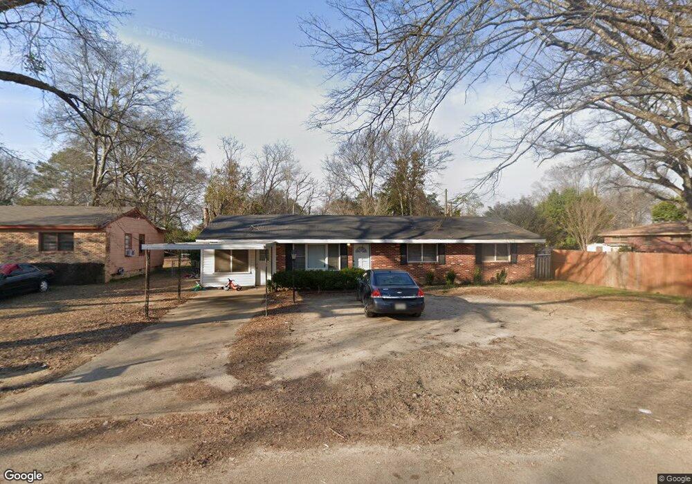
227 McHall Dr Columbus, MS 39702
Estimated Value: $99,000 - $130,000
3
Beds
2
Baths
1,500
Sq Ft
$78/Sq Ft
Est. Value
About This Home
This home is located at 227 McHall Dr, Columbus, MS 39702 and is currently estimated at $117,123, approximately $78 per square foot. 227 McHall Dr is a home located in Lowndes County with nearby schools including Columbus Middle School, Columbus High School, and Annunciation Catholic School.
Ownership History
Date
Name
Owned For
Owner Type
Purchase Details
Closed on
Jan 24, 2013
Sold by
Bobo Johnny and Bobo Margaret
Bought by
Eh Pooled 912 Lp
Current Estimated Value
Purchase Details
Closed on
Dec 4, 2012
Sold by
Deutsche Bank National Company
Bought by
Eh Pooled 912 Lp
Purchase Details
Closed on
Sep 9, 2005
Sold by
Golden Triangle Investment Company Inc
Bought by
Colvin Gracie
Home Financials for this Owner
Home Financials are based on the most recent Mortgage that was taken out on this home.
Original Mortgage
$70,000
Interest Rate
5.86%
Create a Home Valuation Report for This Property
The Home Valuation Report is an in-depth analysis detailing your home's value as well as a comparison with similar homes in the area
Purchase History
| Date | Buyer | Sale Price | Title Company |
|---|---|---|---|
| Eh Pooled 912 Lp | -- | -- | |
| Eh Pooled 912 Lp | -- | -- | |
| Colvin Gracie | -- | -- |
Source: Public Records
Mortgage History
| Date | Status | Borrower | Loan Amount |
|---|---|---|---|
| Previous Owner | Colvin Gracie | $70,000 |
Source: Public Records
Tax History
| Year | Tax Paid | Tax Assessment Tax Assessment Total Assessment is a certain percentage of the fair market value that is determined by local assessors to be the total taxable value of land and additions on the property. | Land | Improvement |
|---|---|---|---|---|
| 2025 | $621 | $5,050 | $0 | $0 |
| 2024 | $611 | $5,050 | $0 | $0 |
| 2023 | $643 | $5,255 | $0 | $0 |
| 2022 | $647 | $5,255 | $0 | $0 |
| 2021 | $615 | $5,255 | $0 | $0 |
| 2020 | $595 | $5,255 | $0 | $0 |
| 2019 | $570 | $5,243 | $0 | $0 |
| 2018 | $570 | $5,151 | $0 | $0 |
| 2017 | $526 | $5,151 | $0 | $0 |
| 2016 | $526 | $5,151 | $0 | $0 |
| 2015 | $540 | $5,290 | $0 | $0 |
| 2014 | $1,150 | $7,935 | $0 | $0 |
Source: Public Records
Map
Nearby Homes
- 215 Robinwood Cir
- 307 Vance St
- 201 Mccrary Dr
- 125 Robinwood Cir
- 210 Airline Rd
- 408 Idlewild Rd
- 102 S Browder St
- 119 King St
- 0 Highway 182 E
- 534 Alabama St
- 140 Juanita St
- 405 Springdale Dr
- 225 Maple St
- 119 Maple St
- 279 Pandora Dr
- 111 Florence St
- 612 Sycamore St
- 320 Florence St
- 112 Gaylane Dr
- 721 Cypress St
Your Personal Tour Guide
Ask me questions while you tour the home.