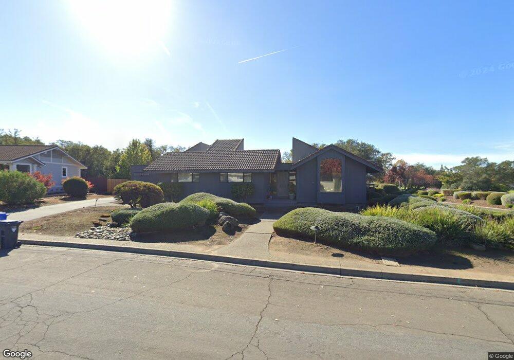
227 Saint Andrews Dr Napa, CA 94558
Silverado Resort NeighborhoodEstimated Value: $1,714,966 - $2,269,000
3
Beds
2
Baths
2,871
Sq Ft
$698/Sq Ft
Est. Value
About This Home
This home is located at 227 Saint Andrews Dr, Napa, CA 94558 and is currently estimated at $2,004,742, approximately $698 per square foot. 227 Saint Andrews Dr is a home located in Napa County with nearby schools including Vichy Elementary School, Silverado Middle School, and Vintage High School.
Ownership History
Date
Name
Owned For
Owner Type
Purchase Details
Closed on
Oct 26, 2016
Sold by
Ellington Laura W
Bought by
Ellington Laura W and Laura W Ellington Trust
Current Estimated Value
Purchase Details
Closed on
Oct 1, 2016
Sold by
Willback Karen M
Bought by
Willback Karen M and Karen M Willback Trust
Purchase Details
Closed on
Jul 13, 2016
Sold by
Willback Karen M and Ellington Laura W
Bought by
Willback Karen M and Ellington Laura W
Purchase Details
Closed on
Sep 22, 1999
Sold by
Willback Angie
Bought by
Willback Angie and Melvin J Willback Exemption Tr
Purchase Details
Closed on
Mar 29, 1995
Sold by
Willback Melvin J and Willback Angie E
Bought by
Willback Melvin J and Willback Angie
Create a Home Valuation Report for This Property
The Home Valuation Report is an in-depth analysis detailing your home's value as well as a comparison with similar homes in the area
Home Values in the Area
Average Home Value in this Area
Purchase History
| Date | Buyer | Sale Price | Title Company |
|---|---|---|---|
| Ellington Laura W | -- | None Available | |
| Willback Karen M | -- | None Available | |
| Willback Karen M | -- | None Available | |
| Willback Angie | -- | -- | |
| Willback Melvin J | -- | -- |
Source: Public Records
Tax History Compared to Growth
Tax History
| Year | Tax Paid | Tax Assessment Tax Assessment Total Assessment is a certain percentage of the fair market value that is determined by local assessors to be the total taxable value of land and additions on the property. | Land | Improvement |
|---|---|---|---|---|
| 2025 | $4,775 | $351,139 | $57,744 | $293,395 |
| 2024 | $4,775 | $344,255 | $56,612 | $287,643 |
| 2023 | $4,775 | $337,505 | $55,502 | $282,003 |
| 2022 | $4,632 | $330,888 | $54,414 | $276,474 |
| 2021 | $4,563 | $324,401 | $53,348 | $271,053 |
| 2020 | $4,524 | $321,075 | $52,801 | $268,274 |
| 2019 | $4,437 | $314,780 | $51,766 | $263,014 |
| 2018 | $4,360 | $308,608 | $50,751 | $257,857 |
| 2017 | $4,235 | $302,557 | $49,756 | $252,801 |
| 2016 | $4,078 | $296,626 | $48,781 | $247,845 |
| 2015 | $3,784 | $292,172 | $48,049 | $244,123 |
| 2014 | $3,725 | $286,449 | $47,108 | $239,341 |
Source: Public Records
Map
Nearby Homes
- 2134 Monticello Rd
- 2152 Monticello Rd
- 265 Kaanapali Dr
- 2186 Monticello Rd
- 833 Augusta Cir Unit 34
- 808 Augusta Cir
- 2143 Monticello Rd
- 2863 Atlas Peak Rd
- 2277 Monticello Rd
- 2015 Monticello Rd
- 1600 Atlas Peak Rd Unit 432
- 1600 Atlas Peak Rd Unit 428
- 1600 Atlas Peak Rd Unit 365
- 14 Maui Way
- 523 Westgate Dr
- 1777 Mckinley Rd
- 350 Deer Hollow Dr
- 1776 Monticello Rd
- 346 Deer Hollow Dr
- 1669 Atlas Peak Rd
- 233 Saint Andrews Dr
- 230 Saint Andrews Dr
- 237 Saint Andrews Dr
- 236 Saint Andrews Dr
- 2001 Hillcrest Dr
- 243 Saint Andrews Dr
- 242 Saint Andrews Dr
- 352 Troon Ct
- 247 Saint Andrews Dr
- 351 Troon Ct
- 347 Troon Ct
- 254 Saint Andrews Dr
- 17 Pinehurst Cir
- 348 Troon Ct
- 360 Troon Dr
- 343 Troon Ct
- 257 Saint Andrews Dr
- 978 Augusta Cir
- 344 Troon Ct
- 19 Pinehurst Cir