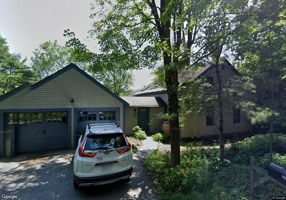
227 W Leyden Rd Colrain, MA 01340
Colrain NeighborhoodEstimated Value: $390,000 - $450,000
3
Beds
2
Baths
1,778
Sq Ft
$239/Sq Ft
Est. Value
About This Home
This home is located at 227 W Leyden Rd, Colrain, MA 01340 and is currently estimated at $425,034, approximately $239 per square foot. 227 W Leyden Rd is a home located in Franklin County with nearby schools including Mohawk Trail Regional High School.
Ownership History
Date
Name
Owned For
Owner Type
Purchase Details
Closed on
Jul 3, 2019
Sold by
Greenberg David and Erickson Elizabeth
Bought by
Elizabeth Erickson Ret
Current Estimated Value
Purchase Details
Closed on
Oct 7, 1985
Bought by
Greenberg David and Erickson Elizabeth
Create a Home Valuation Report for This Property
The Home Valuation Report is an in-depth analysis detailing your home's value as well as a comparison with similar homes in the area
Home Values in the Area
Average Home Value in this Area
Purchase History
| Date | Buyer | Sale Price | Title Company |
|---|---|---|---|
| Elizabeth Erickson Ret | -- | -- | |
| Greenberg David | $63,000 | -- |
Source: Public Records
Mortgage History
| Date | Status | Borrower | Loan Amount |
|---|---|---|---|
| Previous Owner | Greenberg David | $50,000 | |
| Previous Owner | Greenberg David | $80,000 |
Source: Public Records
Tax History Compared to Growth
Tax History
| Year | Tax Paid | Tax Assessment Tax Assessment Total Assessment is a certain percentage of the fair market value that is determined by local assessors to be the total taxable value of land and additions on the property. | Land | Improvement |
|---|---|---|---|---|
| 2025 | $4,614 | $252,700 | $44,100 | $208,600 |
| 2024 | $4,772 | $251,400 | $44,100 | $207,300 |
| 2023 | $4,888 | $249,000 | $43,400 | $205,600 |
| 2022 | $4,743 | $231,600 | $38,400 | $193,200 |
| 2021 | $4,873 | $230,300 | $37,000 | $193,300 |
| 2020 | $4,590 | $230,300 | $37,000 | $193,300 |
| 2019 | $4,359 | $211,900 | $37,000 | $174,900 |
| 2018 | $4,248 | $209,900 | $37,000 | $172,900 |
| 2017 | $4,135 | $209,900 | $37,000 | $172,900 |
| 2016 | $3,921 | $209,900 | $37,000 | $172,900 |
| 2015 | $3,207 | $177,300 | $37,000 | $140,300 |
Source: Public Records
Map
Nearby Homes
- 21 River St
- 66 Reil Ln
- 319 Greenfield Rd
- 218 Greenfield Rd
- 295 Jacksonville Rd
- 0 Fiske Mill Rd
- 3+5 Church St
- 27 Lunt Dr
- 151 Smead Hill Rd
- 544 Fox Hill Rd (Vacant Land)
- 539 Fox Hill Rd
- 83 Eden Trail Branch
- 34 Brookside Ave
- Lot 9 Fox Hill Rd (Off)
- 0 Jacksonville Rd
- 187 Plain Rd
- 704 Brattleboro Rd
- 775 Brattleboro Rd
- 56 Brattleboro Rd
- 75 South St Unit 3
- 235 W Leyden Rd
- 245 W Leyden Rd
- 206 W Leyden Rd
- 253 W Leyden Rd
- 160 S Green River Rd
- 261 W Leyden Rd
- 100 S Green River Rd
- 33 Green River Ln
- 179 W Leyden Rd
- 29 Green River Ln
- 98 S Green River Rd
- 31 Green River Ln
- 140 W Leyden Rd
- 160 W Leyden Rd
- 26 Green River Ln
- 19 Green River Ln
- 24 Green River Ln
- 22 Green River Ln
- 0 Green River Road Lot 2 Unit 71217778
- 0 Green River Road Lot 2 Unit 71635690