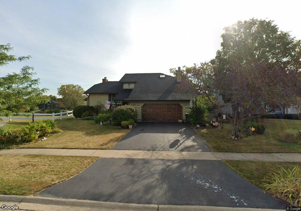
2270 High Point Dr Lindenhurst, IL 60046
Estimated Value: $456,000 - $524,000
3
Beds
3
Baths
2,406
Sq Ft
$202/Sq Ft
Est. Value
About This Home
This home is located at 2270 High Point Dr, Lindenhurst, IL 60046 and is currently estimated at $485,857, approximately $201 per square foot. 2270 High Point Dr is a home located in Lake County with nearby schools including Lakes Community High School.
Ownership History
Date
Name
Owned For
Owner Type
Purchase Details
Closed on
Feb 19, 2024
Sold by
Johnson Roy P and Johnson Elizabeth E
Bought by
Johnson Family Trust and Johnson
Current Estimated Value
Create a Home Valuation Report for This Property
The Home Valuation Report is an in-depth analysis detailing your home's value as well as a comparison with similar homes in the area
Home Values in the Area
Average Home Value in this Area
Purchase History
| Date | Buyer | Sale Price | Title Company |
|---|---|---|---|
| Johnson Family Trust | -- | None Listed On Document |
Source: Public Records
Tax History Compared to Growth
Tax History
| Year | Tax Paid | Tax Assessment Tax Assessment Total Assessment is a certain percentage of the fair market value that is determined by local assessors to be the total taxable value of land and additions on the property. | Land | Improvement |
|---|---|---|---|---|
| 2024 | $10,644 | $126,430 | $26,050 | $100,380 |
| 2023 | $12,326 | $111,707 | $23,016 | $88,691 |
| 2022 | $12,326 | $118,944 | $27,603 | $91,341 |
| 2021 | $11,699 | $110,491 | $25,641 | $84,850 |
| 2020 | $11,425 | $106,950 | $24,819 | $82,131 |
| 2019 | $11,697 | $102,787 | $23,853 | $78,934 |
| 2018 | $10,760 | $98,724 | $26,673 | $72,051 |
| 2017 | $10,468 | $96,091 | $25,962 | $70,129 |
| 2016 | $10,668 | $92,200 | $24,911 | $67,289 |
| 2015 | $10,166 | $86,112 | $23,266 | $62,846 |
| 2014 | $11,078 | $81,829 | $21,848 | $59,981 |
| 2012 | $10,295 | $95,460 | $24,503 | $70,957 |
Source: Public Records
Map
Nearby Homes
- 422 Northgate Rd
- 527 Northgate Rd Unit 28
- 694 Monroe Dr
- 692 Monroe Dr
- 691 N Autumn Cir
- 590 Oxford Ln
- 2726 Providence Ln
- 59 Chestnut Cir
- 586 Harvard Ct
- 102 Hawthorne Dr
- 1900 Burr Oak Ln Unit 15
- 1896 E Vista Terrace
- 205 Countryside Ln
- 19135 W Millburn Rd
- 1847 Natures Ct
- 405 Woodland Trail
- 225 Ironwood Dr
- 420 Woodland Trail
- 812 Auburn Ln
- 428 Woodland Trail
- 2276 High Point Dr
- 2260 High Point Dr
- 2282 High Point Dr
- 2257 High Point Dr
- 2252 High Point Dr Unit 4
- 2288 High Point Dr
- 2241 High Point Dr
- 2244 High Point Dr
- 2296 High Point Dr
- 2265 High Point Dr
- 498 Whispering Pines Rd
- 2236 High Point Dr
- 2233 High Point Dr
- 497 Whispering Pines Rd
- 2273 High Point Dr
- 2300 High Point Dr
- 2228 High Point Dr
- 2225 High Point Dr
- 500 Whispering Pines Rd
- 2281 High Point Dr