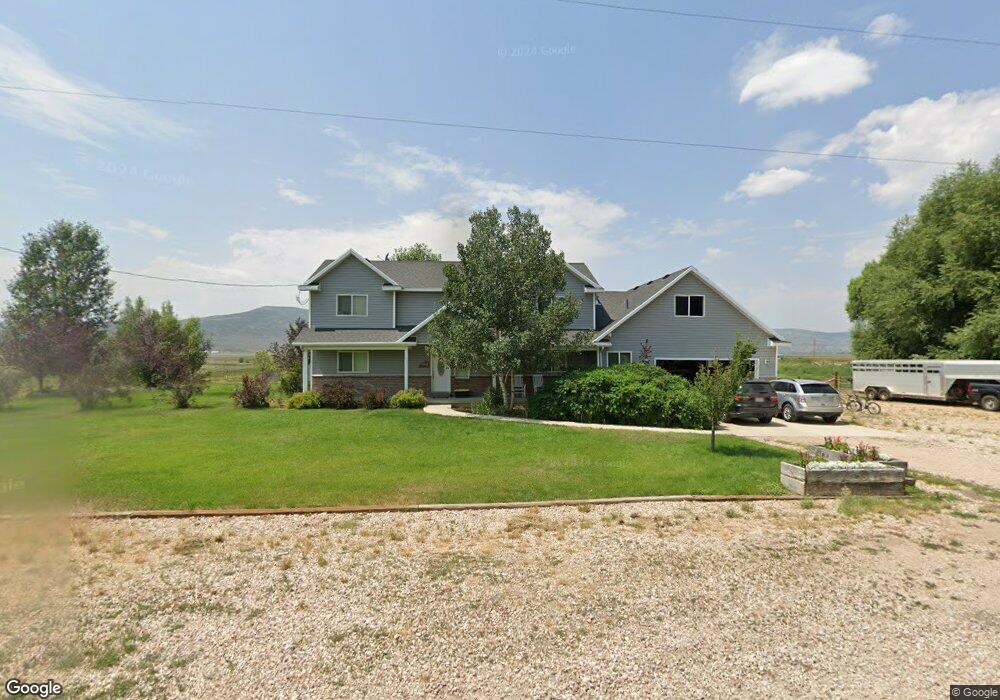
2271 N 450 W Kamas, UT 84036
Kamas Valley NeighborhoodEstimated Value: $1,199,750 - $1,828,000
--
Bed
1
Bath
2,973
Sq Ft
$477/Sq Ft
Est. Value
About This Home
This home is located at 2271 N 450 W, Kamas, UT 84036 and is currently estimated at $1,419,438, approximately $477 per square foot. 2271 N 450 W is a home with nearby schools including South Summit Elementary School and South Summit High School.
Ownership History
Date
Name
Owned For
Owner Type
Purchase Details
Closed on
Jan 8, 2008
Sold by
Louder Terence Lee and Louder Danielle V
Bought by
Louder Terence L and Louder Danielle V
Current Estimated Value
Home Financials for this Owner
Home Financials are based on the most recent Mortgage that was taken out on this home.
Original Mortgage
$286,500
Outstanding Balance
$188,504
Interest Rate
6.25%
Mortgage Type
Adjustable Rate Mortgage/ARM
Estimated Equity
$1,230,934
Purchase Details
Closed on
Dec 20, 2007
Sold by
Louder Tony E and Louder Judy R
Bought by
Louder Terence Lee and Louder Danielle V
Home Financials for this Owner
Home Financials are based on the most recent Mortgage that was taken out on this home.
Original Mortgage
$286,500
Outstanding Balance
$188,504
Interest Rate
6.25%
Mortgage Type
Adjustable Rate Mortgage/ARM
Estimated Equity
$1,230,934
Create a Home Valuation Report for This Property
The Home Valuation Report is an in-depth analysis detailing your home's value as well as a comparison with similar homes in the area
Home Values in the Area
Average Home Value in this Area
Purchase History
| Date | Buyer | Sale Price | Title Company |
|---|---|---|---|
| Louder Terence L | -- | Atlas Title | |
| Louder Terence Lee | -- | None Available | |
| Louder Tony E | -- | None Available |
Source: Public Records
Mortgage History
| Date | Status | Borrower | Loan Amount |
|---|---|---|---|
| Open | Louder Terence L | $286,500 |
Source: Public Records
Tax History Compared to Growth
Tax History
| Year | Tax Paid | Tax Assessment Tax Assessment Total Assessment is a certain percentage of the fair market value that is determined by local assessors to be the total taxable value of land and additions on the property. | Land | Improvement |
|---|---|---|---|---|
| 2024 | $2,558 | $490,111 | $123,750 | $366,361 |
| 2023 | $2,558 | $490,111 | $123,750 | $366,361 |
| 2022 | $2,306 | $385,973 | $90,750 | $295,223 |
| 2021 | $1,938 | $262,914 | $49,500 | $213,414 |
| 2020 | $1,683 | $213,118 | $49,500 | $163,618 |
| 2019 | $1,862 | $213,118 | $49,500 | $163,618 |
| 2018 | $1,583 | $189,540 | $40,700 | $148,840 |
| 2017 | $1,390 | $175,019 | $40,700 | $134,319 |
| 2016 | $1,368 | $161,709 | $34,650 | $127,059 |
| 2015 | $1,398 | $161,709 | $0 | $0 |
| 2013 | $1,510 | $161,709 | $0 | $0 |
Source: Public Records
Map
Nearby Homes
- 84 W 2100 N
- 307 W Lazy Acres Ln
- 1226 Dovetail Dr Unit 13
- 240 W Simpson Ln Unit 512
- 750 E 3200 N
- 960 Splendor Valley Rd Unit 70
- 87 Splendor Valley Rd Unit 87
- 9 Splendor Valley Rd
- 1081 Splendor Valley Rd Unit 56
- 97 Splendor Valley Rd Unit 97
- 2579 Splendor Valley Rd
- 1417 Splendor Valley Rd Unit 41
- Lot 87 Splendor Valley Rd Unit 87
- 396 W 3700 N
- 364 W 3700 N
- 1099 Cabin Way
- 1157 Cabin Way Unit 16
- 1157 Cabin Way
- 1099 Cabin Way Unit 23
- 1180 Cabin Way
- 2320 N 450 W
- 2329 N 450 W
- 2377 N 450 W
- 2191 N 450 W
- 2037 N Lower Loop Rd
- 2326 N 450 W
- 2138 N 450 W
- 2141 N 450 W
- 2157 N 450 W
- 2152 N 450 W
- 136 W Lower Loop Rd Unit 136
- 2149 N 450 W
- 2147 N 450 W
- 413 W 2500 N
- 2085 N 450 W
- 2085 N 450 West W Unit 6
- 2085 N 450 W Unit 6
- 2059 N 450 W
- 2059 N 450 W Unit 7
- 370 W 2500 N