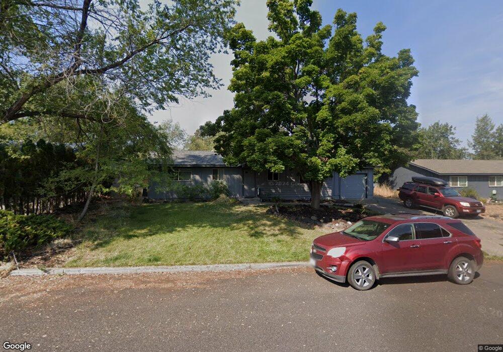
2271 NE Pheasant Ln Bend, OR 97701
Orchard District NeighborhoodEstimated Value: $497,000 - $566,000
4
Beds
2
Baths
1,286
Sq Ft
$413/Sq Ft
Est. Value
About This Home
This home is located at 2271 NE Pheasant Ln, Bend, OR 97701 and is currently estimated at $531,550, approximately $413 per square foot. 2271 NE Pheasant Ln is a home located in Deschutes County with nearby schools including Juniper Elementary School and Bend Senior High School.
Ownership History
Date
Name
Owned For
Owner Type
Purchase Details
Closed on
Mar 1, 2011
Sold by
Valceschini Harold D
Bought by
Valceschini Harold D and Survivors Trust Share Of Harold & Joan V
Current Estimated Value
Purchase Details
Closed on
Apr 16, 2004
Sold by
Valceschini Harold and Valceschini Joan
Bought by
Valceschini Harold and Valceschini Joan
Home Financials for this Owner
Home Financials are based on the most recent Mortgage that was taken out on this home.
Original Mortgage
$116,000
Interest Rate
4.62%
Mortgage Type
Unknown
Create a Home Valuation Report for This Property
The Home Valuation Report is an in-depth analysis detailing your home's value as well as a comparison with similar homes in the area
Home Values in the Area
Average Home Value in this Area
Purchase History
| Date | Buyer | Sale Price | Title Company |
|---|---|---|---|
| Valceschini Harold D | -- | None Available | |
| Valceschini Harold D | -- | None Available | |
| Valceschini Harold | -- | Amerititle | |
| Valceschini Harold | -- | Amerititle |
Source: Public Records
Mortgage History
| Date | Status | Borrower | Loan Amount |
|---|---|---|---|
| Previous Owner | Valceschini Harold | $116,000 |
Source: Public Records
Tax History Compared to Growth
Tax History
| Year | Tax Paid | Tax Assessment Tax Assessment Total Assessment is a certain percentage of the fair market value that is determined by local assessors to be the total taxable value of land and additions on the property. | Land | Improvement |
|---|---|---|---|---|
| 2025 | $2,937 | $173,820 | -- | -- |
| 2024 | $2,826 | $168,760 | -- | -- |
| 2023 | $2,619 | $163,850 | $0 | $0 |
| 2022 | $2,444 | $154,450 | $0 | $0 |
| 2021 | $2,448 | $149,960 | $0 | $0 |
| 2020 | $2,322 | $149,960 | $0 | $0 |
| 2019 | $2,258 | $145,600 | $0 | $0 |
| 2018 | $2,194 | $141,360 | $0 | $0 |
| 2017 | $2,130 | $137,250 | $0 | $0 |
| 2016 | $2,031 | $133,260 | $0 | $0 |
| 2015 | $1,975 | $129,380 | $0 | $0 |
| 2014 | $1,917 | $125,620 | $0 | $0 |
Source: Public Records
Map
Nearby Homes
- 1333 NE Dempsey Dr
- 1848 NE 14th St
- 1473 NE Mable Ct
- 1407 NE Talon Ct
- 1622 NE Parkridge Dr
- 2109 NE 11th Place
- 2667 NE Jones Rd
- 1630 NE 13th St
- 2640 NE 8th St
- 2025 NE Neil Way
- 2026 NE Neil Way
- 1687 NE Lotus Dr
- 2011 NE Neil Way
- 2939 NE Quiet Canyon Dr
- 2170 NE 8th St
- 2739 NE Cordata
- 2101 NE Holliday Ave
- 1419 NE Lucinda Ct
- 1000 NE Butler Market Rd Unit 1
- 748 NE Vail Ln
- 2257 NE Pheasant Ln
- 2198 NE Shepard Rd
- 2239 NE Pheasant Ln
- 2192 NE Shepard Rd
- 2295 NE Pheasant Ln
- 2264 NE Pheasant Ln
- 2206 NE Shepard Rd
- 2252 NE Pheasant Ln
- 2188 NE Shepard Rd
- 2236 NE Pheasant Ln
- 1600 NE Pheasant Ln
- 2225 NE Pheasant Ln
- 2224 NE Shepard Rd
- 2199 NE Shepard Rd
- 2220 NE Pheasant Ln
- 1610 NE Pheasant Ln
- 2174 NE Shepard Rd
- 2209 NE Shepard Rd
- 1629 NE Pheasant Ln