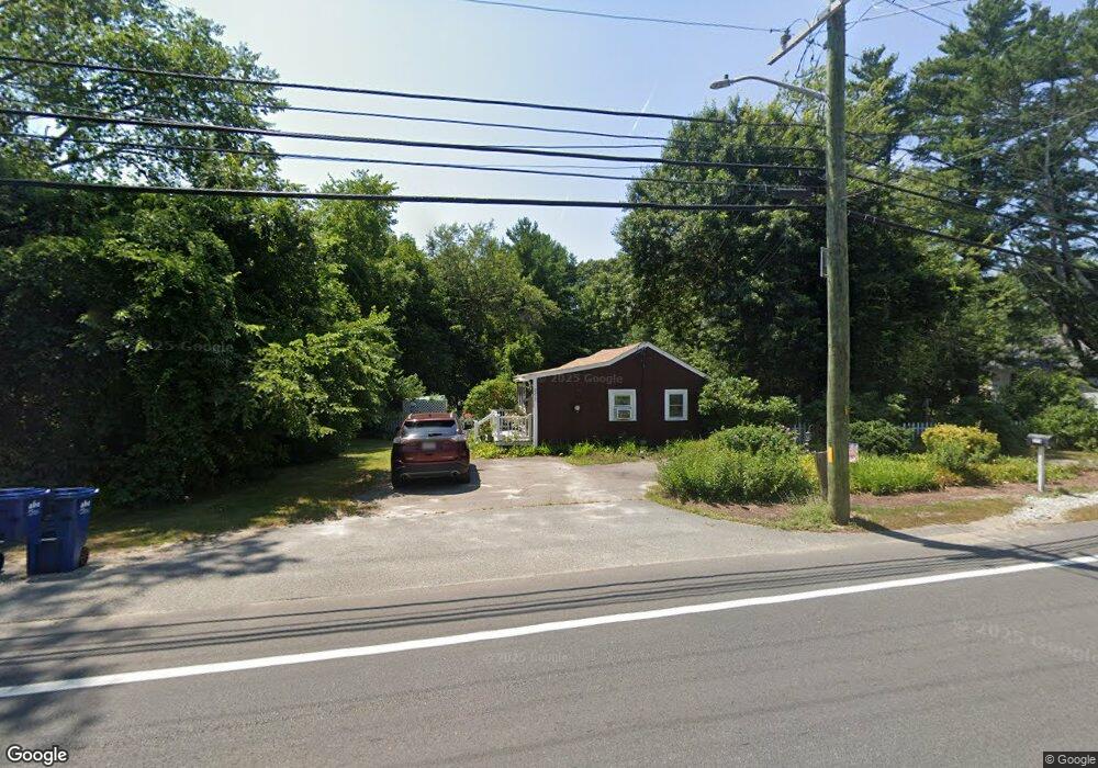
2273 Cranberry Hwy West Wareham, MA 02576
Estimated Value: $388,100 - $450,000
3
Beds
1
Bath
1,047
Sq Ft
$402/Sq Ft
Est. Value
About This Home
This home is located at 2273 Cranberry Hwy, West Wareham, MA 02576 and is currently estimated at $420,775, approximately $401 per square foot. 2273 Cranberry Hwy is a home located in Plymouth County.
Ownership History
Date
Name
Owned For
Owner Type
Purchase Details
Closed on
May 3, 2017
Sold by
Fontes Anthony and Fontes Patricia A
Bought by
Fontes Jeremy T and Fontes Kristianna R
Current Estimated Value
Purchase Details
Closed on
Aug 11, 2004
Sold by
Fontes Anthony
Bought by
Fontes Anthony and Fontes Patricia A
Home Financials for this Owner
Home Financials are based on the most recent Mortgage that was taken out on this home.
Original Mortgage
$50,000
Interest Rate
6.16%
Mortgage Type
Purchase Money Mortgage
Purchase Details
Closed on
Feb 3, 2004
Sold by
Fontes Anthony
Bought by
Carmody Leie and Carmody Sean
Home Financials for this Owner
Home Financials are based on the most recent Mortgage that was taken out on this home.
Original Mortgage
$250,000
Interest Rate
5.82%
Mortgage Type
Purchase Money Mortgage
Create a Home Valuation Report for This Property
The Home Valuation Report is an in-depth analysis detailing your home's value as well as a comparison with similar homes in the area
Home Values in the Area
Average Home Value in this Area
Purchase History
| Date | Buyer | Sale Price | Title Company |
|---|---|---|---|
| Fontes Jeremy T | -- | -- | |
| Fontes Jeremy T | -- | -- | |
| Fontes Anthony | -- | -- | |
| Fontes Anthony | -- | -- | |
| Carmody Leie | $5,000 | -- | |
| Carmody Leie | $5,000 | -- |
Source: Public Records
Mortgage History
| Date | Status | Borrower | Loan Amount |
|---|---|---|---|
| Previous Owner | Carmody Leie | $50,000 | |
| Previous Owner | Carmody Leie | $250,000 |
Source: Public Records
Tax History Compared to Growth
Tax History
| Year | Tax Paid | Tax Assessment Tax Assessment Total Assessment is a certain percentage of the fair market value that is determined by local assessors to be the total taxable value of land and additions on the property. | Land | Improvement |
|---|---|---|---|---|
| 2025 | $2,920 | $280,200 | $116,400 | $163,800 |
| 2024 | $2,900 | $258,200 | $92,800 | $165,400 |
| 2023 | $2,552 | $223,000 | $75,900 | $147,100 |
| 2022 | $2,552 | $193,600 | $75,900 | $117,700 |
| 2021 | $2,530 | $188,100 | $75,900 | $112,200 |
| 2020 | $2,372 | $178,900 | $75,900 | $103,000 |
| 2019 | $2,338 | $175,900 | $77,000 | $98,900 |
| 2018 | $2,227 | $163,400 | $77,000 | $86,400 |
| 2017 | $2,077 | $154,400 | $77,000 | $77,400 |
| 2016 | $1,944 | $143,700 | $77,000 | $66,700 |
| 2015 | $1,878 | $143,700 | $77,000 | $66,700 |
| 2014 | $1,775 | $138,100 | $73,200 | $64,900 |
Source: Public Records
Map
Nearby Homes
- 47 Weaver St
- 50 N Carver Rd
- 132 Queen Dr
- 103 Castle Dr
- 51 Crest Dr
- 20 Gault Rd
- 67 Crest Dr
- 13 Siesta Dr
- 27 Siesta Dr
- 4 Siesta Dr
- 72 Papermill Rd Unit 72
- 64 Papermill Rd
- 64 Papermill Rd Unit 64
- 421 County Rd
- 14 Timber Ln
- 21 Windswept Rd
- 85 Great Hill Dr
- 44 Great Hill Dr
- 32 Windswept Rd
- 127 Dolittle Ln
- 2271 Cranberry Hwy
- 2278 Cranberry Hwy
- 2274 Cranberry Hwy
- 2277 Cranberry Hwy
- 2272 Cranberry Hwy
- 2272 Cranberry Hwy
- 2270 Cranberry Hwy
- 2269 Cranberry Hwy
- 2280 Cranberry Hwy
- 2284 Cranberry Hwy
- 2281 Cranberry Hwy
- 45 Weaver St
- 6 Aunt Maryville Ln
- 2290 Cranberry Hwy
- 2289 Cranberry Hwy
- 2 Aunt Maryville Ln
- 0 Aunt Maryville Ln
- 2288 Cranberry Hwy
- 34 Weaver St
- 3 Aunt Maryville Ln