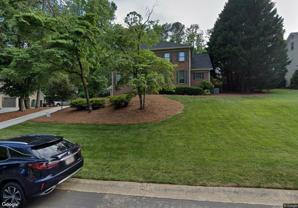
2276 Woodsfield Ln NE Unit 2 Marietta, GA 30062
East Cobb NeighborhoodEstimated Value: $544,565 - $651,000
4
Beds
3
Baths
2,374
Sq Ft
$259/Sq Ft
Est. Value
About This Home
This home is located at 2276 Woodsfield Ln NE Unit 2, Marietta, GA 30062 and is currently estimated at $614,141, approximately $258 per square foot. 2276 Woodsfield Ln NE Unit 2 is a home located in Cobb County with nearby schools including Murdock Elementary School, Dodgen Middle School, and Pope High School.
Ownership History
Date
Name
Owned For
Owner Type
Purchase Details
Closed on
Apr 15, 2005
Sold by
Lurie Mark and Lurie Diane
Bought by
Allphin Mark and Allphin Pam
Current Estimated Value
Home Financials for this Owner
Home Financials are based on the most recent Mortgage that was taken out on this home.
Original Mortgage
$214,000
Outstanding Balance
$107,701
Interest Rate
5.5%
Mortgage Type
New Conventional
Estimated Equity
$506,440
Create a Home Valuation Report for This Property
The Home Valuation Report is an in-depth analysis detailing your home's value as well as a comparison with similar homes in the area
Home Values in the Area
Average Home Value in this Area
Purchase History
| Date | Buyer | Sale Price | Title Company |
|---|---|---|---|
| Allphin Mark | $267,500 | -- |
Source: Public Records
Mortgage History
| Date | Status | Borrower | Loan Amount |
|---|---|---|---|
| Open | Allphin Mark | $214,000 |
Source: Public Records
Tax History Compared to Growth
Tax History
| Year | Tax Paid | Tax Assessment Tax Assessment Total Assessment is a certain percentage of the fair market value that is determined by local assessors to be the total taxable value of land and additions on the property. | Land | Improvement |
|---|---|---|---|---|
| 2025 | $5,096 | $212,224 | $52,000 | $160,224 |
| 2024 | $5,100 | $212,224 | $52,000 | $160,224 |
| 2023 | $3,425 | $160,020 | $39,600 | $120,420 |
| 2022 | $3,928 | $156,832 | $38,000 | $118,832 |
| 2021 | $3,698 | $146,308 | $34,000 | $112,308 |
| 2020 | $3,698 | $146,308 | $34,000 | $112,308 |
| 2019 | $3,568 | $140,372 | $29,400 | $110,972 |
| 2018 | $3,568 | $140,372 | $29,400 | $110,972 |
| 2017 | $3,066 | $123,172 | $29,400 | $93,772 |
| 2016 | $3,071 | $123,172 | $29,400 | $93,772 |
| 2015 | $2,767 | $106,532 | $29,400 | $77,132 |
| 2014 | $2,788 | $106,532 | $0 | $0 |
Source: Public Records
Map
Nearby Homes
- 2268 Woodsfield Ln NE
- 2510 Camelot Cir
- 3246 Able Ct
- 2041 Kramer Way
- 2410 Kingsley Dr NE
- 3650 Oak Ln
- 2567 Kingsley Dr NE
- 2570 Rocky Springs Dr
- 3297 Post Oak Tritt Rd
- 3741 Bays Ferry Way
- 3218 Holly Mill Run
- 3152 Normandy Cir NE
- 2608 Tritt Springs Trace NE
- 2628 Tritt Springs Trace NE Unit 2
- 3292 Holly Mill Ct
- 3287 Harvest Way
- 2278 Woodsfield Ln NE
- 2274 Woods Field Ln NE
- 2274 Woodsfield Ln NE
- 2270 Woodsfield Ln NE
- 2272 Woods Field Ln NE
- 2272 Woodsfield Ln NE
- 3349 Woodsfield Trace NE Unit 2
- 2280 Woodsfield Ln NE
- 2268 Woods Field Ln NE
- 2277 Woodsfield Ln NE
- 2275 Woodsfield Ln NE
- 2279 Woodsfield Ln NE
- 2281 Woodsfield Ln NE
- 2266 Woodsfield Ln NE
- 2312 Woodsfield Ct NE Unit 2
- 3347 Woodsfield Trace NE
- 2369 Woodsfield Ln NE Unit 2
- 2371 Woodsfield Ln NE
- 3402 Falling Brook Dr
- 2283 Woodsfield Ln NE