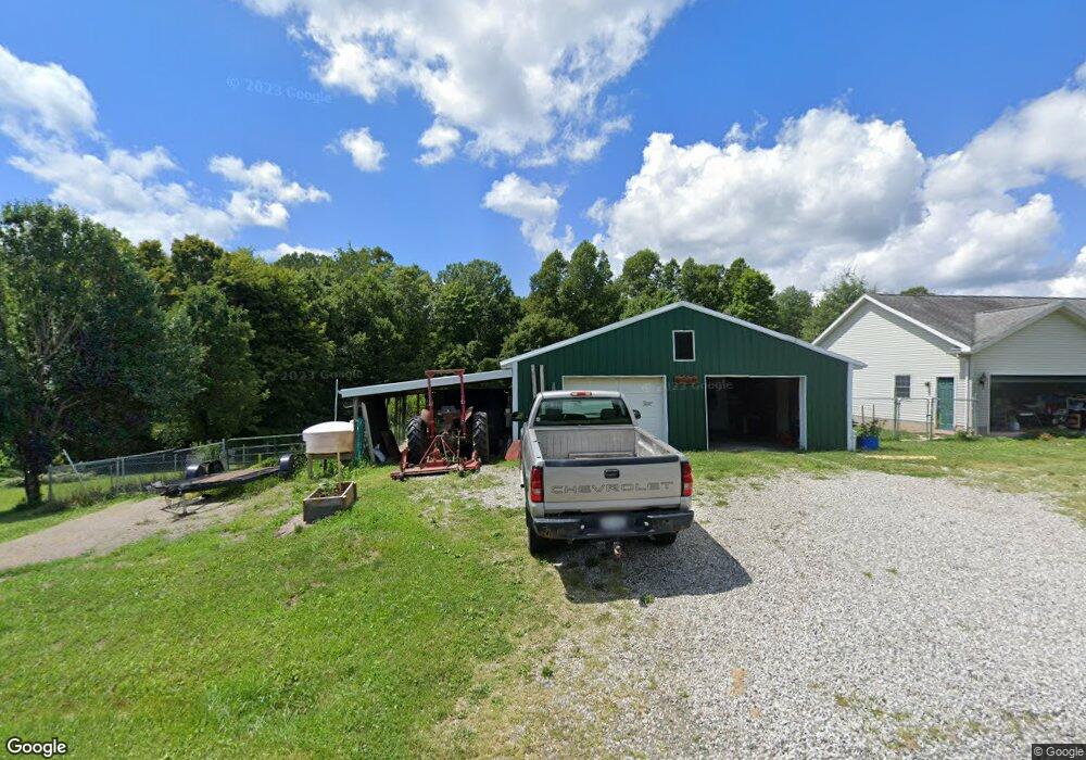
2277 Laurel Ridge Rd Lowell, OH 45744
Estimated Value: $118,000 - $481,000
3
Beds
2
Baths
1,472
Sq Ft
$203/Sq Ft
Est. Value
About This Home
This home is located at 2277 Laurel Ridge Rd, Lowell, OH 45744 and is currently estimated at $298,445, approximately $202 per square foot. 2277 Laurel Ridge Rd is a home located in Washington County with nearby schools including Fort Frye High School.
Ownership History
Date
Name
Owned For
Owner Type
Purchase Details
Closed on
Jun 29, 2022
Sold by
Ohio Franklin Realty Llc
Bought by
West Texas Energy Acquisitions Llc
Current Estimated Value
Purchase Details
Closed on
May 18, 2004
Bought by
Delancey Walter and Delancey Leanne
Create a Home Valuation Report for This Property
The Home Valuation Report is an in-depth analysis detailing your home's value as well as a comparison with similar homes in the area
Purchase History
| Date | Buyer | Sale Price | Title Company |
|---|---|---|---|
| West Texas Energy Acquisitions Llc | $6,750 | None Listed On Document | |
| Delancey Walter | $18,500 | -- | |
| Delancey Walter | $18,500 | -- |
Source: Public Records
Tax History
| Year | Tax Paid | Tax Assessment Tax Assessment Total Assessment is a certain percentage of the fair market value that is determined by local assessors to be the total taxable value of land and additions on the property. | Land | Improvement |
|---|---|---|---|---|
| 2024 | $2,472 | $67,020 | $14,330 | $52,690 |
| 2023 | $2,053 | $67,020 | $14,330 | $52,690 |
| 2022 | $2,043 | $67,020 | $14,330 | $52,690 |
| 2021 | $1,745 | $55,670 | $9,080 | $46,590 |
| 2020 | $1,746 | $55,670 | $9,080 | $46,590 |
| 2019 | $1,743 | $55,670 | $9,080 | $46,590 |
| 2018 | $1,593 | $49,640 | $7,900 | $41,740 |
| 2017 | $1,599 | $49,640 | $7,900 | $41,740 |
| 2016 | $3,004 | $49,640 | $7,900 | $41,740 |
| 2015 | $1,440 | $42,870 | $7,610 | $35,260 |
| 2014 | $2,579 | $42,870 | $7,610 | $35,260 |
| 2013 | $1,451 | $42,870 | $7,610 | $35,260 |
Source: Public Records
Map
Nearby Homes
- 0 E Branch Rd Unit 5199023
- 0 E Branch Rd Unit 5199004
- 0 E Branch Rd Unit 5198987
- 0 E Branch Rd Unit 5199019
- 0 E Branch Rd Unit 5199012
- 88 Laurel Ridge Rd
- 0 State Route 530 Unit Lowell OH 45744
- 0 Ohio 530
- 323 5th St
- 310 5th St
- 208 Main St
- 175 3rd St
- 570 Coal Run Dr
- 360 E Henniger Rd
- 36863 Township Road 10
- 0 Highland Ridge Rd
- 8292 State Route 60
- 0 Township Road 318
- 3275 Highland Ridge Rd
- 38 Fair Ave
- 2331 Laurel Ridge Rd
- 2420 Laurel Ridge Rd
- 2160 Laurel Ridge Rd
- 2200 Laurel Ridge Rd
- 1095 Vanfossen Rd
- 2335 Laurel Ridge Rd
- 1060 Vanfossen Rd
- 955 Vanfossen Rd
- 2339 Laurel Ridge Rd
- 904 Vanfossen Rd
- 1840 Laurel Ridge Rd
- 1875 Laurel Ridge Rd
- 1750 Laurel Ridge Rd
- 815 Vanfossen Rd
- 2736 Laurel Ridge Rd
- 1725 Laurel Ridge Rd
- 2865 Laurel Ridge Rd
- 1675 Laurel Ridge Rd
- 2740 Laurel Ridge Rd
- 1575 Laurel Ridge Rd
Your Personal Tour Guide
Ask me questions while you tour the home.