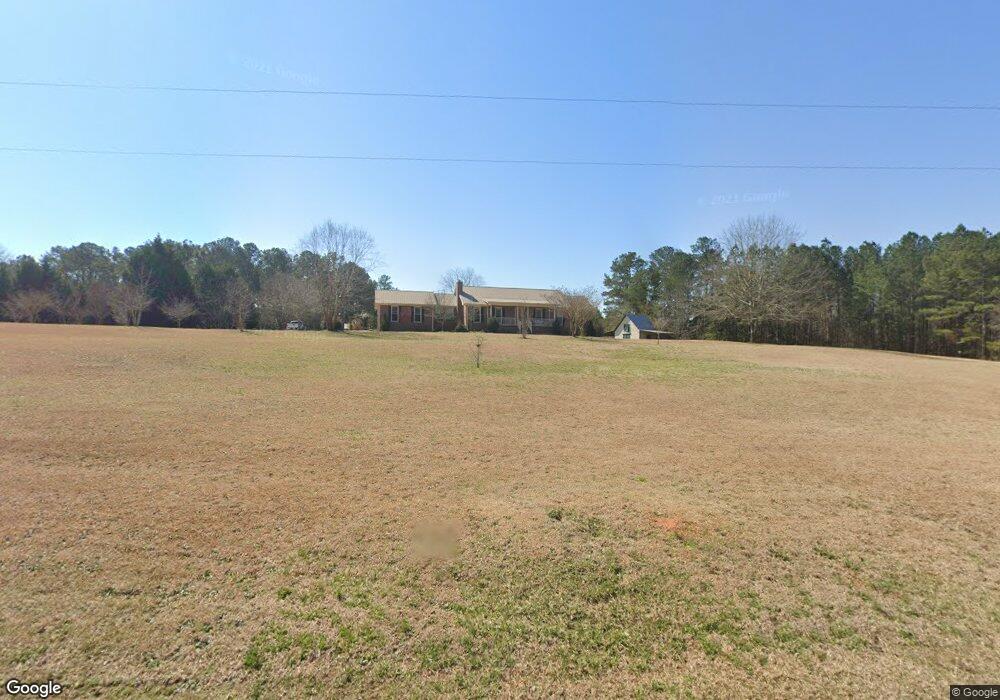
2279 Lemonds Rd Social Circle, GA 30025
Estimated Value: $464,000 - $537,000
3
Beds
2
Baths
1,995
Sq Ft
$258/Sq Ft
Est. Value
About This Home
This home is located at 2279 Lemonds Rd, Social Circle, GA 30025 and is currently estimated at $514,238, approximately $257 per square foot. 2279 Lemonds Rd is a home located in Walton County with nearby schools including Atha Road Elementary School, Youth Middle School, and Walnut Grove High School.
Ownership History
Date
Name
Owned For
Owner Type
Purchase Details
Closed on
Oct 21, 2020
Sold by
Spencer Maria
Bought by
Mckissick Colt Brandon
Current Estimated Value
Home Financials for this Owner
Home Financials are based on the most recent Mortgage that was taken out on this home.
Original Mortgage
$342,000
Outstanding Balance
$304,191
Interest Rate
2.9%
Mortgage Type
New Conventional
Estimated Equity
$210,047
Purchase Details
Closed on
Jul 29, 2002
Sold by
Queen Joanne S
Bought by
Spencer Philip and Spencer Maria
Home Financials for this Owner
Home Financials are based on the most recent Mortgage that was taken out on this home.
Original Mortgage
$120,000
Interest Rate
6.52%
Mortgage Type
New Conventional
Purchase Details
Closed on
May 16, 2000
Sold by
Queen Joanne S and Queen Robert
Bought by
Queen Joanne S
Home Financials for this Owner
Home Financials are based on the most recent Mortgage that was taken out on this home.
Original Mortgage
$160,000
Interest Rate
8.14%
Mortgage Type
New Conventional
Purchase Details
Closed on
May 23, 1988
Bought by
Queen G Robert
Create a Home Valuation Report for This Property
The Home Valuation Report is an in-depth analysis detailing your home's value as well as a comparison with similar homes in the area
Home Values in the Area
Average Home Value in this Area
Purchase History
| Date | Buyer | Sale Price | Title Company |
|---|---|---|---|
| Mckissick Colt Brandon | $360,000 | -- | |
| Spencer Philip | $182,000 | -- | |
| Queen Joanne S | -- | -- | |
| Queen Robert | -- | -- | |
| Queen G Robert | $25,000 | -- |
Source: Public Records
Mortgage History
| Date | Status | Borrower | Loan Amount |
|---|---|---|---|
| Open | Mckissick Colt Brandon | $342,000 | |
| Previous Owner | Spencer Philip | $120,000 | |
| Previous Owner | Queen Robert | $160,000 |
Source: Public Records
Tax History Compared to Growth
Tax History
| Year | Tax Paid | Tax Assessment Tax Assessment Total Assessment is a certain percentage of the fair market value that is determined by local assessors to be the total taxable value of land and additions on the property. | Land | Improvement |
|---|---|---|---|---|
| 2024 | $5,470 | $185,564 | $72,720 | $112,844 |
| 2023 | $5,230 | $172,444 | $69,040 | $103,404 |
| 2022 | $4,930 | $155,924 | $64,600 | $91,324 |
| 2021 | $4,199 | $128,884 | $50,200 | $78,684 |
| 2020 | $1,021 | $102,804 | $43,520 | $59,284 |
| 2019 | $1,543 | $93,124 | $38,720 | $54,404 |
| 2018 | $1,510 | $93,124 | $38,720 | $54,404 |
| 2017 | $3,156 | $91,604 | $38,720 | $52,884 |
| 2016 | $1,302 | $74,500 | $30,280 | $44,220 |
| 2015 | $1,315 | $72,420 | $30,280 | $42,140 |
| 2014 | $2,285 | $68,520 | $26,320 | $42,200 |
Source: Public Records
Map
Nearby Homes
- 2560 Whitney Rd SE
- 709 White Oak Trail
- 511 Alcovy Lakes Dr
- 2214 Alcovy Station Ln
- 2412 Waterside Dr
- 374 Georgia 11
- 2457 Waterside Dr
- 1169 Dean Hill Rd SE
- 1229 Dean Hill Rd
- 1526 N Cherokee Rd
- 569 Highway 11 SW
- 0 Social Circle Fairplay Rd Unit 7662271
- 0 Social Circle Fairplay Rd Unit 10620284
- 958 High Shoal Dr
- 998 High Shoal Dr
- 401 Mountain Dr
- 246 Club Dr
- 290 Club Dr
- 278 Club Dr
- 2299 Lemonds Rd
- 0 Lemonds Rd Unit 4047735
- 0 Lemonds Rd Unit 3154020
- 0 Lemonds Rd Unit 8759861
- 0 Lemonds Rd Unit 8846121
- 0 Lemonds Rd Unit 7619266
- 2300 Lemonds Rd
- 2218 Lemonds Rd
- 2318 Lemonds Rd
- 2178 Lemonds Rd
- 2335 Lemonds Rd
- 2205 Lemonds Rd
- 2317 Lemonds Rd
- 2375 Lemonds Rd
- 2407 Lemonds Rd
- 2108 Lemonds Rd
- 2445 Lemonds Rd
- 2070 Lemonds Rd
- 1431 Arnold Dairy Farm Rd
- 1335 Lemonds Loop