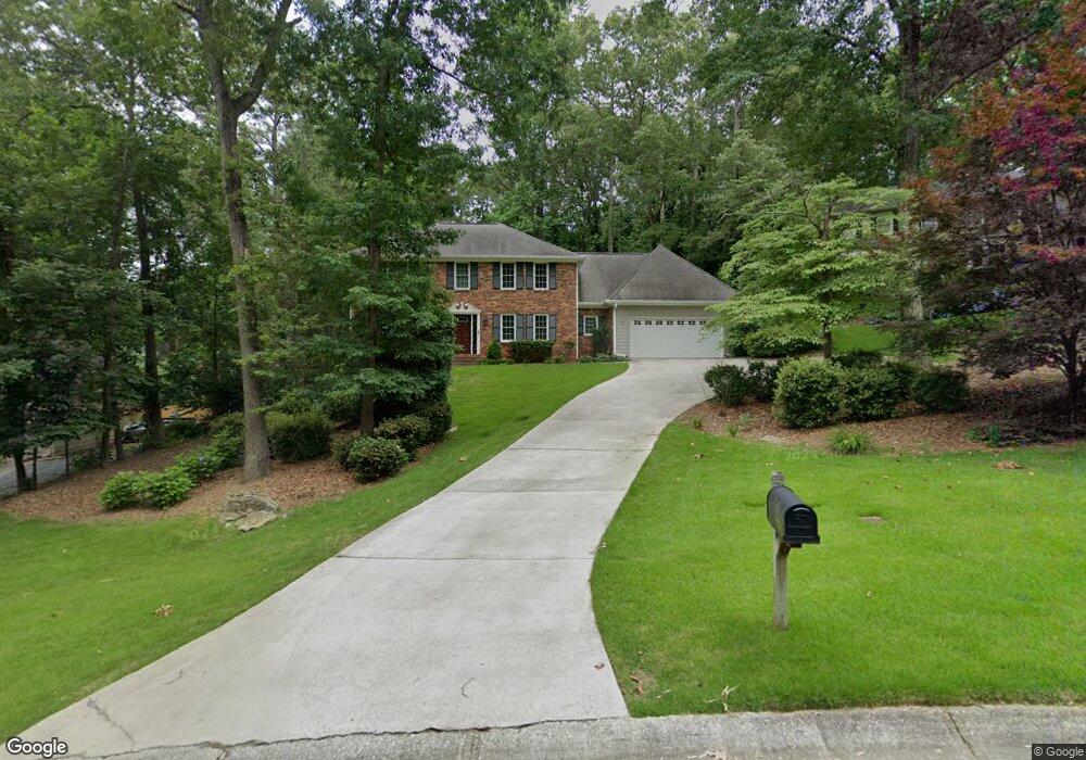
2279 N Forest Dr Marietta, GA 30062
East Cobb NeighborhoodEstimated Value: $610,000 - $709,274
4
Beds
3
Baths
2,497
Sq Ft
$264/Sq Ft
Est. Value
About This Home
This home is located at 2279 N Forest Dr, Marietta, GA 30062 and is currently estimated at $660,319, approximately $264 per square foot. 2279 N Forest Dr is a home located in Cobb County with nearby schools including Timber Ridge Elementary School, Dodgen Middle School, and Walton High School.
Ownership History
Date
Name
Owned For
Owner Type
Purchase Details
Closed on
Jan 31, 1994
Sold by
Magee Thomas L Jeri L
Bought by
Raulerson Donald A Patricia
Current Estimated Value
Home Financials for this Owner
Home Financials are based on the most recent Mortgage that was taken out on this home.
Original Mortgage
$124,000
Interest Rate
7.17%
Create a Home Valuation Report for This Property
The Home Valuation Report is an in-depth analysis detailing your home's value as well as a comparison with similar homes in the area
Home Values in the Area
Average Home Value in this Area
Purchase History
| Date | Buyer | Sale Price | Title Company |
|---|---|---|---|
| Raulerson Donald A Patricia | $155,000 | -- |
Source: Public Records
Mortgage History
| Date | Status | Borrower | Loan Amount |
|---|---|---|---|
| Closed | Raulerson Donald A Patricia | $124,000 |
Source: Public Records
Tax History Compared to Growth
Tax History
| Year | Tax Paid | Tax Assessment Tax Assessment Total Assessment is a certain percentage of the fair market value that is determined by local assessors to be the total taxable value of land and additions on the property. | Land | Improvement |
|---|---|---|---|---|
| 2025 | $1,165 | $217,660 | $48,000 | $169,660 |
| 2024 | $1,112 | $198,424 | $48,000 | $150,424 |
| 2023 | $906 | $198,424 | $48,000 | $150,424 |
| 2022 | $1,038 | $173,728 | $36,000 | $137,728 |
| 2021 | $993 | $158,504 | $34,000 | $124,504 |
| 2020 | $993 | $158,504 | $34,000 | $124,504 |
| 2019 | $3,799 | $158,504 | $34,000 | $124,504 |
| 2018 | $3,799 | $158,504 | $34,000 | $124,504 |
| 2017 | $3,200 | $135,252 | $34,000 | $101,252 |
| 2016 | $3,207 | $135,252 | $34,000 | $101,252 |
| 2015 | $3,122 | $128,680 | $30,000 | $98,680 |
| 2014 | $3,141 | $128,680 | $0 | $0 |
Source: Public Records
Map
Nearby Homes
- 2212 Heritage Trace View
- 2255 Rushmore Dr
- 1929 Fields Pond Glen
- 5108 Nicolet Ct
- 2655 Boulder Creek Dr NE
- 2066 Old Forge Way
- 2482 N Forest Dr
- 1961 Fields Pond Dr
- 1009 Lake Pointe Cir
- 2039 Old Forge Way
- 2743 Chimney Springs Dr
- 3113 Lake Pointe Cir
- 4013 Lake Pointe Cir Unit 4013
- 3210 Lake Pointe Cir
- 2661 Sandpoint Way NE
- 110 Boulder Dr
- 2271 N Forest Dr
- 2285 N Forest Dr
- 5239 Pikes Peak Ct
- 5241 Pikes Peak Ct
- 2265 N Forest Dr
- 2260 Willeo Rill Rd
- 2270 Willeo Rill Rd
- 2274 N Forest Dr
- 5237 Pikes Peak Ct
- 5243 Pikes Peak Ct
- 2294 N Forest Dr
- 5245 Pikes Peak Ct
- 5235 Pikes Peak Ct
- 2259 N Forest Dr
- 5234 Pikes Peak Ct
- 2264 N Forest Dr
- 0 Willeo Rill Rd NE Unit 7586628
- 0 Willeo Rill Rd NE Unit 7320762
- 0 Willeo Rill Rd NE Unit 8667094
- 0 Willeo Rill Rd NE Unit 8620892